How to get to Blue Sand by bus?
Click on the bus route to see step by step directions with maps, line arrival times and updated time schedules.
From Bruno Buozzi Street, Campi Bisenzio
50 minFrom Asmana Wellness World Florence, Campi Bisenzio
64 minFrom Colossus of the Apennines, Vaglia
42 minFrom Scandicci, Scandicci
51 minFrom Scandicci Fair, Scandicci
52 minFrom Firenze Food Kiosk, Sesto Fiorentino
55 minFrom Antonio Meucci Street 4, Bagno a Ripoli
43 minFrom Villa Costanza Parking, Scandicci
60 minFrom Campi Bisenzio, Campi Bisenzio
54 minFrom Pratolino Park, Vaglia
41 min
Bus stops near Blue Sand in Florence
Light Rail stations near Blue Sand in Florence
- Fortress, 12 min walk,VIEW
Train station near Blue Sand in Florence
- Florence Santa Maria Novella, 20 min walk,VIEW
Bus lines to Blue Sand in Florence
- 6, Novelli,VIEW
- 11, La Gora,VIEW
- C1, Provv Mozzi,VIEW
- C4, Santa Maria Maggiore,VIEW
- 900, Borgo S.L. Station,VIEW
- 901, Florence Santa Maria Novella Station,VIEW
- 911, Arezzo Terminal (Interior),VIEW
- 911, Figline Valdarno,VIEW
- 14, Rocca Tedalda Villa Favard,VIEW
- C2, Leopolda T1 Porta Al Prato,VIEW
- 12, Scalette Station,VIEW
- 17, Cascine Kennedy Square,VIEW
- 23, Florence T2 Guidoni,VIEW
What are the closest stations to Blue Sand?
The closest stations to Blue Sand are:
- Panzani Unity is 41 meters away, 1 min walk.
- Medici Chapels is 205 meters away, 3 min walk.
- Santa Maria Maggiore is 207 meters away, 3 min walk.
- Florence National Station is 297 meters away, 4 min walk.
- Largo Alinari is 301 meters away, 4 min walk.
- Scalette Station is 313 meters away, 5 min walk.
- Fortress is 870 meters away, 12 min walk.
- Florence Santa Maria Novella is 1476 meters away, 20 min walk.
Which bus lines stop near Blue Sand?
These bus lines stop near Blue Sand: 17, 23, 6, C1, C2.
Which light rail lines stop near Blue Sand?
These light rail lines stop near Blue Sand: T1, T2.
What’s the nearest light rail station to Blue Sand in Florence?
The nearest light rail station to Blue Sand in Florence is Fortress. It’s a 12 min walk away.
What’s the nearest train station to Blue Sand in Florence?
The nearest train station to Blue Sand in Florence is Florence Santa Maria Novella. It’s a 20 min walk away.
What’s the nearest bus station to Blue Sand in Florence?
The nearest bus station to Blue Sand in Florence is Panzani Unity. It’s a 1 min walk away.
What time is the first light rail to Blue Sand in Florence?
The T2 is the first light rail that goes to Blue Sand in Florence. It stops nearby at 4:53 AM.
What time is the last light rail to Blue Sand in Florence?
The T2 is the last light rail that goes to Blue Sand in Florence. It stops nearby at 12:45 AM.
What time is the first train to Blue Sand in Florence?
The R is the first train that goes to Blue Sand in Florence. It stops nearby at 4:32 AM.
What time is the last train to Blue Sand in Florence?
The R is the last train that goes to Blue Sand in Florence. It stops nearby at 12:40 AM.
What time is the first bus to Blue Sand in Florence?
The 14 is the first bus that goes to Blue Sand in Florence. It stops nearby at 5:58 AM.
What time is the last bus to Blue Sand in Florence?
The 901 is the last bus that goes to Blue Sand in Florence. It stops nearby at 2:52 AM.
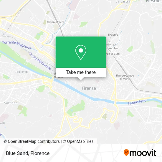
See Blue Sand, Florence, on the map
Public Transit to Blue Sand in Florence
Wondering how to get to Blue Sand in Florence? Moovit helps you find the best way to get to Blue Sand with step-by-step directions from the nearest public transit station.
Moovit provides free maps and live directions to help you navigate through your city. View schedules, routes, timetables, and find out how long does it take to get to Blue Sand in real time.
Looking for the nearest stop or station to Blue Sand? Check out this list of stops closest to your destination: Panzani Unity; Medici Chapels; Santa Maria Maggiore; Florence National Station; Largo Alinari; Scalette Station; Fortress; Florence Santa Maria Novella.
Bus: 17, 23, 6, C1, C2, 11, C4, 900, 901, 911, 911, 14.Train: R, R, R, R, R.Light Rail: T1, T2.
Want to see if there’s another route that gets you there at an earlier time? Moovit helps you find alternative routes or times. Get directions from and directions to Blue Sand easily from the Moovit App or Website.
We make riding to Blue Sand easy, which is why over 1.5 million users, including users in Florence, trust Moovit as the best app for public transit. You don’t need to download an individual bus app or train app, Moovit is your all-in-one transit app that helps you find the best bus time or train time available.
For information on prices of bus and light rail, costs and ride fares to Blue Sand, please check the Moovit app.
Use the app to navigate to popular places including to the airport, hospital, stadium, grocery store, mall, coffee shop, school, college, and university.
Blue Sand Address: Via Panzani, 35R 50123 Firenze street in Florence
- Burchianti Hotel Florence,
- Panzani Street 11/13,
- 31 Giglio Street,
- Paris Hotel Florence Tuscany Italy,
- Limoni Perfumeries,
- Josmar SAS by Simone Galletti & C.,
- Grand Hotel Baglioni Florence,
- Hotel Rosso 23,
- Aura Medica Medical Center Corso Italia,
- Grand Hotel Baglioni,
- Vivimarket,
- VIVI Market Supermarket - Supermarkets and Groceries,
- Dolce Vita Vintage Lab,
- Wycon,
- Via del Trebbio 14,
- The Frame Hotel,
- Atelier Emé,
- Santa Maria Novella,
- San Lorenzo,
- Richard Ginori
Places Near Blue Sand (Florence)
- Campi Bisenzio, Campi Bisenzio,
- Verdi Theater, Florence,
- Field of Mars, Florence,
- I Gigli, Campi Bisenzio,
- Santa Maria Novella Station, Florence,
- Mandela Forum (Nelson Mandela Forum), Florence,
- IKEA Florence, Sesto Fiorentino,
- Torregalli Hospital Scandicci *, Scandicci,
- Asmana, Campi Bisenzio,
- Cascine Park, Florence,
- Santa Maria Nuova Hospital, Florence,
- Artemio Franchi Municipal Stadium, Florence,
- Michelangelo Square, Florence,
- Visarno Arena, Florence,
- Michelangelo Square, Florence,
- Nelson Mandela Forum, Florence,
- Tobacco Manufacture, Florence,
- Piero Palagi Hospital Facility-Florence, Florence,
- OOO, Florence,
- Visarno Hippodrome, Florence
How to get to popular places in Florence with public transit
Get around Florence by public transit!
Traveling around Florence has never been so easy. See step by step directions as you travel to any attraction, street or major public transit station. View bus and train schedules, arrival times, service alerts and detailed routes on a map, so you know exactly how to get to anywhere in Florence.
When traveling to any destination around Florence use Moovit's Live Directions with Get Off Notifications to know exactly where and how far to walk, how long to wait for your line, and how many stops are left. Moovit will alert you when it's time to get off — no need to constantly re-check whether yours is the next stop.
Wondering how to use public transit in Florence or how to pay for public transit in Florence? Moovit public transit app can help you navigate your way with public transit easily, and at minimum cost. It includes public transit fees, ticket prices, and costs. Looking for a map of Florence public transit lines? Moovit public transit app shows all public transit maps in Florence with all Bus, Train, Light Rail, Ferry and Funicular routes and stops on an interactive map.
Florence has 5 transit type(s), including: Bus, Train, Light Rail, Ferry and Funicular, operated by several transit agencies, including Florence Urban - Tuscan Bus Lines, GEST, Livorno and Province - Tuscan Bus Lines, Arezzo, Florence and Provinces - Tuscan Bus Lines, Prato and Province - Tuscan Bus Lines, Lucca and Province - Tuscan Bus Lines, Massa, Carrara and Province - Tuscan Bus Lines, Pisa and Province - Tuscan Bus Lines, Grosseto, Siena and Provinces - Tuscan Bus Lines, Arezzo, Siena and Provinces - Tuscan Bus Lines, Florence and Province - Tuscan Bus Lines, Pistoia and Province - Tuscan Bus Lines, Siena and Province - Tuscan Bus Lines, Arezzo and Province - Tuscan Bus Lines and Trenitalia