Directions to Blue Wave Tashoot (Nes Ziona) with public transportation
The following transit lines have routes that pass near Blue Wave Tashoot
 Bus: 201, 204, 274, 80 ♿, 88 ♿.
- Israel Railways: Ashkelon - Binyamina, Binyamina - Ashkelon, Binyamina - Rehovot, Ashkelon - Binyamina, Ashkelon - Tel Aviv Center.
- Shuttle: Shuttle.
How to get to Blue Wave Tashoot by bus?
Click on the bus route to see step by step directions with maps, line arrival times and updated time schedules.
From Israel Police Recruitment Office, Bat Yam
49 minFrom Yes Planet, Rishon LeZion
49 minFrom Rishon LeZion Beach, Rishon LeZion
55 minFrom Home Front Command - Rechavam Base (Checkpoint 103), Gezer Regional Council
48 minFrom Ben Gurion Airport, Rishon LeZion
59 minFrom Bat Yamon Mall, Bat Yam
57 minFrom Kaplan Hospital, Rehovot
35 minFrom Bat Yamon, Bat Yam
57 minFrom Beit Balev, Rishon LeZion
44 minFrom Beach 4, Rishon LeZion
55 min
How to get to Blue Wave Tashoot by Israel Railways?
Click on the Israel Railways route to see step by step directions with maps, line arrival times and updated time schedules.
From Israel Police Recruitment Office, Bat Yam
86 minFrom Yes Planet, Rishon LeZion
107 minFrom Home Front Command - Rechavam Base (Checkpoint 103), Gezer Regional Council
75 minFrom Ben Gurion Airport, Rishon LeZion
111 minFrom Bat Yamon Mall, Bat Yam
94 minFrom Bat Yamon, Bat Yam
94 minFrom Beit Balev, Rishon LeZion
103 min
Bus stops near Blue Wave Tashoot in Nes Ziona
Shuttle station near Blue Wave Tashoot in Nes Ziona
- Rehovot Railway Station, 31 min walk,VIEW
Israel Railways stations near Blue Wave Tashoot in Nes Ziona
Bus lines to Blue Wave Tashoot in Nes Ziona
- 5, Rehovot,VIEW
- 6, Rehovot,VIEW
- 6A, Nes Ziona,VIEW
- 7A, Power Center,VIEW
- 80 ♿, Rehovot,VIEW
- 88 ♿, Rehovot,VIEW
- 164, Rehovot,VIEW
- 166, Ramat Gan,VIEW
- 174, Tel Aviv-Yafo,VIEW
- 201, Rehovot,VIEW
- 204, Rishon LeZion,VIEW
- 205, Holon,VIEW
- 226, Brenner,VIEW
- 273, Gedera,VIEW
- 274, Tel Aviv-Yafo,VIEW
- 277, Kiryat Ekron,VIEW
- 294, Ariel,VIEW
- 301, Ashkelon,VIEW
- 313, Ramla,VIEW
- 318, Rehovot,VIEW
What are the closest stations to Blue Wave Tashoot?
The closest stations to Blue Wave Tashoot are:
- Kanyoter/Emek HaShoshanim is 360 meters away, 5 min walk.
- Nes Ziona Central Station/Weizmann is 362 meters away, 5 min walk.
- Kanioter/Bilu is 391 meters away, 6 min walk.
- Yitzhak Rabin Road/TARMAG is 405 meters away, 6 min walk.
- TARMAG/Yitzhak Rabin Road is 428 meters away, 6 min walk.
- Nes Tziona Central Station is 571 meters away, 8 min walk.
- Kanyoter/Weizmann is 571 meters away, 8 min walk.
- Rehovot Railway Station is 2415 meters away, 31 min walk.
- Rehovot Station is 2459 meters away, 32 min walk.
- Rishon LeTzion HaRishonim Station is 4505 meters away, 58 min walk.
Which bus lines stop near Blue Wave Tashoot?
These bus lines stop near Blue Wave Tashoot: 201, 204, 274.
Which Israel Railways lines stop near Blue Wave Tashoot?
These Israel Railways lines stop near Blue Wave Tashoot: Ashkelon - Binyamina, Binyamina - Ashkelon, Binyamina - Rehovot.
What’s the nearest bus station to Blue Wave Tashoot in Nes Ziona?
The nearest bus stations to Blue Wave Tashoot in Nes Ziona are Kanyoter/Emek HaShoshanim and Nes Ziona Central Station/Weizmann. The closest one is a 5 min walk away.
What time is the first Israel Railways to Blue Wave Tashoot in Nes Ziona?
The Ashkelon - Binyamina is the first Israel Railways that goes to Blue Wave Tashoot in Nes Ziona. It stops nearby at 5:24 AM.
What time is the last Israel Railways to Blue Wave Tashoot in Nes Ziona?
The Binyamina - Ashkelon is the last Israel Railways that goes to Blue Wave Tashoot in Nes Ziona. It stops nearby at 12:33 AM.
What time is the first bus to Blue Wave Tashoot in Nes Ziona?
The 164 is the first bus that goes to Blue Wave Tashoot in Nes Ziona. It stops nearby at 4:57 AM.
What time is the last bus to Blue Wave Tashoot in Nes Ziona?
The 319 is the last bus that goes to Blue Wave Tashoot in Nes Ziona. It stops nearby at 1:38 AM.
What time is the first shuttle to Blue Wave Tashoot in Nes Ziona?
The Shuttle is the first shuttle that goes to Blue Wave Tashoot in Nes Ziona. It stops nearby at 7:10 AM.
What time is the last shuttle to Blue Wave Tashoot in Nes Ziona?
The Shuttle is the last shuttle that goes to Blue Wave Tashoot in Nes Ziona. It stops nearby at 6:54 PM.
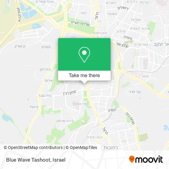
See Blue Wave Tashoot, Nes Ziona, on the map
Public Transit to Blue Wave Tashoot in Nes Ziona
Wondering how to get to Blue Wave Tashoot in Nes Ziona? Moovit helps you find the best way to get to Blue Wave Tashoot with step-by-step directions from the nearest public transit station.
Moovit provides free maps and live directions to help you navigate through your city. View schedules, routes, timetables, and find out how long does it take to get to Blue Wave Tashoot in real time.
Looking for the nearest stop or station to Blue Wave Tashoot? Check out this list of stops closest to your destination: Kanyoter/Emek HaShoshanim; Nes Ziona Central Station/Weizmann; Kanioter/Bilu; Yitzhak Rabin Road/TARMAG; TARMAG/Yitzhak Rabin Road; Nes Tziona Central Station; Kanyoter/Weizmann; Rehovot Railway Station; Rehovot Station; Rishon LeTzion HaRishonim Station.
Bus: 201, 204, 274, 80 ♿, 88 ♿, 164, 166, 174, 5, 6, 6A, 7A, 5A, 7.Israel Railways: Ashkelon - Binyamina, Binyamina - Ashkelon, Binyamina - Rehovot, Ashkelon - Binyamina, Ashkelon - Tel Aviv Center, Bnei Brak - Ashkelon, Binyamina - Ashkelon, Binyamina - Rehovot, Lod - Rishonim, Rishonim - Lod.Shuttle: Shuttle.
Want to see if there’s another route that gets you there at an earlier time? Moovit helps you find alternative routes or times. Get directions from and directions to Blue Wave Tashoot easily from the Moovit App or Website.
We make riding to Blue Wave Tashoot easy, which is why over 1.5 million users, including users in Nes Ziona, trust Moovit as the best app for public transit. You don’t need to download an individual bus app or train app, Moovit is your all-in-one transit app that helps you find the best bus time or train time available.
For information on prices of bus and Israel Railways, costs and ride fares to Blue Wave Tashoot, please check the Moovit app.
Use the app to navigate to popular places including to the airport, hospital, stadium, grocery store, mall, coffee shop, school, college, and university.
Blue Wave Tashoot Address: מכבי 74046 נס ציונה street in Nes Ziona
- Salimi Restaurant,
- Vachach Japanese Food,
- Jazz Kissa,
- Beerbazaar Brewery,
- Shelter Nes Ziona,
- Shelter - Nes Ziona, Tel Aviv,
- Shelter Nes Ziona,
- Pioneers House,
- The Round Garden,
- National,
- Sigalit Berenzon,
- Rico Brands,
- Nes Ziona Shelter, HaMinyan HaRishon 15,
- Central Station Nes Tziona,
- Shelter Nes Ziona, Weizmann Street Central Station,
- Hobeb Studios,
- Tissona & Partners Law Firm,
- Michael Bach Law Firm,
- Bombach Ilan, Lawyer,
- Ness Ziona
Places Near Blue Wave Tashoot (Nes Ziona)
- Southern Medical Center, Ramat Negev Regional Council,
- Expo Tel Aviv, Tel Aviv-Yafo,
- Tel Hashomer Base, Ramat Gan,
- Glilot Complex, Hof HaSharon Regional Council,
- Bloomfield Stadium, Tel Aviv-Yafo,
- Kashcafe, Kiryat Ata,
- Ichilov Hospital, Tel Aviv-Yafo,
- Azrieli, Tel Aviv-Yafo,
- Ramat Gan Stadium, Ramat Gan,
- Gideon Camp - Military Base 7, Emek Lod Regional Council,
- Menora Mivtachim Arena, Tel Aviv-Yafo,
- HaKotel, Jerusalem,
- Tel HaShomer North Gate, Ramat Gan,
- Yarkon Park, Tel Aviv-Yafo,
- Dizengoff Center, Tel Aviv-Yafo,
- Carmel Market, Tel Aviv-Yafo,
- Beilinson Hospital, Petah Tikva,
- Bislach 17, Ramat Negev Regional Council,
- Assuta Hospital - Ramat HaHayal, Tel Aviv-Yafo,
- Moovit Office, Nes Ziona
How to get to popular places in Israel with public transit
Get around Nes Ziona by public transit!
Traveling around Nes Ziona has never been so easy. See step by step directions as you travel to any attraction, street or major public transit station. View bus and train schedules, arrival times, service alerts and detailed routes on a map, so you know exactly how to get to anywhere in Nes Ziona.
When traveling to any destination around Nes Ziona use Moovit's Live Directions with Get Off Notifications to know exactly where and how far to walk, how long to wait for your line, and how many stops are left. Moovit will alert you when it's time to get off — no need to constantly re-check whether yours is the next stop.
Wondering how to use public transit in Nes Ziona or how to pay for public transit in Nes Ziona? Moovit public transit app can help you navigate your way with public transit easily, and at minimum cost. It includes public transit fees, ticket prices, and costs. Looking for a map of Nes Ziona public transit lines? Moovit public transit app shows all public transit maps in Nes Ziona with all Bus, Israel Railways, Light Rail, Carmelit / Rachbalit and Shuttle routes and stops on an interactive map.
Israel has 5 transit type(s), including: Bus, Israel Railways, Light Rail, Carmelit / Rachbalit and Shuttle, operated by several transit agencies, including Dan, Tel Aviv Light Rail - Tevel - Red Line, Israel Railways, Egged, Metropoline, Kavim, Electra Afikim, Nateev Express, Extra, Extra Jerusalem, Jerusalem Light Rail - Kfir, Egged Jerusalem Envelope Route, Dan Badarom, Dan Beer-Sheva and Electra Afikim Transport

