How to get to Blueworks Technologies by bus?
Click on the bus route to see step by step directions with maps, line arrival times and updated time schedules.
From Hilton McLean Tysons Corner, Fairfax County
57 minFrom Walmart, Fairfax County
62 minFrom Vienna, Virginia, Fairfax County
41 minFrom The Ritz-Carlton, Tysons Corner, Fairfax County
41 minFrom Freddie Mac, Fairfax County
58 minFrom The Watermark Hotel, Fairfax County
63 minFrom Hollywood Casino at Charles Town Races, Fairfax County
62 minFrom Kaiser Permanente Tysons Corner Medical Center, Fairfax County
46 minFrom Inova Fair Oaks Hospital, Fairfax County
64 minFrom [I-495] Exit 54 - Braddock Road, Fairfax County
78 min
Bus stops near Blueworks Technologies in Fairfax
Metro station near Blueworks Technologies in Fairfax
- Vienna Metro Station, 63 min walk,VIEW
Bus lines to Blueworks Technologies in Fairfax
What are the closest stations to Blueworks Technologies?
The closest stations to Blueworks Technologies are:
- Eaton Place at 10306 Block (Wb) is 154 yards away, 3 min walk.
- Eaton Place at 10306 Block is 165 yards away, 3 min walk.
- Fairfax Blvd at Eaton Pl (Wb) is 419 yards away, 6 min walk.
- Fairfax Bl+Eaton Pl is 477 yards away, 6 min walk.
- Fairfax Blvd at Eaton Pl is 491 yards away, 7 min walk.
- Vienna Metro Station is 5352 yards away, 63 min walk.
Which bus lines stop near Blueworks Technologies?
These bus lines stop near Blueworks Technologies: GOLD 1, GOLD 2, GREEN 2.
What’s the nearest bus station to Blueworks Technologies in Fairfax?
The nearest bus stations to Blueworks Technologies in Fairfax are Eaton Place at 10306 Block (Wb) and Eaton Place at 10306 Block. The closest one is a 3 min walk away.
What time is the first metro to Blueworks Technologies in Fairfax?
The ORANGE is the first metro that goes to Blueworks Technologies in Fairfax. It stops nearby at 5:00 AM.
What time is the last metro to Blueworks Technologies in Fairfax?
The ORANGE is the last metro that goes to Blueworks Technologies in Fairfax. It stops nearby at 12:32 AM.
What time is the first bus to Blueworks Technologies in Fairfax?
The F60 is the first bus that goes to Blueworks Technologies in Fairfax. It stops nearby at 5:14 AM.
What time is the last bus to Blueworks Technologies in Fairfax?
The GOLD 1 is the last bus that goes to Blueworks Technologies in Fairfax. It stops nearby at 11:00 PM.
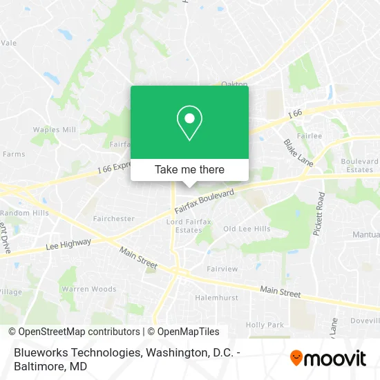
See Blueworks Technologies, Fairfax, on the map
Public Transit to Blueworks Technologies in Fairfax
Wondering how to get to Blueworks Technologies in Fairfax? Moovit helps you find the best way to get to Blueworks Technologies with step-by-step directions from the nearest public transit station.
Moovit provides free maps and live directions to help you navigate through your city. View schedules, routes, timetables, and find out how long does it take to get to Blueworks Technologies in real time.
Looking for the nearest stop or station to Blueworks Technologies? Check out this list of stops closest to your destination: Eaton Place at 10306 Block (Wb); Eaton Place at 10306 Block; Fairfax Blvd at Eaton Pl (Wb); Fairfax Bl+Eaton Pl; Fairfax Blvd at Eaton Pl; Vienna Metro Station.
Bus: GOLD 1, GOLD 2, GREEN 2, GREEN 1, F60.Metro: ORANGE.
Want to see if there’s another route that gets you there at an earlier time? Moovit helps you find alternative routes or times. Get directions from and directions to Blueworks Technologies easily from the Moovit App or Website.
We make riding to Blueworks Technologies easy, which is why over 1.5 million users, including users in Fairfax, trust Moovit as the best app for public transit. You don’t need to download an individual bus app or train app, Moovit is your all-in-one transit app that helps you find the best bus time or train time available.
For information on prices of bus and metro, costs and ride fares to Blueworks Technologies, please check the Moovit app.
Use the app to navigate to popular places including to the airport, hospital, stadium, grocery store, mall, coffee shop, school, college, and university.
Blueworks Technologies Address: 10304 Eaton Pl Fairfax, VA 22030 street in Fairfax
- Karma Care,
- Mike Stein - Fairway Independent Mortgage Corp,
- Gordon W. Frazier Tree Service,
- Freddie Mac,
- Gsa, FS, Office of the CHF Info,
- Maxx Impact Group,
- Formed Families Forward,
- Playworks Counseling,
- Platinum Roofing & Masonry,
- Dudley Door,
- Collective Renovations,
- Diginetplore,
- Jenny's Therapeutic Massage & Spa,
- Nova Psych & Wellness,
- Pink Point,
- Infrastructure Consulting Services, Inc.,
- Window Replacement & Installation Contractor,
- Free Estimate,
- Dwight Foley at Comparion Insurance Agency,
- Fast Cash Offer US
Places Near Blueworks Technologies (Fairfax)
- National Mall, Washington,
- Basilica of the National Shrine, Washington,
- Westfield Montgomery Mall, Montgomery County,
- National Zoo, Washington,
- PG Mall, Prince George's County,
- Washington National Cathedral, Washington,
- Pennsylvania Ave NW (3rd st and pennsylvania), Washington,
- Washington DC VA Medical Center, Washington,
- Amazon Hq2, Arlington County,
- Museum Of The Bible, Washington,
- M&T Bank Stadium, Baltimore,
- The Anthem, Washington,
- Georgetown, Washington,
- Sibley Memorial Hospital, Washington,
- Rock Creek Tennis Center, Washington,
- National Museum of African American History and Culture, Washington,
- Warner Theatre, Washington,
- Marriott Marquis Washington, DC, Washington,
- Camden Yards, Baltimore,
- Capital One Arena, Washington
How to get to popular places in Washington, D.C. - Baltimore, MD with public transit
Get around Fairfax by public transit!
Traveling around Fairfax has never been so easy. See step by step directions as you travel to any attraction, street or major public transit station. View bus and train schedules, arrival times, service alerts and detailed routes on a map, so you know exactly how to get to anywhere in Fairfax.
When traveling to any destination around Fairfax use Moovit's Live Directions with Get Off Notifications to know exactly where and how far to walk, how long to wait for your line, and how many stops are left. Moovit will alert you when it's time to get off — no need to constantly re-check whether yours is the next stop.
Wondering how to use public transit in Fairfax or how to pay for public transit in Fairfax? Moovit public transit app can help you navigate your way with public transit easily, and at minimum cost. It includes public transit fees, ticket prices, and costs. Looking for a map of Fairfax public transit lines? Moovit public transit app shows all public transit maps in Fairfax with all Bus, Train, Metro, Light Rail and Ferry routes and stops on an interactive map.
Washington, D.C. - Baltimore, MD has 5 transit type(s), including: Bus, Train, Metro, Light Rail and Ferry, operated by several transit agencies, including WMATA, Montgomery County Ride On, Fairfax Connector, TheBus, PRTC, DASH - Alexandria, Arlington Transit (ART), RTA of Central Maryland, MDOT MTA, MDOT MTA Light RailLink, MDOT MTA Commuter Bus, MDOT MTA Local Bus, FXBGO!, Virginia Railway Express (VRE) and MARC