How to get to Bmax Custom Tuning & Performance by bus?
Click on the bus route to see step by step directions with maps, line arrival times and updated time schedules.
From Hca Florida Lawnwood Hospital, Fort Pierce
58 minFrom US-1 / SE Port St Lucie Blvd, Port St. Lucie
47 minFrom Clover Park, Port St. Lucie
95 minFrom Indian River State College, Fort Pierce
75 minFrom Tradition Park, Port St. Lucie
150 minFrom CVS Pharmacy - (Lyngate Dr), Port St. Lucie
37 minFrom Stuart, Florida, Stuart
87 min
Bus stops near Bmax Custom Tuning & Performance in Miami
Bus lines to Bmax Custom Tuning & Performance in Miami
What are the closest stations to Bmax Custom Tuning & Performance?
The closest stations to Bmax Custom Tuning & Performance are:
- Kitterman Rd E & US Hwy 1 is 630 yards away, 8 min walk.
- Rio Mar Dr S & US Hwy 1 is 1243 yards away, 15 min walk.
Which bus line stops near Bmax Custom Tuning & Performance?
1 (Treasure Coast Mall)
What’s the nearest bus station to Bmax Custom Tuning & Performance in Miami?
The nearest bus station to Bmax Custom Tuning & Performance in Miami is Kitterman Rd E & US Hwy 1. It’s a 8 min walk away.
What time is the first bus to Bmax Custom Tuning & Performance in Miami?
The 1 is the first bus that goes to Bmax Custom Tuning & Performance in Miami. It stops nearby at 6:27 AM.
What time is the last bus to Bmax Custom Tuning & Performance in Miami?
The 1 is the last bus that goes to Bmax Custom Tuning & Performance in Miami. It stops nearby at 7:34 PM.
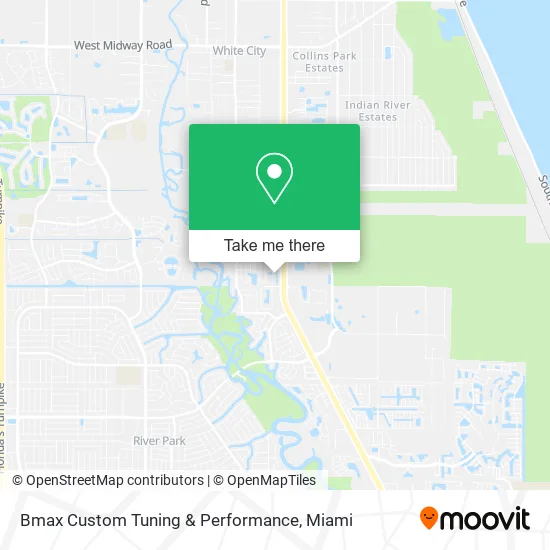
See Bmax Custom Tuning & Performance, Miami, on the map
Public Transit to Bmax Custom Tuning & Performance in Miami
Wondering how to get to Bmax Custom Tuning & Performance in Miami? Moovit helps you find the best way to get to Bmax Custom Tuning & Performance with step-by-step directions from the nearest public transit station.
Moovit provides free maps and live directions to help you navigate through your city. View schedules, routes, timetables, and find out how long does it take to get to Bmax Custom Tuning & Performance in real time.
Looking for the nearest stop or station to Bmax Custom Tuning & Performance? Check out this list of stops closest to your destination: Kitterman Rd E & US Hwy 1; Rio Mar Dr S & US Hwy 1.
Bus: 1, 6.
Want to see if there’s another route that gets you there at an earlier time? Moovit helps you find alternative routes or times. Get directions from and directions to Bmax Custom Tuning & Performance easily from the Moovit App or Website.
We make riding to Bmax Custom Tuning & Performance easy, which is why over 1.5 million users, including users in Miami, trust Moovit as the best app for public transit. You don’t need to download an individual bus app or train app, Moovit is your all-in-one transit app that helps you find the best bus time or train time available.
For information on prices of bus, costs and ride fares to Bmax Custom Tuning & Performance, please check the Moovit app.
Use the app to navigate to popular places including to the airport, hospital, stadium, grocery store, mall, coffee shop, school, college, and university.
Bmax Custom Tuning & Performance Address: 6900 Heritage Dr Port St Lucie, FL 34952 street in Miami
- L and H Packing and Moving Supplies,
- Douglass Restoration,
- Treasure Coast Pottery,
- Miami Deco Drive Mini Market & Tax,
- Genesis Community Church,
- Carebag,
- Berzerk Comics,
- New Beginning Church,
- Gittens Carl CF MD Pa,
- Edward Jones - Financial Advisor: Michael Sorvillo,
- Jesus Center Community Church,
- Tropicana Arcade,
- Advanced Diagnostic GR,
- Port St. Lucie, Fl,
- Social Security,
- St. Lucie Bowling Lanes,
- Mi Casa de Oration El Elyion,
- Friends of Care Net TC,
- Zapatas Restaurant,
- Bellagio Arcade
Places Near Bmax Custom Tuning & Performance (Miami)
- Wynwood, Miami,
- Richard E. Gerstein Justice Building, Miami,
- Zoo Miami, Miami,
- Miami VA Hospital, Miami,
- Marlins Park, Miami,
- Sawgrass mall ( FL ), Miami Beach,
- Keiser University Flagship Campus, West Palm Beach,
- Miami Design District, Miami,
- Brickell City Centre, Miami,
- Miami-Dade County Courthouse, Miami,
- Aventura Mall, Miami,
- Miami Freedom Park, Miami,
- Hard Rock Stadium, Miami Gardens,
- Bayside Marketplace, Miami,
- Port of Miami Cruise Terminal, Miami,
- Dolphin Mall, Miami,
- Dolphin Mall Bus, Miami,
- Sawgrass Mall, Miami,
- Aventura Mall, Miami Beach,
- Little Havana, Miami
How to get to popular places in Miami with public transit
Get around Miami by public transit!
Traveling around Miami has never been so easy. See step by step directions as you travel to any attraction, street or major public transit station. View bus and train schedules, arrival times, service alerts and detailed routes on a map, so you know exactly how to get to anywhere in Miami.
When traveling to any destination around Miami use Moovit's Live Directions with Get Off Notifications to know exactly where and how far to walk, how long to wait for your line, and how many stops are left. Moovit will alert you when it's time to get off — no need to constantly re-check whether yours is the next stop.
Wondering how to use public transit in Miami or how to pay for public transit in Miami? Moovit public transit app can help you navigate your way with public transit easily, and at minimum cost. It includes public transit fees, ticket prices, and costs. Looking for a map of Miami public transit lines? Moovit public transit app shows all public transit maps in Miami with all Bus, Train, Light Rail and Ferry routes and stops on an interactive map.
Miami has 4 transit type(s), including: Bus, Train, Light Rail and Ferry, operated by several transit agencies, including Broward County Transit, Miami-Dade Transit, Metrorail, Palm Tran, Tri-Rail, Brightline, MARTY, City of Homestead Trolley, Key West Transit, Treasure Coast Connector, GoLine IRT, Amtrak, Greyhound-us, FlixBus-us and Aventura Express Shuttle Bus