How to get to Bml by bus?
Click on the bus route to see step by step directions with maps, line arrival times and updated time schedules.
From Gleis 103, Pforzheim
33 minFrom Rkh Kliniken, Verwaltungsgemeinschaft Bretten
129 minFrom 75217, Birkenfeld
89 minFrom Erotikhaus Astoria Pforzheim, Pforzheim
41 minFrom Gasometer Pforzheim, Pforzheim
57 minFrom Friedenstraße, Pforzheim
50 minFrom Kupferhammer, Pforzheim
60 minFrom Helios Klinikum Pforzheim-Notaufnahme, Pforzheim
52 minFrom Johanna-Wittum Schule, Pforzheim
54 minFrom Konrad-Adenauer-Realschule, Pforzheim
52 min
How to get to Bml by train?
Click on the train route to see step by step directions with maps, line arrival times and updated time schedules.
Bus stops near Bml in Verwaltungsverband Kämpfelbachtal
Train stations near Bml in Verwaltungsverband Kämpfelbachtal
Light Rail stations near Bml in Verwaltungsverband Kämpfelbachtal
- Königsbach, 25 min walk,VIEW
Bus lines to Bml in Verwaltungsverband Kämpfelbachtal
What are the closest stations to Bml?
The closest stations to Bml are:
- Stein Siemensstraße is 30 meters away, 1 min walk.
- Stein Lisztstraße is 435 meters away, 6 min walk.
- Königsbach (Baden) is 1927 meters away, 25 min walk.
- Königsbach Bahnhof is 1929 meters away, 25 min walk.
- Königsbach is 1929 meters away, 25 min walk.
Which train line stops near Bml?
S5 (Karlsruhe Albtalbahnhof)
Which bus line stops near Bml?
731 (Königsbach Ankerstraße)
What’s the nearest light rail station to Bml in Verwaltungsverband Kämpfelbachtal?
The nearest light rail station to Bml in Verwaltungsverband Kämpfelbachtal is Königsbach. It’s a 25 min walk away.
What’s the nearest train station to Bml in Verwaltungsverband Kämpfelbachtal?
The nearest train stations to Bml in Verwaltungsverband Kämpfelbachtal are Königsbach (Baden) and Königsbach Bahnhof. The closest one is a 25 min walk away.
What’s the nearest bus station to Bml in Verwaltungsverband Kämpfelbachtal?
The nearest bus station to Bml in Verwaltungsverband Kämpfelbachtal is Stein Siemensstraße. It’s a 1 min walk away.
What time is the first light rail to Bml in Verwaltungsverband Kämpfelbachtal?
The S5 is the first light rail that goes to Bml in Verwaltungsverband Kämpfelbachtal. It stops nearby at 4:43 AM.
What time is the last light rail to Bml in Verwaltungsverband Kämpfelbachtal?
The S5 is the last light rail that goes to Bml in Verwaltungsverband Kämpfelbachtal. It stops nearby at 1:19 AM.
What time is the first train to Bml in Verwaltungsverband Kämpfelbachtal?
The S5 is the first train that goes to Bml in Verwaltungsverband Kämpfelbachtal. It stops nearby at 4:45 AM.
What time is the last train to Bml in Verwaltungsverband Kämpfelbachtal?
The S5 is the last train that goes to Bml in Verwaltungsverband Kämpfelbachtal. It stops nearby at 1:19 AM.
What time is the first bus to Bml in Verwaltungsverband Kämpfelbachtal?
The 731 is the first bus that goes to Bml in Verwaltungsverband Kämpfelbachtal. It stops nearby at 5:05 AM.
What time is the last bus to Bml in Verwaltungsverband Kämpfelbachtal?
The 731 is the last bus that goes to Bml in Verwaltungsverband Kämpfelbachtal. It stops nearby at 12:04 AM.
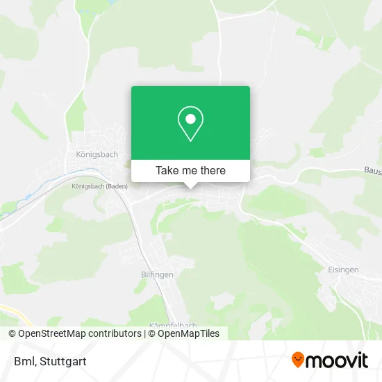
See Bml, Verwaltungsverband Kämpfelbachtal, on the map
Public Transit to Bml in Verwaltungsverband Kämpfelbachtal
Wondering how to get to Bml in Verwaltungsverband Kämpfelbachtal? Moovit helps you find the best way to get to Bml with step-by-step directions from the nearest public transit station.
Moovit provides free maps and live directions to help you navigate through your city. View schedules, routes, timetables, and find out how long does it take to get to Bml in real time.
Looking for the nearest stop or station to Bml? Check out this list of stops closest to your destination: Stein Siemensstraße; Stein Lisztstraße; Königsbach (Baden); Königsbach Bahnhof; Königsbach.
Train: S5, S51, MEX17, MEX17, S51.Bus: 731, 933.
Want to see if there’s another route that gets you there at an earlier time? Moovit helps you find alternative routes or times. Get directions from and directions to Bml easily from the Moovit App or Website.
We make riding to Bml easy, which is why over 1.5 million users, including users in Verwaltungsverband Kämpfelbachtal, trust Moovit as the best app for public transit. You don’t need to download an individual bus app or train app, Moovit is your all-in-one transit app that helps you find the best bus time or train time available.
For information on prices of bus and train, costs and ride fares to Bml, please check the Moovit app.
Use the app to navigate to popular places including to the airport, hospital, stadium, grocery store, mall, coffee shop, school, college, and university.
Bml Address: Siemensstraße 1 Stein, 75203 Königsbach-Stein street in Verwaltungsverband Kämpfelbachtal
- Gewerbegebiet Mitteltal,
- Bml Baumaschinen,
- Wagner Patrick Musiklehrer,
- Härter Werkzeugbau,
- Veile Günther Feindrehteile,
- Gaststätte Felsquelle,
- Spindlers Essbar,
- Eurovia,
- Mitteltal,
- Härter Stanztechnik Gmbh,
- Günther Veile Tennis-Center,
- Hottinger Präzisionstechnik,
- Bruchbachsee,
- Stein,
- Schreinerei Kauselmann Inh. Achim Kastner,
- Felss Group Gmbh,
- Coiltech Deutschland,
- Chamfer Skiving,
- Felsomat,
- Zapf
Places Near Bml (Verwaltungsverband Kämpfelbachtal)
- Klinikum Stuttgart - Katharinenhospital, Stuttgart-Mitte,
- Waldfriedhof, Degerloch,
- Mercedes-Benz Museum (Mercedes Museum Stuttgart), Bad Cannstatt,
- Wilhelma (U-Bahn Wilhelma), Bad Cannstatt,
- FlixBus Haltestelle, Stuttgart,
- Geilhaus Haus 33a, Reutlingen-Betzingen,
- Hanns-Martin-Schleyer-Halle, Bad Cannstatt,
- Marmorsaal Im Weissenburgpark, Stuttgart-Süd,
- Mettingen Eros-Center Puff Laufhaus, Esslingen Am Neckar,
- Gleis 101/102 (tief), Stuttgart-Mitte,
- Hanns-Martin-Schleyer-Halle (Stuttgart Hans-Martin-Schleyerhalle), Bad Cannstatt,
- SI-Centrum, Möhringen,
- Gasometer Pforzheim, Pforzheim,
- Porsche Museum, Zuffenhausen,
- Mercedes-Benz Museum, Bad Cannstatt,
- Schleyerhalle, Bad Cannstatt,
- Hauptbahnhof Stuttgart, Stuttgart-Mitte,
- Im Wizemann (Halle), Bad Cannstatt,
- Porsche-Arena, Bad Cannstatt,
- Pariser Platz Stuttgart, Stuttgart-Mitte
How to get to popular places in Stuttgart with public transit
Get around Verwaltungsverband Kämpfelbachtal by public transit!
Traveling around Verwaltungsverband Kämpfelbachtal has never been so easy. See step by step directions as you travel to any attraction, street or major public transit station. View bus and train schedules, arrival times, service alerts and detailed routes on a map, so you know exactly how to get to anywhere in Verwaltungsverband Kämpfelbachtal.
When traveling to any destination around Verwaltungsverband Kämpfelbachtal use Moovit's Live Directions with Get Off Notifications to know exactly where and how far to walk, how long to wait for your line, and how many stops are left. Moovit will alert you when it's time to get off — no need to constantly re-check whether yours is the next stop.
Wondering how to use public transit in Verwaltungsverband Kämpfelbachtal or how to pay for public transit in Verwaltungsverband Kämpfelbachtal? Moovit public transit app can help you navigate your way with public transit easily, and at minimum cost. It includes public transit fees, ticket prices, and costs. Looking for a map of Verwaltungsverband Kämpfelbachtal public transit lines? Moovit public transit app shows all public transit maps in Verwaltungsverband Kämpfelbachtal with all Bus, Train, Subway, Light Rail, Ferry, S-Bahn and Funicular routes and stops on an interactive map.
Stuttgart has 7 transit type(s), including: Bus, Train, Subway, Light Rail, Ferry, S-Bahn and Funicular, operated by several transit agencies, including SSB - Stadtbahn, SSB, SSB - Seilbahn / Zacke, S-Bahn Stuttgart, Rhein-Neckar-Verkehr GmbH (rnv), Karlsruher Verkehrsverbund, DB AG, DB Regiobus BW, Arverio Baden-Württemberg GmbH, DB RegioNetz Verkehrs GmbH Westfrankenbahn, DB Regio AG Baden-Württemberg, Südwestdeutsche Verkehrs-AG, DB Regio AG Mitte Region Hessen, DB and Bodensee-Oberschwaben-Bahn