Directions to Bmore Visual (Baltimore) with public transportation
The following transit lines have routes that pass near Bmore Visual
 Bus: 94, BANNER ROUTE, CHERRY ROUTE.
- Ferry: HC1, HC2, HC3.
How to get to Bmore Visual by bus?
Click on the bus route to see step by step directions with maps, line arrival times and updated time schedules.
From I-70 at Security Blvd Baltimore City Lot Park & Ride, Baltimore
73 minFrom Baltimore Poly Tech High School, Baltimore
53 minFrom Guinness Open Gate Brewery & Barrel House, Baltimore County
73 minFrom Good Samaritan Hospital, Baltimore
58 minFrom University Of Maryland Baltimore (Umbc), Baltimore County
57 minFrom Dundalk, Maryland, Baltimore County
53 minFrom Walmart, Baltimore
46 minFrom Sinai Hospital, Baltimore
72 minFrom MVA Glen Burnie, Anne Arundel County
47 minFrom Baltimore Museum Of Art, Baltimore
44 min
Bus stops near Bmore Visual in Baltimore
Ferry stations near Bmore Visual in Baltimore
Bus lines to Bmore Visual in Baltimore
What are the closest stations to Bmore Visual?
The closest stations to Bmore Visual are:
- Fort Ave & Andre St is 255 yards away, 4 min walk.
- Fort Ave & Andre St Eb is 301 yards away, 4 min walk.
- Locust Point is 1135 yards away, 14 min walk.
- Mchenry Row (Sb) is 1161 yards away, 14 min walk.
- Pier Five is 1991 yards away, 24 min walk.
Which bus lines stop near Bmore Visual?
These bus lines stop near Bmore Visual: 94, BANNER ROUTE.
What’s the nearest bus station to Bmore Visual in Baltimore?
The nearest bus stations to Bmore Visual in Baltimore are Fort Ave & Andre St and Fort Ave & Andre St Eb. The closest one is a 4 min walk away.
What’s the nearest ferry station to Bmore Visual in Baltimore?
The nearest ferry station to Bmore Visual in Baltimore is Locust Point. It’s a 14 min walk away.
What time is the first bus to Bmore Visual in Baltimore?
The 94 is the first bus that goes to Bmore Visual in Baltimore. It stops nearby at 3:55 AM.
What time is the last bus to Bmore Visual in Baltimore?
The 94 is the last bus that goes to Bmore Visual in Baltimore. It stops nearby at 2:18 AM.
What time is the first ferry to Bmore Visual in Baltimore?
The HC3 is the first ferry that goes to Bmore Visual in Baltimore. It stops nearby at 6:00 AM.
What time is the last ferry to Bmore Visual in Baltimore?
The HC1 is the last ferry that goes to Bmore Visual in Baltimore. It stops nearby at 8:07 PM.
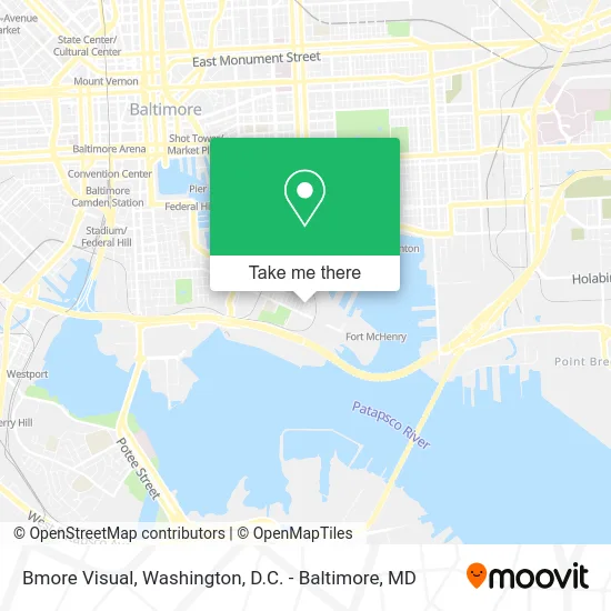
See Bmore Visual, Baltimore, on the map
Public Transit to Bmore Visual in Baltimore
Wondering how to get to Bmore Visual in Baltimore? Moovit helps you find the best way to get to Bmore Visual with step-by-step directions from the nearest public transit station.
Moovit provides free maps and live directions to help you navigate through your city. View schedules, routes, timetables, and find out how long does it take to get to Bmore Visual in real time.
Looking for the nearest stop or station to Bmore Visual? Check out this list of stops closest to your destination: Fort Ave & Andre St; Fort Ave & Andre St Eb; Locust Point; Mchenry Row (Sb); Pier Five.
Bus: 94, BANNER ROUTE, CHERRY ROUTE.Ferry: HC1, HC2, HC3.
Want to see if there’s another route that gets you there at an earlier time? Moovit helps you find alternative routes or times. Get directions from and directions to Bmore Visual easily from the Moovit App or Website.
We make riding to Bmore Visual easy, which is why over 1.5 million users, including users in Baltimore, trust Moovit as the best app for public transit. You don’t need to download an individual bus app or train app, Moovit is your all-in-one transit app that helps you find the best bus time or train time available.
For information on prices of bus, costs and ride fares to Bmore Visual, please check the Moovit app.
Use the app to navigate to popular places including to the airport, hospital, stadium, grocery store, mall, coffee shop, school, college, and university.
Bmore Visual Address: 1409 Steuart St Baltimore, MD 21230 street in Baltimore
- Breed Street Beer Co.,
- Stocklin, Eric J,
- Divahglaminc,
- Glenn Petersen Marine Service,
- Invein Aesthetics,
- Prive Salon & Spa - Locust Point,
- Locust Point, Maryland,
- Khan Management Group,
- Furever & Fur Always - Wedding Day Dog Care,
- Paint Perfection,
- CSX Transportation,
- Locust Point,
- Music Together of Charm City,
- Distinctive Promotions,
- Emge Donald L Rev,
- Francis Scott Key Elementary / Middle School,
- Port of Baltimore-Locust Point,
- Baltimore City,
- Daniel W Wilson,
- Bus Stop At Fort Mchenry
Places Near Bmore Visual (Baltimore)
- National Museum of African American History and Culture, Washington,
- National Mall, Washington,
- Amazon Hq2, Arlington County,
- National Zoo, Washington,
- Museum Of The Bible, Washington,
- Sibley Memorial Hospital, Washington,
- PG Mall, Prince George's County,
- Washington DC VA Medical Center, Washington,
- Pennsylvania Ave NW (3rd st and pennsylvania), Washington,
- Rock Creek Tennis Center, Washington,
- Capital One Arena, Washington,
- Camden Yards, Baltimore,
- Washington National Cathedral, Washington,
- Westfield Montgomery Mall, Montgomery County,
- Basilica of the National Shrine, Washington,
- Marriott Marquis Washington, DC, Washington,
- Georgetown, Washington,
- The Anthem, Washington,
- M&T Bank Stadium, Baltimore,
- Warner Theatre, Washington
How to get to popular places in Washington, D.C. - Baltimore, MD with public transit
Get around Baltimore by public transit!
Traveling around Baltimore has never been so easy. See step by step directions as you travel to any attraction, street or major public transit station. View bus and train schedules, arrival times, service alerts and detailed routes on a map, so you know exactly how to get to anywhere in Baltimore.
When traveling to any destination around Baltimore use Moovit's Live Directions with Get Off Notifications to know exactly where and how far to walk, how long to wait for your line, and how many stops are left. Moovit will alert you when it's time to get off — no need to constantly re-check whether yours is the next stop.
Wondering how to use public transit in Baltimore or how to pay for public transit in Baltimore? Moovit public transit app can help you navigate your way with public transit easily, and at minimum cost. It includes public transit fees, ticket prices, and costs. Looking for a map of Baltimore public transit lines? Moovit public transit app shows all public transit maps in Baltimore with all Bus, Train, Metro, Light Rail and Ferry routes and stops on an interactive map.
Washington, D.C. - Baltimore, MD has 5 transit type(s), including: Bus, Train, Metro, Light Rail and Ferry, operated by several transit agencies, including WMATA, Montgomery County Ride On, Fairfax Connector, TheBus, PRTC, DASH - Alexandria, Arlington Transit (ART), RTA of Central Maryland, MDOT MTA, MDOT MTA Light RailLink, MDOT MTA Commuter Bus, MDOT MTA Local Bus, FXBGO!, Virginia Railway Express (VRE) and MARC