How to get to Boboat by bus?
Click on the bus route to see step by step directions with maps, line arrival times and updated time schedules.
Bus stops near Boboat in Reims
Bus lines to Boboat in Reims
What are the closest stations to Boboat?
The closest stations to Boboat are:
- St Maurice is 178 meters away, 3 min walk.
- Vesle is 227 meters away, 3 min walk.
- St Bernard is 401 meters away, 6 min walk.
- Flechambault is 658 meters away, 9 min walk.
- Folle Peine is 790 meters away, 11 min walk.
- Rollin is 793 meters away, 11 min walk.
Which bus lines stop near Boboat?
These bus lines stop near Boboat: E5, U5.
What’s the nearest bus station to Boboat in Reims?
The nearest bus stations to Boboat in Reims are St Maurice and Vesle. The closest one is a 3 min walk away.
What time is the first light rail to Boboat in Reims?
The TRAM is the first light rail that goes to Boboat in Reims. It stops nearby at 5:07 AM.
What time is the last light rail to Boboat in Reims?
The TRAM is the last light rail that goes to Boboat in Reims. It stops nearby at 1:05 AM.
What time is the first bus to Boboat in Reims?
The U9 is the first bus that goes to Boboat in Reims. It stops nearby at 5:24 AM.
What time is the last bus to Boboat in Reims?
The O1 is the last bus that goes to Boboat in Reims. It stops nearby at 12:42 AM.
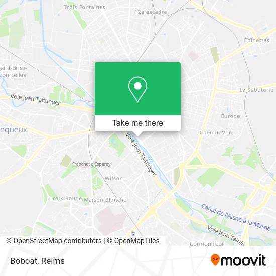
See Boboat, Reims, on the map
Public Transit to Boboat in Reims
Wondering how to get to Boboat in Reims? Moovit helps you find the best way to get to Boboat with step-by-step directions from the nearest public transit station.
Moovit provides free maps and live directions to help you navigate through your city. View schedules, routes, timetables, and find out how long does it take to get to Boboat in real time.
Looking for the nearest stop or station to Boboat? Check out this list of stops closest to your destination: St Maurice; Vesle; St Bernard; Flechambault; Folle Peine; Rollin.
Bus: E5, U5, C, O1, U2, TRAM, U1, U7, U8, U6, U4, U9.
Want to see if there’s another route that gets you there at an earlier time? Moovit helps you find alternative routes or times. Get directions from and directions to Boboat easily from the Moovit App or Website.
We make riding to Boboat easy, which is why over 1.5 million users, including users in Reims, trust Moovit as the best app for public transit. You don’t need to download an individual bus app or train app, Moovit is your all-in-one transit app that helps you find the best bus time or train time available.
For information on prices of bus, costs and ride fares to Boboat, please check the Moovit app.
Use the app to navigate to popular places including to the airport, hospital, stadium, grocery store, mall, coffee shop, school, college, and university.
Boboat Address: 67 Boulevard Paul Doumer 51100 Reims street in Reims
- Vrabie Beatric,
- Fournil du Jard,
- Rondeaux Rémi,
- Couples et Familles Marne,
- Le Ruban Bleu (Reims),
- La Parenthese,
- Association la,
- Colvert Logistique,
- Zheebra,
- Business Fabrik,
- Nicolas Robinet,
- Venise Cars,
- Eurl Perin Jonathan,
- Marcher Frais,
- Life-Meubles,
- Proxi,
- Docteur Picavet,
- Scm Cabinet Dentaire du Pont de Venise,
- Jardin David,
- Derbecourt Duplouy Marie
Places Near Boboat (Reims)
- CHU, Reims,
- Gare Tgv, Bezannes,
- Campus Croix Rouge, Reims,
- Polyclinique Reims Bezannes, Bezannes,
- St Remi, Reims,
- Bétheny, Bétheny,
- Hôpital Debré, Reims,
- E. Leclerc Champfleury, Champfleury,
- Carrefour, Tinqueux,
- Parc Des Expositions, Reims,
- Croix Blandin, Reims,
- Bezannes, Bezannes,
- Parc de Champagne, Reims,
- La Neuvillette, Reims,
- Leclerc, Saint-Brice-Courcelles,
- Tinqueux, Tinqueux,
- Moulin De La Housse, Reims,
- Cormontreuil, Reims,
- Ikea, Thillois,
- Hôpital Maison Blanche, Reims
How to get to popular places in Reims with public transit
Get around Reims by public transit!
Traveling around Reims has never been so easy. See step by step directions as you travel to any attraction, street or major public transit station. View bus and train schedules, arrival times, service alerts and detailed routes on a map, so you know exactly how to get to anywhere in Reims.
When traveling to any destination around Reims use Moovit's Live Directions with Get Off Notifications to know exactly where and how far to walk, how long to wait for your line, and how many stops are left. Moovit will alert you when it's time to get off — no need to constantly re-check whether yours is the next stop.
Wondering how to use public transit in Reims or how to pay for public transit in Reims? Moovit public transit app can help you navigate your way with public transit easily, and at minimum cost. It includes public transit fees, ticket prices, and costs. Looking for a map of Reims public transit lines? Moovit public transit app shows all public transit maps in Reims with all Bus and Light Rail routes and stops on an interactive map.
Reims has 2 transit type(s), including: Bus and Light Rail, operated by several transit agencies, including Transdev Reims