How to get to Boca Locks Change by bus?
Click on the bus route to see step by step directions with maps, line arrival times and updated time schedules.
From Butterfly World, Pompano Beach
90 minFrom Intersection : N Andrews Ave & Sample Rd., Pompano Beach
71 minFrom Blanche Ely High School, Pompano Beach
78 minFrom Pretty in Palm Beach, Boynton Beach-Delray Beach
82 minFrom Sample Rd, Deerfield Beach
76 minFrom Broward College North Campus Bldg. 48, Pompano Beach
102 minFrom North Area Transportation Terminal, Pompano Beach
102 minFrom Brazzers, Boca Raton
34 minFrom Lynn University, Boca Raton
66 min
How to get to Boca Locks Change by train?
Click on the train route to see step by step directions with maps, line arrival times and updated time schedules.
Bus stops near Boca Locks Change in Boca Raton
Train stations near Boca Locks Change in Boca Raton
Bus lines to Boca Locks Change in Boca Raton
What are the closest stations to Boca Locks Change?
The closest stations to Boca Locks Change are:
- E CAMINO REAL at DIXIE HWY is 159 yards away, 2 min walk.
- Camino Real/US 1 is 226 yards away, 3 min walk.
- Boca Raton is 716 yards away, 9 min walk.
- Deerfield Beach Station is 5000 yards away, 58 min walk.
Which bus lines stop near Boca Locks Change?
These bus lines stop near Boca Locks Change: 1, 10, 94.
Which train line stops near Boca Locks Change?
BLFM (Ekw)
What’s the nearest train station to Boca Locks Change in Boca Raton?
The nearest train station to Boca Locks Change in Boca Raton is Boca Raton. It’s a 9 min walk away.
What’s the nearest bus station to Boca Locks Change in Boca Raton?
The nearest bus station to Boca Locks Change in Boca Raton is E CAMINO REAL at DIXIE HWY. It’s a 2 min walk away.
What time is the first train to Boca Locks Change in Boca Raton?
The TRIRAIL is the first train that goes to Boca Locks Change in Boca Raton. It stops nearby at 4:35 AM.
What time is the last train to Boca Locks Change in Boca Raton?
The FLORIDIAN is the last train that goes to Boca Locks Change in Boca Raton. It stops nearby at 4:57 PM.
What time is the first bus to Boca Locks Change in Boca Raton?
The 10 is the first bus that goes to Boca Locks Change in Boca Raton. It stops nearby at 5:23 AM.
What time is the last bus to Boca Locks Change in Boca Raton?
The 10 is the last bus that goes to Boca Locks Change in Boca Raton. It stops nearby at 12:18 AM.
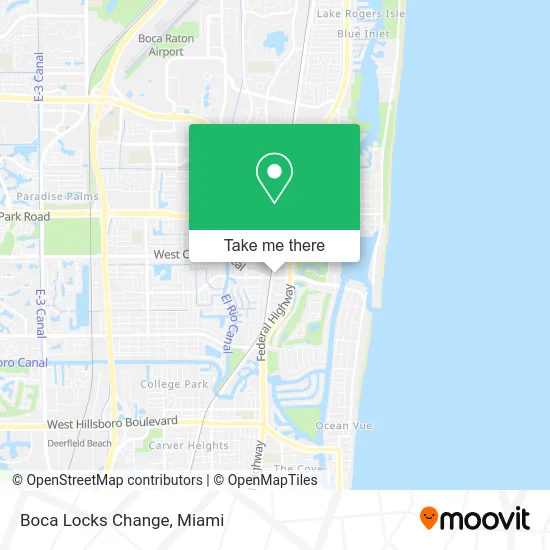
See Boca Locks Change, Boca Raton, on the map
Public Transit to Boca Locks Change in Boca Raton
Wondering how to get to Boca Locks Change in Boca Raton? Moovit helps you find the best way to get to Boca Locks Change with step-by-step directions from the nearest public transit station.
Moovit provides free maps and live directions to help you navigate through your city. View schedules, routes, timetables, and find out how long does it take to get to Boca Locks Change in real time.
Looking for the nearest stop or station to Boca Locks Change? Check out this list of stops closest to your destination: E CAMINO REAL at DIXIE HWY; Camino Real/US 1; Boca Raton; Deerfield Beach Station.
Bus: 1, 10, 94, 92.Train: BLFM, TRIRAIL, FLORIDIAN, SILVER METEOR.
Want to see if there’s another route that gets you there at an earlier time? Moovit helps you find alternative routes or times. Get directions from and directions to Boca Locks Change easily from the Moovit App or Website.
We make riding to Boca Locks Change easy, which is why over 1.5 million users, including users in Boca Raton, trust Moovit as the best app for public transit. You don’t need to download an individual bus app or train app, Moovit is your all-in-one transit app that helps you find the best bus time or train time available.
For information on prices of bus and train, costs and ride fares to Boca Locks Change, please check the Moovit app.
Use the app to navigate to popular places including to the airport, hospital, stadium, grocery store, mall, coffee shop, school, college, and university.
Boca Locks Change Address: 1 E Camino Real Boca Raton, FL 33432 street in Boca Raton
- Mobil Mart,
- Exxon,
- 10x Mizner Park,
- Dickenson Law Firm,
- Fitzgerald Camino Real,
- Penske Truck Rental,
- All Pro Roofing & Building,
- Andrew Ponnock Attorney at Law,
- Garage Remote Programming,
- Publix Super Markets,
- Boca,
- Boca Noon Toastmasters Club 4207,
- Pamela Troglin - 2636289 - Wells Fargo Home Mortgage,
- Global Trust Realty, LLC,
- FedEx,
- WP Management Team,
- JZ Home Services - Audio & Video,
- Dr Dryer Vent Cleaning,
- Junk A Clunker,
- The Fresh Market
Places Near Boca Locks Change (Boca Raton)
- Dolphin Mall Bus, Miami,
- Bayside Marketplace, Miami,
- Sawgrass mall ( FL ), Miami Beach,
- Miami Freedom Park, Miami,
- Wynwood, Miami,
- Aventura Mall, Miami Beach,
- Miami-Dade County Courthouse, Miami,
- Little Havana, Miami,
- Aventura Mall, Miami,
- Zoo Miami, Miami,
- Miami Design District, Miami,
- Miami VA Hospital, Miami,
- Hard Rock Stadium, Miami Gardens,
- Sawgrass Mall, Miami,
- Keiser University Flagship Campus, West Palm Beach,
- Dolphin Mall, Miami,
- Port of Miami Cruise Terminal, Miami,
- Brickell City Centre, Miami,
- Richard E. Gerstein Justice Building, Miami,
- Marlins Park, Miami
How to get to popular places in Miami with public transit
Get around Boca Raton by public transit!
Traveling around Boca Raton has never been so easy. See step by step directions as you travel to any attraction, street or major public transit station. View bus and train schedules, arrival times, service alerts and detailed routes on a map, so you know exactly how to get to anywhere in Boca Raton.
When traveling to any destination around Boca Raton use Moovit's Live Directions with Get Off Notifications to know exactly where and how far to walk, how long to wait for your line, and how many stops are left. Moovit will alert you when it's time to get off — no need to constantly re-check whether yours is the next stop.
Wondering how to use public transit in Boca Raton or how to pay for public transit in Boca Raton? Moovit public transit app can help you navigate your way with public transit easily, and at minimum cost. It includes public transit fees, ticket prices, and costs. Looking for a map of Boca Raton public transit lines? Moovit public transit app shows all public transit maps in Boca Raton with all Bus, Train, Light Rail and Ferry routes and stops on an interactive map.
Miami has 4 transit type(s), including: Bus, Train, Light Rail and Ferry, operated by several transit agencies, including Broward County Transit, Miami-Dade Transit, Metrorail, Palm Tran, Tri-Rail, Brightline, MARTY, City of Homestead Trolley, Key West Transit, Treasure Coast Connector, GoLine IRT, Amtrak, Greyhound-us, FlixBus-us and Aventura Express Shuttle Bus