Directions to Bodega (Yonkers) with public transportation
The following transit lines have routes that pass near Bodega
 Bus: 1, 2, 4, BX7, BXM3.
- Train: 1, ADIRONDACK, BERKSHIRE FLYER, EMPIRE SERVICE, ETHAN ALLEN EXPRESS.
- Subway: 1.
How to get to Bodega by bus?
Click on the bus route to see step by step directions with maps, line arrival times and updated time schedules.
From Washington Heights, Manhattan
50 minFrom The Mall at Bay Plaza, Bronx
81 minFrom Rucker Park, Manhattan
76 minFrom 1910 monterey avenue, Bronx
63 minFrom 1910 Monterey Avenue, Bronx
57 minFrom Parkchester, Bronx
96 minFrom The Bronx, NY, Bronx
75 minFrom Yankee Stadium, Bronx
79 minFrom Broadway and 168th St, Manhattan
58 minFrom Holy Name Hospital, Teaneck
84 min
How to get to Bodega by train?
Click on the train route to see step by step directions with maps, line arrival times and updated time schedules.
How to get to Bodega by subway?
Click on the subway route to see step by step directions with maps, line arrival times and updated time schedules.
Bus stops near Bodega in Yonkers
Train stations near Bodega in Yonkers
Subway station near Bodega in Yonkers
- Van Cortlandt Park-242 St, 33 min walk,VIEW
Bus lines to Bodega in Yonkers
What are the closest stations to Bodega?
The closest stations to Bodega are:
- S Broadway/Radford St is 105 yards away, 2 min walk.
- S Broadway @ Radford St is 115 yards away, 2 min walk.
- Valentine La @ S Broadway is 300 yards away, 4 min walk.
- McLean Ave @ Lawrence St is 458 yards away, 6 min walk.
- Ludlow is 1563 yards away, 19 min walk.
- Van Cortlandt Park-242 St is 2822 yards away, 33 min walk.
- Yonkers is 4840 yards away, 57 min walk.
- Wakefield is 5126 yards away, 61 min walk.
Which bus lines stop near Bodega?
These bus lines stop near Bodega: 1, 2, 4, BX7, BXM3.
Which train line stops near Bodega?
1 (713#| Croton-Harmon)
Which subway line stops near Bodega?
1 (Uptown & The Bronx)
What’s the nearest train station to Bodega in Yonkers?
The nearest train station to Bodega in Yonkers is Ludlow. It’s a 19 min walk away.
What’s the nearest bus station to Bodega in Yonkers?
The nearest bus stations to Bodega in Yonkers are S Broadway/Radford St and S Broadway @ Radford St. The closest one is a 2 min walk away.
What time is the first subway to Bodega in Yonkers?
The 1 is the first subway that goes to Bodega in Yonkers. It stops nearby at 5:09 AM.
What time is the last subway to Bodega in Yonkers?
The 1 is the last subway that goes to Bodega in Yonkers. It stops nearby at 3:52 AM.
What time is the first train to Bodega in Yonkers?
The 2 is the first train that goes to Bodega in Yonkers. It stops nearby at 5:08 AM.
What time is the last train to Bodega in Yonkers?
The 1 is the last train that goes to Bodega in Yonkers. It stops nearby at 2:25 AM.
What time is the first bus to Bodega in Yonkers?
The 4 is the first bus that goes to Bodega in Yonkers. It stops nearby at 4:48 AM.
What time is the last bus to Bodega in Yonkers?
The BXM3 is the last bus that goes to Bodega in Yonkers. It stops nearby at 12:59 AM.
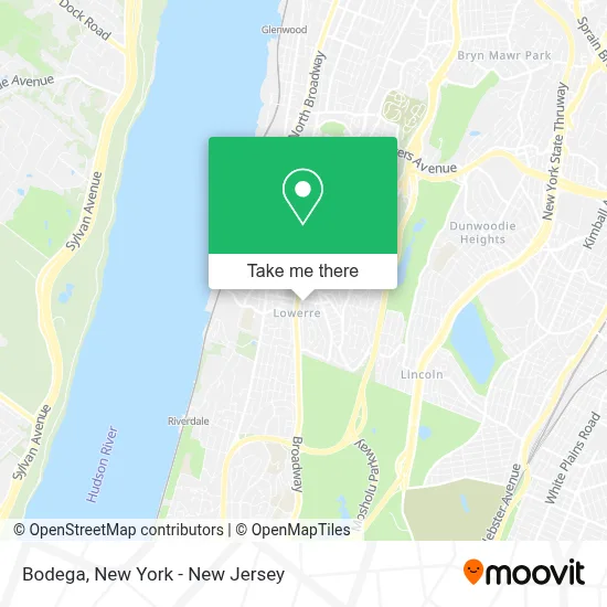
See Bodega, Yonkers, on the map
Public Transit to Bodega in Yonkers
Wondering how to get to Bodega in Yonkers? Moovit helps you find the best way to get to Bodega with step-by-step directions from the nearest public transit station.
Moovit provides free maps and live directions to help you navigate through your city. View schedules, routes, timetables, and find out how long does it take to get to Bodega in real time.
Looking for the nearest stop or station to Bodega? Check out this list of stops closest to your destination: S Broadway/Radford St; S Broadway @ Radford St; Valentine La @ S Broadway; McLean Ave @ Lawrence St; Ludlow; Van Cortlandt Park-242 St; Yonkers; Wakefield.
Bus: 1, 2, 4, BX7, BXM3, 3.Train: 1, ADIRONDACK, BERKSHIRE FLYER, EMPIRE SERVICE, ETHAN ALLEN EXPRESS, MAPLE LEAF, 2.Subway: 1.
Want to see if there’s another route that gets you there at an earlier time? Moovit helps you find alternative routes or times. Get directions from and directions to Bodega easily from the Moovit App or Website.
We make riding to Bodega easy, which is why over 1.5 million users, including users in Yonkers, trust Moovit as the best app for public transit. You don’t need to download an individual bus app or train app, Moovit is your all-in-one transit app that helps you find the best bus time or train time available.
For information on prices of bus, subway and train, costs and ride fares to Bodega, please check the Moovit app.
Use the app to navigate to popular places including to the airport, hospital, stadium, grocery store, mall, coffee shop, school, college, and university.
Bodega Address: Bruce Ave Yonkers, NY 10705 street in Yonkers
- United Pentecostal Church,
- Escuela Dominical Crr,
- Yonkers Hub,
- U Spa,
- Stop Wasting Abandoned Properties,
- El Puerto Cigars,
- Jurgen Barber Shop,
- Matthew Aqeel,
- Eagle Home Care,
- Ana Nails Yonkers NY,
- Last Pack,
- The Brothers Barbershop,
- Dunkin Donuts,
- United In Jesus Christ,
- Boost Mobile,
- Iglesia Universal,
- Auto Dynamix,
- Dollar Wonder Inc,
- St Andrews S Broadway,
- Yonkers Paint & Hardware
Places Near Bodega (Yonkers)
- 66 John Street, Manhattan,
- Hudson Yards, Manhattan,
- Wall Street, Manhattan,
- Pier 83, Manhattan,
- qqqq, Manhattan,
- Queens Center Mall, Queens,
- Times Square, Manhattan,
- 376 Hudson Street, Manhattan,
- 1 Police Plaza, Manhattan,
- 26 Federal Plaza, Manhattan,
- 3 Stone St, Manhattan,
- 911 Memorial, Manhattan,
- Bellevue Hospital, Manhattan,
- Mountainside Hospital, Glen Ridge,
- SoHo, Manhattan,
- Chinatown, Manhattan,
- San Gennaro Feast, Manhattan,
- 111 Centre New York City Supreme Court, Manhattan,
- Katz's Deli, Manhattan,
- Rockefeller Center, Manhattan
How to get to popular places in New York - New Jersey with public transit
Get around Yonkers by public transit!
Traveling around Yonkers has never been so easy. See step by step directions as you travel to any attraction, street or major public transit station. View bus and train schedules, arrival times, service alerts and detailed routes on a map, so you know exactly how to get to anywhere in Yonkers.
When traveling to any destination around Yonkers use Moovit's Live Directions with Get Off Notifications to know exactly where and how far to walk, how long to wait for your line, and how many stops are left. Moovit will alert you when it's time to get off — no need to constantly re-check whether yours is the next stop.
Wondering how to use public transit in Yonkers or how to pay for public transit in Yonkers? Moovit public transit app can help you navigate your way with public transit easily, and at minimum cost. It includes public transit fees, ticket prices, and costs. Looking for a map of Yonkers public transit lines? Moovit public transit app shows all public transit maps in Yonkers with all Bus, Train, Subway, Light Rail, Ferry and Cable Car routes and stops on an interactive map.
New York - New Jersey has 6 transit type(s), including: Bus, Train, Subway, Light Rail, Ferry and Cable Car, operated by several transit agencies, including MTA Subway, Metro-North Railroad, LIRR, PATH, MTA New York City Transit - Express routes, MTA Bus, NJ Transit, NYC Ferry, NICE bus, Bee-Line Bus, NJ Transit Rail, Norwalk Transit District, Hartford Line, River Valley Transit and HART