How to get to Bodega La Chinita by bus?
Click on the bus route to see step by step directions with maps, line arrival times and updated time schedules.
From Calle Fermin Tanguis 155 La Victoria, La Victori
44 minFrom Av venezuela, Lima
51 minFrom Avenida España 734, Breña
39 minFrom Ovalo Gutierrez, San Isidro
61 minFrom Scarlet Night Club, Los Olivos
44 minFrom Reniec, Jesus Mari
40 minFrom Panamericana Norte, Independen
47 minFrom METRO AV CANADA, La Victori
40 minFrom AV GUARDIA CIVIL SAN ISIDRO, San Isidro
48 min
How to get to Bodega La Chinita by metro?
Click on the metro route to see step by step directions with maps, line arrival times and updated time schedules.
Bus stops near Bodega La Chinita in El Agustin
Metro station near Bodega La Chinita in El Agustin
- El Ángel, 33 min walk,VIEW
Bus lines to Bodega La Chinita in El Agustin
- 1195, Chuquitanta (San Martin De Porres) - Huachipa (Lurigancho),VIEW
- 1220, Gamarra (El Agustino) - Proceres (San Juan de Lurigancho) ,VIEW
- 1043, S.J.L. - La Molina,VIEW
- 1044, Mangomarca (San Juan De Lurigancho) - Hospital Rebagliati (Jesús Maria),VIEW
- 1053, Campoy (San Juan De Lurigancho) - San Genaro (Chorrillos),VIEW
- 1055, Campoy (San Juan De Lurigancho) - Delicias De Villa (Chorrillos),VIEW
- 1060, Campoy (San Juan De Lurigancho) - Nueva Esperanza (Villa María Del Triunfo),VIEW
- 1204, S.J.L. - La Victoria - S.J.L.,VIEW
- 1475, Campoy (San Juan De Lurigancho) - La Paz (Callao),VIEW
- 4303, Ate - S.J.L.,VIEW
- 1474, Hospital del Empleado (Jesús Maria) - Campoy (San Juan de Lurigancho),VIEW
- 1256, S.J.L,VIEW
- 1346, Lima - S.JL,VIEW
- 1054, Wiesse (San Juan De Lurigancho) - Cedros de Villa (Chorrillos),VIEW
- 1058, Av. Industrial (Lurín) - Jicamarca (San Juan De Lurigancho),VIEW
- 1177, Torre Blanca (Carabayllo) - Metropolitana (Ate),VIEW
- 1178, Tagore (Ate) - Km.22 (Carabayllo),VIEW
- 1184, Las Palmas (Pachacamac) - Profam (Santa Rosa),VIEW
- 1185, Ensenada (Puente Piedra) - Av. Lima (Villa El Salvador),VIEW
- 1235, Manchay (Pachacamac) - Santo Domingo (Carabayllo),VIEW
What are the closest stations to Bodega La Chinita?
The closest stations to Bodega La Chinita are:
- Los Libertadores is 408 meters away, 6 min walk.
- Puente Los Libertadores is 431 meters away, 6 min walk.
- Avenida Las Lomas, 129 is 527 meters away, 7 min walk.
- Chimu X Haravicu is 667 meters away, 9 min walk.
- Ramiro Prialé is 835 meters away, 11 min walk.
- Charapita is 942 meters away, 13 min walk.
- El Ángel is 2577 meters away, 33 min walk.
Which bus lines stop near Bodega La Chinita?
These bus lines stop near Bodega La Chinita: 1053, 1195, 1220, 1243, 1346, 1475.
Which metro line stops near Bodega La Chinita?
LINEA 1 (Separadora Industrial (Villa El Salvador) - Bayóvar (San Juan De Lurigancho))
What’s the nearest bus station to Bodega La Chinita in El Agustin?
The nearest bus stations to Bodega La Chinita in El Agustin are Los Libertadores and Puente Los Libertadores. The closest one is a 6 min walk away.
What time is the first metro to Bodega La Chinita in El Agustin?
The LINEA 1 is the first metro that goes to Bodega La Chinita in El Agustin. It stops nearby at 5:09 AM.
What time is the last metro to Bodega La Chinita in El Agustin?
The LINEA 1 is the last metro that goes to Bodega La Chinita in El Agustin. It stops nearby at 10:38 PM.
What time is the first bus to Bodega La Chinita in El Agustin?
The 1471 is the first bus that goes to Bodega La Chinita in El Agustin. It stops nearby at 4:02 AM.
What time is the last bus to Bodega La Chinita in El Agustin?
The 1248 is the last bus that goes to Bodega La Chinita in El Agustin. It stops nearby at 11:39 PM.
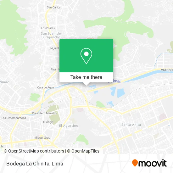
See Bodega La Chinita, El Agustin, on the map
Public Transit to Bodega La Chinita in El Agustin
Wondering how to get to Bodega La Chinita in El Agustin? Moovit helps you find the best way to get to Bodega La Chinita with step-by-step directions from the nearest public transit station.
Moovit provides free maps and live directions to help you navigate through your city. View schedules, routes, timetables, and find out how long does it take to get to Bodega La Chinita in real time.
Looking for the nearest stop or station to Bodega La Chinita? Check out this list of stops closest to your destination: Los Libertadores; Puente Los Libertadores; Avenida Las Lomas; Chimu X Haravicu; Ramiro Prialé; Charapita; El Ángel.
Bus: 1053, 1195, 1220, 1243, 1346, 1475, 1043, 1044, 1055, 1060, 1474, 1256, 1054, 1058, 1177, 1178, 1184.Metro: LINEA 1.
Want to see if there’s another route that gets you there at an earlier time? Moovit helps you find alternative routes or times. Get directions from and directions to Bodega La Chinita easily from the Moovit App or Website.
We make riding to Bodega La Chinita easy, which is why over 1.5 million users, including users in El Agustin, trust Moovit as the best app for public transit. You don’t need to download an individual bus app or train app, Moovit is your all-in-one transit app that helps you find the best bus time or train time available.
For information on prices of bus and metro, costs and ride fares to Bodega La Chinita, please check the Moovit app.
Use the app to navigate to popular places including to the airport, hospital, stadium, grocery store, mall, coffee shop, school, college, and university.
Bodega La Chinita Address: Calle Galilea Canaan, 15006 El Agustino street in El Agustin
- Parque Central Canaán,
- Av Rio Jordan Asociacion Canaan El Agustino,
- Bodega,
- Iglesia Corona de Canaán,
- Iglesia Movimiento Misionero Mundial-Canaán,
- Campo Deportivo Canaán 2009,
- Rockola Bar Cabina 15,
- Institución Educativa 0009 Jose Maria Arguedas,
- Bodega Don Julio,
- Bodega Yoselin,
- Parque Circunvalación,
- Mercado Circunvalación,
- Hospedaje Venus,
- Peaje Huachipa,
- Autopista Ramiro Prialé 1,
- Peaje Ramiro Priale,
- Jayli Joyas,
- Avenida Malecón Checa & Avenida Las Lomas,
- via evitamiento,
- Nuevo Puente las Lomas
Places Near Bodega La Chinita (El Agustin)
- Mall Del Sur,
- Real Plaza Puruchuco, Ate,
- Barranco, Barranco,
- Gamarra,
- Larcomar, Miraflores,
- Parque Kennedy, Miraflores,
- av arequipa, Lima,
- Aeropuerto Internacional Jorge Chávez, Ventanilla,
- Plaza San Miguel, San Miguel,
- Pontificia Universidad Católica del Perú - PUCP, San Miguel,
- Parque de las Leyendas, San Miguel,
- Circuito Mágico Del Agua, Lima,
- Av. La Marina, San Miguel,
- Av. Salaverry, Jesus Mari,
- Av. Abancay, Lima,
- Jockey Plaza, Santiago D,
- Paradero Av.Brasil,
- Centro Comercial Plaza Norte, Independen,
- Miraflores, Miraflores,
- Hospital Edgardo Rebagliati Martins, Jesus Mari
How to get to popular places in Lima with public transit
Get around El Agustin by public transit!
Traveling around El Agustin has never been so easy. See step by step directions as you travel to any attraction, street or major public transit station. View bus and train schedules, arrival times, service alerts and detailed routes on a map, so you know exactly how to get to anywhere in El Agustin.
When traveling to any destination around El Agustin use Moovit's Live Directions with Get Off Notifications to know exactly where and how far to walk, how long to wait for your line, and how many stops are left. Moovit will alert you when it's time to get off — no need to constantly re-check whether yours is the next stop.
Wondering how to use public transit in El Agustin or how to pay for public transit in El Agustin? Moovit public transit app can help you navigate your way with public transit easily, and at minimum cost. It includes public transit fees, ticket prices, and costs. Looking for a map of El Agustin public transit lines? Moovit public transit app shows all public transit maps in El Agustin with all Bus, Metro and Ferry routes and stops on an interactive map.
Lima has 3 transit type(s), including: Bus, Metro and Ferry, operated by several transit agencies, including Metro de Lima Línea 2 , Metro de Lima, Corredor Rojo, Metropolitano, Metropolitano - Alimentadores, Corredor Morado, Corredor Azul, Rutas Tradicionales, Transportes y Servicios La Esperanza S.A., Las Flores S.A., Virgen de la Asunción S.A., Consorcio HAM, Transportes y Service Canadá S.A., ETUL4SA and ETUCHISA