How to get to Bodega Santa Rosa by bus?
Click on the bus route to see step by step directions with maps, line arrival times and updated time schedules.
From Universidad Tecnológica del Perú - UTP, Los Olivos
56 minFrom Primera de Pro, Los Olivos
59 minFrom ZOOLOGICO DE HUACHIPA, San Juan D
98 minFrom Universidad César Vallejo, Los Olivos
52 minFrom Avenida Tupac Amaru, Comas
35 minFrom AV LOS PROCERES DE LA INDEPENDENCIA CON AV LURIGANCHO, San Juan D
99 minFrom MARISCAL CACERES SJL, San Juan D
112 minFrom Puente Piedra, Puente Pie
62 minFrom Comas, Comas
37 minFrom Las Lomas de Carabayllo, Carabayllo
70 min
Bus stops near Bodega Santa Rosa in Carabayllo
Bus lines to Bodega Santa Rosa in Carabayllo
- AN09, Terminal Chimpu Ocllo (Carabayllo) - Tokio (Carabayllo),VIEW
- 1105, Santa Rosa de Quives (Quives) - Km. 22 (Carabayllo) ,VIEW
- AN19, Torre Blanca (Carabayllo) - Estación 22 de agosto (Comas) ,VIEW
- 1005, Huánuco (La Victoria) - Punchauca (Carabayllo),VIEW
- 1006, Carabayllo - Ate - Carabayllo,VIEW
- 1012, Comas - Magdalena,VIEW
- 1013, Jesús María - Carabayllo,VIEW
- 1015, Carabayllo - Lince - Carabayllo,VIEW
- 1021, Mercado (Magdalena Del Mar) - Torre Blanca (Carabayllo),VIEW
- 1023, Centro Poblado Rio Seco (Carabayllo) - Colonial (Callao) ,VIEW
- 1138, Carabayllo - Caquetá - Faucett - Carabayllo,VIEW
- 1177, Torre Blanca (Carabayllo) - Metropolitana (Ate),VIEW
- 1180, Pamplona Alta (San Juan De Miraflores) - Torre Blanca (Carabayllo),VIEW
- 1182, San Juan de Miraflores - Carabayllo,VIEW
- 1183, Carabayllo - Surco - Carabayllo,VIEW
- 1243, Santo Domingo (Carabayllo) - Velasco Alvarado (Villa el Salvador),VIEW
- 1336, Torreblanca (Carabayllo) - Universitaria (San Miguel),VIEW
- 1435, Minka (Callao) - Torre Blanca (Carabayllo),VIEW
- 1462, Carabayllo - Universitaria - Brasil - Carabayllo,VIEW
- 1610, Torreblanca (Carabayllo) - Las Torres (San Luis),VIEW
What are the closest stations to Bodega Santa Rosa?
The closest stations to Bodega Santa Rosa are:
- Santo Chocano is 168 meters away, 3 min walk.
- Colectivos A Canta is 224 meters away, 3 min walk.
- Machuca is 290 meters away, 4 min walk.
- Augusto B. Leguía is 929 meters away, 13 min walk.
Which bus line stops near Bodega Santa Rosa?
AN09 (Terminal Chimpu Ocllo (Carabayllo) - Tokio (Carabayllo))
What’s the nearest bus station to Bodega Santa Rosa in Carabayllo?
The nearest bus stations to Bodega Santa Rosa in Carabayllo are Santo Chocano and Colectivos A Canta. The closest one is a 3 min walk away.
What time is the first bus to Bodega Santa Rosa in Carabayllo?
The 1180 is the first bus that goes to Bodega Santa Rosa in Carabayllo. It stops nearby at 3:07 AM.
What time is the last bus to Bodega Santa Rosa in Carabayllo?
The IM47 is the last bus that goes to Bodega Santa Rosa in Carabayllo. It stops nearby at 1:55 AM.
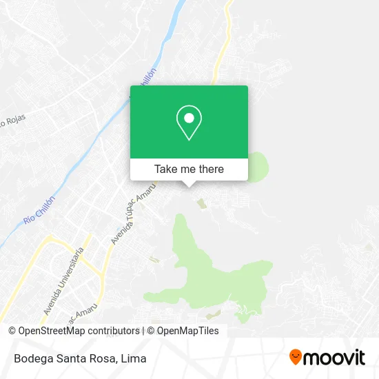
See Bodega Santa Rosa, Carabayllo, on the map
Public Transit to Bodega Santa Rosa in Carabayllo
Wondering how to get to Bodega Santa Rosa in Carabayllo? Moovit helps you find the best way to get to Bodega Santa Rosa with step-by-step directions from the nearest public transit station.
Moovit provides free maps and live directions to help you navigate through your city. View schedules, routes, timetables, and find out how long does it take to get to Bodega Santa Rosa in real time.
Looking for the nearest stop or station to Bodega Santa Rosa? Check out this list of stops closest to your destination: Santo Chocano; Colectivos A Canta; Machuca; Augusto B. Leguía.
Bus: AN09, 1105, AN19, 1011, 1005, 1006, 1012, 1013, 1015.
Want to see if there’s another route that gets you there at an earlier time? Moovit helps you find alternative routes or times. Get directions from and directions to Bodega Santa Rosa easily from the Moovit App or Website.
We make riding to Bodega Santa Rosa easy, which is why over 1.5 million users, including users in Carabayllo, trust Moovit as the best app for public transit. You don’t need to download an individual bus app or train app, Moovit is your all-in-one transit app that helps you find the best bus time or train time available.
For information on prices of bus, costs and ride fares to Bodega Santa Rosa, please check the Moovit app.
Use the app to navigate to popular places including to the airport, hospital, stadium, grocery store, mall, coffee shop, school, college, and university.
Bodega Santa Rosa Address: Jirón Andrés Avelino Cáceres E El Progreso Cuarto Sector, 15319 Carabayllo street in Carabayllo
- Ab Soluciones Integrales,
- Restaurante la Anchoveta Azul,
- Cetpro José Olaya-Chorrillos,
- Escuela Metropolitana El Progreso,
- I.E. 2025,
- Institución Educativa No. 2025,
- Bodega Lizeth,
- Grifo Jehova,
- Colegio Sec Niño McAl Chaperito,
- Nicole,
- Colegio El Progreso,
- Institución Educativa Inicial Luis Enrique I,
- Av ANDRÉS AVELINO CÁCERES 760 ( Altura Km 19 de la Av Tupac Amaru (Mercado Progreso),
- Mercado Santa Rosa,
- San Pedro De Carabayllo,
- Colegio San Jose de Carabayllo,
- Benavides 1967,
- Fotocopiadoras-Perúcad,
- Diseños y Fabricaciones Marmorey,
- Bustamante Y Rivero
Places Near Bodega Santa Rosa (Carabayllo)
- Miraflores, Miraflores,
- Gamarra,
- Paradero Av.Brasil,
- Plaza San Miguel, San Miguel,
- Hospital Edgardo Rebagliati Martins, Jesus Mari,
- Av. Abancay, Lima,
- Av. Salaverry, Jesus Mari,
- Parque Kennedy, Miraflores,
- Barranco, Barranco,
- Larcomar, Miraflores,
- Jockey Plaza, Santiago D,
- Av. La Marina, San Miguel,
- Mall Del Sur,
- av arequipa, Lima,
- Pontificia Universidad Católica del Perú - PUCP, San Miguel,
- Centro Comercial Plaza Norte, Independen,
- Real Plaza Puruchuco, Ate,
- Circuito Mágico Del Agua, Lima,
- Aeropuerto Internacional Jorge Chávez, Ventanilla,
- Parque de las Leyendas, San Miguel
How to get to popular places in Lima with public transit
Get around Carabayllo by public transit!
Traveling around Carabayllo has never been so easy. See step by step directions as you travel to any attraction, street or major public transit station. View bus and train schedules, arrival times, service alerts and detailed routes on a map, so you know exactly how to get to anywhere in Carabayllo.
When traveling to any destination around Carabayllo use Moovit's Live Directions with Get Off Notifications to know exactly where and how far to walk, how long to wait for your line, and how many stops are left. Moovit will alert you when it's time to get off — no need to constantly re-check whether yours is the next stop.
Wondering how to use public transit in Carabayllo or how to pay for public transit in Carabayllo? Moovit public transit app can help you navigate your way with public transit easily, and at minimum cost. It includes public transit fees, ticket prices, and costs. Looking for a map of Carabayllo public transit lines? Moovit public transit app shows all public transit maps in Carabayllo with all Bus, Metro and Ferry routes and stops on an interactive map.
Lima has 3 transit type(s), including: Bus, Metro and Ferry, operated by several transit agencies, including Metro de Lima Línea 2 , Metro de Lima, Corredor Rojo, Metropolitano, Metropolitano - Alimentadores, Corredor Morado, Corredor Azul, Rutas Tradicionales, Transportes y Servicios La Esperanza S.A., Las Flores S.A., Virgen de la Asunción S.A., Consorcio HAM, Transportes y Service Canadá S.A., ETUL4SA and ETUCHISA