How to get to Bodega a&A by bus?
Click on the bus route to see step by step directions with maps, line arrival times and updated time schedules.
From Hospital Nacional Guillermo Almenara Irigoyen, La Victori
43 minFrom Plaza Alameda "28 de Julio", Jesus Mari
37 minFrom Breña, Breña
37 minFrom Av Argentina, Lima
38 minFrom Urbanización Mangomarca San Juan de Lurigancho, San Juan D
55 minFrom Empresa de Transportes Flores Hnos., La Victori
46 minFrom Av. Universitaria / Av. Colonial, Lima
37 minFrom Plaza Dos de Mayo, Lima
28 minFrom Ecco La Rambla Brasil, Breña
39 min
Bus stops near Bodega a&A in Independen
Bus lines to Bodega a&A in Independen
- 1023, Centro Poblado Rio Seco (Carabayllo) - Colonial (Callao) ,VIEW
- 1138, Carabayllo - Caquetá - Faucett - Carabayllo,VIEW
- 1243, Santo Domingo (Carabayllo) - Velasco Alvarado (Villa el Salvador),VIEW
- 1006, Carabayllo - Ate - Carabayllo,VIEW
- 1012, Comas - Magdalena,VIEW
- 1020, Pte. Piedra - San Isidro,VIEW
- 1176, Collique (Comas) - Faraday (Ate),VIEW
- 1180, Pamplona Alta (San Juan De Miraflores) - Torre Blanca (Carabayllo),VIEW
- 1183, Carabayllo - Surco - Carabayllo,VIEW
- 1208, Pte. Piedra - S.M.P.,VIEW
- 1326, Av. San Juan (Puente Piedra) - Plaza San Miguel (San Miguel),VIEW
- 1435, Minka (Callao) - Torre Blanca (Carabayllo),VIEW
- 1462, Carabayllo - Universitaria - Brasil - Carabayllo,VIEW
- 1610, Torreblanca (Carabayllo) - Las Torres (San Luis),VIEW
- 2203, Tomás Valle - Las Torres,VIEW
- 2208, Tantamayo - Japón,VIEW
- AN06, EXPRESO MAÑANA Terminal Naranjal (Independencia) - Puno (Comas) ,VIEW
- AN08, Milagro De Jesús (Comas) - Terminal Naranjal (Independencia),VIEW
- CR34, San Miguel - Comas,VIEW
- CR43, Carabayllo - Ventanilla,VIEW
What are the closest stations to Bodega a&A?
The closest stations to Bodega a&A are:
- Avenida Túpac Amaru, 31 is 134 meters away, 2 min walk.
- La Cincuenta is 230 meters away, 4 min walk.
- Túpac Amaru is 332 meters away, 5 min walk.
- Unger is 332 meters away, 5 min walk.
- Terminal Naranjal - Zona Alimentadores is 426 meters away, 6 min walk.
- Hurin Cuzco is 514 meters away, 7 min walk.
Which bus lines stop near Bodega a&A?
These bus lines stop near Bodega a&A: 1020, 1176, 1183, 1326, 1462.
What’s the nearest bus station to Bodega a&A in Independen?
The nearest bus station to Bodega a&A in Independen is Avenida Túpac Amaru, 31. It’s a 2 min walk away.
What time is the first bus to Bodega a&A in Independen?
The 1435 SX is the first bus that goes to Bodega a&A in Independen. It stops nearby at 3:00 AM.
What time is the last bus to Bodega a&A in Independen?
The 1435 SX is the last bus that goes to Bodega a&A in Independen. It stops nearby at 2:38 AM.
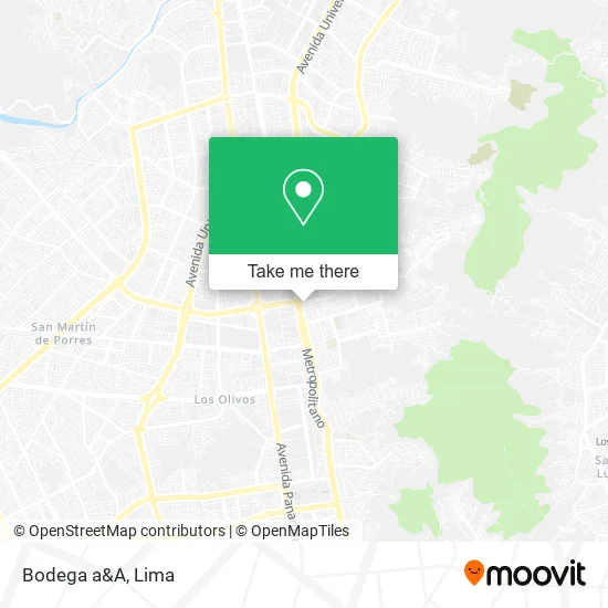
See Bodega a&A, Independen, on the map
Public Transit to Bodega a&A in Independen
Wondering how to get to Bodega a&A in Independen? Moovit helps you find the best way to get to Bodega a&A with step-by-step directions from the nearest public transit station.
Moovit provides free maps and live directions to help you navigate through your city. View schedules, routes, timetables, and find out how long does it take to get to Bodega a&A in real time.
Looking for the nearest stop or station to Bodega a&A? Check out this list of stops closest to your destination: Avenida Túpac Amaru; La Cincuenta; Túpac Amaru; Unger; Terminal Naranjal - Zona Alimentadores; Hurin Cuzco.
Bus: 1020, 1176, 1183, 1326, 1462, 1023, 1138, 1243, 1006, 1012, 1180, 1435 SX, AN14, AN01, AN07, 2407, CR42, IM08.
Want to see if there’s another route that gets you there at an earlier time? Moovit helps you find alternative routes or times. Get directions from and directions to Bodega a&A easily from the Moovit App or Website.
We make riding to Bodega a&A easy, which is why over 1.5 million users, including users in Independen, trust Moovit as the best app for public transit. You don’t need to download an individual bus app or train app, Moovit is your all-in-one transit app that helps you find the best bus time or train time available.
For information on prices of bus, costs and ride fares to Bodega a&A, please check the Moovit app.
Use the app to navigate to popular places including to the airport, hospital, stadium, grocery store, mall, coffee shop, school, college, and university.
Bodega a&A Address: Calle 1 Victor Raúl Haya de la Torre, 15332 Independencia street in Independen
- Cebichería 50 Piratas,
- Chacra Sana,
- Los 50 Piratas,
- AV TUPAC AMARU TERMINAL METROPOLITANO EL NARANJAL,
- El Naranjal & Avenida Tupac Amaru,
- Procuradores-Sergio Ángel Córdova Cena,
- Jesucristo es El Señor,
- Payet,
- Istp Carlos Cueto Fernandini,
- Restaurant Ceviche,
- Colegio Santa Rosa Comas 3062,
- Sauna Naranjal,
- Bodega Magaly,
- García Prudencio Marciano Rogelio,
- Melchorita - Venta De Maderas,
- Estudio Jurídico Delgado Asociados SAC,
- Estudio Romero Abogados S. Civ. R. L.,
- Vanidosas,
- Botica Vida Nueva,
- Calle Urb La alborada Etapa D2 LT 2 Calle las magnolias
Places Near Bodega a&A (Independen)
- Aeropuerto Internacional Jorge Chávez, Ventanilla,
- Av. Abancay, Lima,
- Barranco, Barranco,
- Mall Del Sur,
- Parque de las Leyendas, San Miguel,
- Plaza San Miguel, San Miguel,
- Hospital Edgardo Rebagliati Martins, Jesus Mari,
- Pontificia Universidad Católica del Perú - PUCP, San Miguel,
- Real Plaza Puruchuco, Ate,
- Paradero Av.Brasil,
- av arequipa, Lima,
- Circuito Mágico Del Agua, Lima,
- Jockey Plaza, Santiago D,
- Gamarra,
- Larcomar, Miraflores,
- Av. La Marina, San Miguel,
- Miraflores, Miraflores,
- Av. Salaverry, Jesus Mari,
- Parque Kennedy, Miraflores,
- Centro Comercial Plaza Norte, Independen
How to get to popular places in Lima with public transit
Get around Independen by public transit!
Traveling around Independen has never been so easy. See step by step directions as you travel to any attraction, street or major public transit station. View bus and train schedules, arrival times, service alerts and detailed routes on a map, so you know exactly how to get to anywhere in Independen.
When traveling to any destination around Independen use Moovit's Live Directions with Get Off Notifications to know exactly where and how far to walk, how long to wait for your line, and how many stops are left. Moovit will alert you when it's time to get off — no need to constantly re-check whether yours is the next stop.
Wondering how to use public transit in Independen or how to pay for public transit in Independen? Moovit public transit app can help you navigate your way with public transit easily, and at minimum cost. It includes public transit fees, ticket prices, and costs. Looking for a map of Independen public transit lines? Moovit public transit app shows all public transit maps in Independen with all Bus, Metro and Ferry routes and stops on an interactive map.
Lima has 3 transit type(s), including: Bus, Metro and Ferry, operated by several transit agencies, including Metro de Lima Línea 2 , Metro de Lima, Corredor Rojo, Metropolitano, Metropolitano - Alimentadores, Corredor Morado, Corredor Azul, Rutas Tradicionales, Transportes y Servicios La Esperanza S.A., Las Flores S.A., Virgen de la Asunción S.A., Consorcio HAM, Transportes y Service Canadá S.A., ETUL4SA and ETUCHISA