How to get to Bodega de Tacos by bus?
Click on the bus route to see step by step directions with maps, line arrival times and updated time schedules.
From Mirador de las Culturas, Aguascalientes
51 minFrom tianguis de cumbres, Aguascalientes
44 minFrom Universidad Tecnológica Metropolitana De Aguascalientes, Aguascalientes
54 minFrom Quintas Miguel Gerónimo, Aguascalientes
55 minFrom Tec de Monterrey Campus Ags, Aguascalientes
45 minFrom Fracc. Bosques del Prado Sur, Aguascalientes
38 minFrom Fraccionamiento Camino Real, Aguascalientes
51 minFrom Fracc. Trojes de Alonso, Aguascalientes
46 minFrom Fraccionamiento Viña Antigua, Aguascalientes
63 min
Bus stops near Bodega de Tacos in Aguascalientes
- Avenida Aguascalientes Sur, 908a, 4 min walk,VIEW
- Avenida Héroe De Nacozari, 1809(1810), 5 min walk,VIEW
- Convencion 1914 Sur, 1503, 10 min walk,VIEW
- Avenida De La Convención De 1914 Sur, 1402, 11 min walk,VIEW
- Avenida De La Convención De 1914 Sur, 1205a, 11 min walk,VIEW
- Avenida Aguascalientes Sur, 1100, 11 min walk,VIEW
- Avenida Mariano Escobedo, 1501b, 14 min walk,VIEW
Bus lines to Bodega de Tacos in Aguascalientes
- RUTA 02, Centro (Jardín Carpio),VIEW
- RUTA 07, Villa Las Palmas,VIEW
- RUTA 40, Terminal Oriente - Terminal Oriente (S),VIEW
- RUTA 42, Bellavista,VIEW
- RUTA 40, Terminal Oriente - Terminal Oriente (N),VIEW
- RUTA 28, Jesús María,VIEW
- RUTA 37, Hacienda San Marcos,VIEW
- RUTA 20N, Terminal Oriente - Terminal Oriente (N),VIEW
- RUTA 20S, Terminal Oriente - Terminal Oriente (S),VIEW
- RUTA 18, Uaa,VIEW
- RUTA 29, Centro (Jardínde Zaragoza),VIEW
- RUTA 36, Lunaria,VIEW
- RUTA 51, Puertecito De La Virgen,VIEW
What are the closest stations to Bodega de Tacos?
The closest stations to Bodega de Tacos are:
- Avenida Aguascalientes Sur, 908a is 298 meters away, 4 min walk.
- Avenida Héroe De Nacozari, 1809(1810) is 377 meters away, 5 min walk.
- Convencion 1914 Sur, 1503 is 765 meters away, 10 min walk.
- Avenida De La Convención De 1914 Sur, 1402 is 784 meters away, 11 min walk.
- Avenida De La Convención De 1914 Sur, 1205a is 813 meters away, 11 min walk.
- Avenida Aguascalientes Sur, 1100 is 841 meters away, 11 min walk.
- Avenida Mariano Escobedo, 1501b is 1057 meters away, 14 min walk.
Which bus lines stop near Bodega de Tacos?
These bus lines stop near Bodega de Tacos: RUTA 07, RUTA 18, RUTA 28, RUTA 37, RUTA 42.
What’s the nearest bus station to Bodega de Tacos in Aguascalientes?
The nearest bus station to Bodega de Tacos in Aguascalientes is Avenida Aguascalientes Sur, 908a. It’s a 4 min walk away.
What time is the first bus to Bodega de Tacos in Aguascalientes?
The RUTA 20S is the first bus that goes to Bodega de Tacos in Aguascalientes. It stops nearby at 5:54 AM.
What time is the last bus to Bodega de Tacos in Aguascalientes?
The RUTA 07 is the last bus that goes to Bodega de Tacos in Aguascalientes. It stops nearby at 10:56 PM.
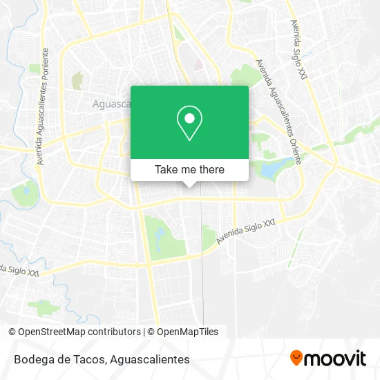
See Bodega de Tacos, Aguascalientes, on the map
Public Transit to Bodega de Tacos in Aguascalientes
Wondering how to get to Bodega de Tacos in Aguascalientes? Moovit helps you find the best way to get to Bodega de Tacos with step-by-step directions from the nearest public transit station.
Moovit provides free maps and live directions to help you navigate through your city. View schedules, routes, timetables, and find out how long does it take to get to Bodega de Tacos in real time.
Looking for the nearest stop or station to Bodega de Tacos? Check out this list of stops closest to your destination: Avenida Aguascalientes Sur; Avenida Héroe De Nacozari; Convencion 1914 Sur; Avenida De La Convención De 1914 Sur; Avenida De La Convención De 1914 Sur; Avenida Aguascalientes Sur; Avenida Mariano Escobedo.
Bus: RUTA 07, RUTA 18, RUTA 28, RUTA 37, RUTA 42, RUTA 02, RUTA 40, RUTA 40, RUTA 20N, RUTA 20S, RUTA 29.
Want to see if there’s another route that gets you there at an earlier time? Moovit helps you find alternative routes or times. Get directions from and directions to Bodega de Tacos easily from the Moovit App or Website.
We make riding to Bodega de Tacos easy, which is why over 1.5 million users, including users in Aguascalientes, trust Moovit as the best app for public transit. You don’t need to download an individual bus app or train app, Moovit is your all-in-one transit app that helps you find the best bus time or train time available.
For information on prices of bus, costs and ride fares to Bodega de Tacos, please check the Moovit app.
Use the app to navigate to popular places including to the airport, hospital, stadium, grocery store, mall, coffee shop, school, college, and university.
Bodega de Tacos Address: Calle Michoacán, Fraccionamiento México, 20270 Aguascalientes, Aguascalientes street in Aguascalientes
- La Buena Suerte Abarrotes y Vinos y Licores,
- Ciclismo Nacional Ruta, mtb, bmx, pista.,
- Banquetes San Luis,
- Comercio al por Menor de Discos y Casetes,
- Dulcería Gioco,
- Bizarro Alarmas,
- Agua Purificada La Celestial,
- American Sport,
- Mini Super Sergios,
- Elavoracion de Menudo,
- Triangulo Estudio,
- Novedades Danash,
- Tamales,
- Tienda de Ropa para Dama Alfaros,
- Dental Mex,
- Jugos,
- Carniceria Nuevo Leon,
- Tacos de Tripas,
- Salon de Usos Multiples,
- Ferretería Durmac
Places Near Bodega de Tacos (Aguascalientes)
- Centro Comercial Altaria, Aguascalientes,
- clinica 3 uaa, Aguascalientes,
- Nuevo Hospital Hidalgo, Aguascalientes,
- Universidad Autónoma de Aguascalientes, Aguascalientes,
- Isla San Marcos, Aguascalientes,
- Parque Las Tres Centurias, Aguascalientes,
- Villasuncion, Aguascalientes,
- Jesús María, Aguascalientes,
- La Isla San Marcos, Aguascalientes,
- Hospital Imss No. 3, Aguascalientes,
- ESPACIOS, Aguascalientes,
- Imss Clinica 1, Aguascalientes,
- Blvd. Luis Donaldo Colosio, Aguascalientes,
- Centro, Aguascalientes,
- Terminal De Combis, Aguascalientes,
- Agropecuario, Aguascalientes,
- Villas de Nuestra Señora de la Asunción, Aguascalientes,
- Aeropuerto de Aguascalientes S.A. de C.V., Aguascalientes,
- Ciudad industrial, Aguascalientes,
- Central De Autobuses, Aguascalientes
How to get to popular places in Aguascalientes with public transit
Get around Aguascalientes by public transit!
Traveling around Aguascalientes has never been so easy. See step by step directions as you travel to any attraction, street or major public transit station. View bus and train schedules, arrival times, service alerts and detailed routes on a map, so you know exactly how to get to anywhere in Aguascalientes.
When traveling to any destination around Aguascalientes use Moovit's Live Directions with Get Off Notifications to know exactly where and how far to walk, how long to wait for your line, and how many stops are left. Moovit will alert you when it's time to get off — no need to constantly re-check whether yours is the next stop.
Wondering how to use public transit in Aguascalientes or how to pay for public transit in Aguascalientes? Moovit public transit app can help you navigate your way with public transit easily, and at minimum cost. It includes public transit fees, ticket prices, and costs. Looking for a map of Aguascalientes public transit lines? Moovit public transit app shows all public transit maps in Aguascalientes with all bus routes and stops on an interactive map.
Aguascalientes has 1 transit type(s), including: bus, operated by several transit agencies, including Coordinación General de Movilidad