How to get to Bodega de Tacos by bus?
Click on the bus route to see step by step directions with maps, line arrival times and updated time schedules.
From Nissan Planta Powertrain, Aguascalientes
52 minFrom Hacienda San Marcos, Aguascalientes
58 minFrom Fracc. Rústicos Calpulli, Aguascalientes
47 minFrom Fracc Rinconada Jesús María, Aguascalientes
86 minFrom Jatco, Aguascalientes
52 minFrom Residencial San José de Pozo Bravo, Aguascalientes
26 minFrom Jatco 1 Agu, Aguascalientes
51 minFrom Imeco, Aguascalientes
61 min
Bus stops near Bodega de Tacos in Aguascalientes
Bus lines to Bodega de Tacos in Aguascalientes
- RUTA 43, Utma,VIEW
- RUTA 43, San Antonio Via Lomas De New York,VIEW
- RUTA 16, Bellavista,VIEW
- RUTA 20S, Terminal Oriente - Terminal Oriente (S),VIEW
- RUTA 35, Uaa,VIEW
- RUTA 20N, Terminal Oriente - Terminal Oriente (N),VIEW
- RUTA 51, Puertecito De La Virgen,VIEW
- RUTA 27, Vicente Guerrero,VIEW
- RUTA 36, Centro (Mercado Terán),VIEW
What are the closest stations to Bodega de Tacos?
The closest stations to Bodega de Tacos are:
- Avenida Heroico Colegio Militar, 707 is 182 meters away, 3 min walk.
- Avenida Heroico Colegio Militar, 505a(505b) is 213 meters away, 3 min walk.
- Avenida Convención 1914 Oriente, 901 is 407 meters away, 6 min walk.
- Parque Lineal is 527 meters away, 7 min walk.
- Complejo Ferrocarrilero is 898 meters away, 12 min walk.
- 28 De Agosto, 508 is 1832 meters away, 24 min walk.
Which bus line stops near Bodega de Tacos?
RUTA 43 (Utma)
What’s the nearest bus station to Bodega de Tacos in Aguascalientes?
The nearest bus stations to Bodega de Tacos in Aguascalientes are Avenida Heroico Colegio Militar, 707 and Avenida Heroico Colegio Militar, 505a(505b). The closest one is a 3 min walk away.
What time is the first bus to Bodega de Tacos in Aguascalientes?
The RUTA 20S is the first bus that goes to Bodega de Tacos in Aguascalientes. It stops nearby at 5:45 AM.
What time is the last bus to Bodega de Tacos in Aguascalientes?
The RUTA 43 is the last bus that goes to Bodega de Tacos in Aguascalientes. It stops nearby at 10:25 PM.
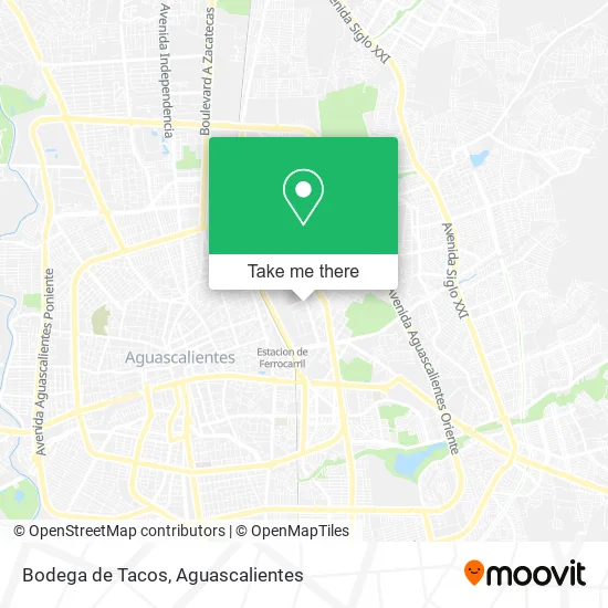
See Bodega de Tacos, Aguascalientes, on the map
Public Transit to Bodega de Tacos in Aguascalientes
Wondering how to get to Bodega de Tacos in Aguascalientes? Moovit helps you find the best way to get to Bodega de Tacos with step-by-step directions from the nearest public transit station.
Moovit provides free maps and live directions to help you navigate through your city. View schedules, routes, timetables, and find out how long does it take to get to Bodega de Tacos in real time.
Looking for the nearest stop or station to Bodega de Tacos? Check out this list of stops closest to your destination: Avenida Heroico Colegio Militar; Avenida Heroico Colegio Militar; Avenida Convención 1914 Oriente; Parque Lineal; Complejo Ferrocarrilero; 28 De Agosto.
Bus: RUTA 43, RUTA 16, RUTA 20S, RUTA 35, RUTA 20N, RUTA 51, RUTA 27, RUTA 36.
Want to see if there’s another route that gets you there at an earlier time? Moovit helps you find alternative routes or times. Get directions from and directions to Bodega de Tacos easily from the Moovit App or Website.
We make riding to Bodega de Tacos easy, which is why over 1.5 million users, including users in Aguascalientes, trust Moovit as the best app for public transit. You don’t need to download an individual bus app or train app, Moovit is your all-in-one transit app that helps you find the best bus time or train time available.
For information on prices of bus, costs and ride fares to Bodega de Tacos, please check the Moovit app.
Use the app to navigate to popular places including to the airport, hospital, stadium, grocery store, mall, coffee shop, school, college, and university.
Bodega de Tacos Address: Calle Durmientes, Barrio La Estación, 20259 Aguascalientes, Aguascalientes street in Aguascalientes
- Ferronales Agu,
- Venta de Tacos Alomita,
- WESTERN UNION,
- Crit Teleton Ags,
- Exhibición de las Galaxias,
- Gorditas Paty,
- Centro de Rehabilitación e Inclusión Infantil Teleton Aguascalietes,
- Centro de Educación Diferencial Especializada para Sordos,
- Iglesia,
- Parroquia de San Isidro Labrador,
- Tienda Escolar Secundaria Técnica 22,
- Cecytea Ferrocarriles,
- Templo de Nuestra Señora del Refugio,
- Colonia del Trabajo,
- Casa de la Familia,
- S. T. Num. 22 Nazario S. Ortiz Garza,
- Secundaria Tecnica, 22, Nazario S. Ortiz Garza,
- Mecanoterapia,
- Crit Aguascalientes,
- Centro de Rehabilitación Infantil Teletón
Places Near Bodega de Tacos (Aguascalientes)
- Jesús María, Aguascalientes,
- Aeropuerto de Aguascalientes S.A. de C.V., Aguascalientes,
- Imss Clinica 1, Aguascalientes,
- Agropecuario, Aguascalientes,
- Hospital Imss No. 3, Aguascalientes,
- Universidad Autónoma de Aguascalientes, Aguascalientes,
- Central De Autobuses, Aguascalientes,
- Nuevo Hospital Hidalgo, Aguascalientes,
- Ciudad industrial, Aguascalientes,
- Centro, Aguascalientes,
- Villas de Nuestra Señora de la Asunción, Aguascalientes,
- clinica 3 uaa, Aguascalientes,
- Terminal De Combis, Aguascalientes,
- Centro Comercial Altaria, Aguascalientes,
- La Isla San Marcos, Aguascalientes,
- Isla San Marcos, Aguascalientes,
- ESPACIOS, Aguascalientes,
- Blvd. Luis Donaldo Colosio, Aguascalientes,
- Parque Las Tres Centurias, Aguascalientes,
- Villasuncion, Aguascalientes
How to get to popular places in Aguascalientes with public transit
Get around Aguascalientes by public transit!
Traveling around Aguascalientes has never been so easy. See step by step directions as you travel to any attraction, street or major public transit station. View bus and train schedules, arrival times, service alerts and detailed routes on a map, so you know exactly how to get to anywhere in Aguascalientes.
When traveling to any destination around Aguascalientes use Moovit's Live Directions with Get Off Notifications to know exactly where and how far to walk, how long to wait for your line, and how many stops are left. Moovit will alert you when it's time to get off — no need to constantly re-check whether yours is the next stop.
Wondering how to use public transit in Aguascalientes or how to pay for public transit in Aguascalientes? Moovit public transit app can help you navigate your way with public transit easily, and at minimum cost. It includes public transit fees, ticket prices, and costs. Looking for a map of Aguascalientes public transit lines? Moovit public transit app shows all public transit maps in Aguascalientes with all bus routes and stops on an interactive map.
Aguascalientes has 1 transit type(s), including: bus, operated by several transit agencies, including Coordinación General de Movilidad