How to get to Body Piercing Barush by bus?
Click on the bus route to see step by step directions with maps, line arrival times and updated time schedules.
From Estacion De Autobus Clínica del IMSS No.1, Aguascalientes
36 minFrom Yonke El Abuelo, Aguascalientes
56 minFrom Jesús Rivera Franco C-18E 409, Aguascalientes
57 minFrom Villasuncion, Aguascalientes
50 minFrom Parque Industrial El Vergel, Aguascalientes
56 minFrom Centro De Convenciones De La Isla San Marcos, Aguascalientes
70 minFrom Isla San Marcos, Aguascalientes
69 minFrom San José del Arenal, Aguascalientes
40 minFrom La Chiripa, Aguascalientes
41 minFrom Velaria, Aguascalientes
81 min
Bus stops near Body Piercing Barush in Aguascalientes
Bus lines to Body Piercing Barush in Aguascalientes
What are the closest stations to Body Piercing Barush?
The closest stations to Body Piercing Barush are:
- Ermita De San Sebastián, 904 is 181 meters away, 3 min walk.
- Avenida Poliducto, 317(Vd) is 517 meters away, 7 min walk.
Which bus lines stop near Body Piercing Barush?
These bus lines stop near Body Piercing Barush: RUTA 23, RUTA 37, RUTA 43.
What’s the nearest bus station to Body Piercing Barush in Aguascalientes?
The nearest bus station to Body Piercing Barush in Aguascalientes is Ermita De San Sebastián, 904. It’s a 3 min walk away.
What time is the first bus to Body Piercing Barush in Aguascalientes?
The RUTA 30 is the first bus that goes to Body Piercing Barush in Aguascalientes. It stops nearby at 5:53 AM.
What time is the last bus to Body Piercing Barush in Aguascalientes?
The RUTA 43 is the last bus that goes to Body Piercing Barush in Aguascalientes. It stops nearby at 10:46 PM.
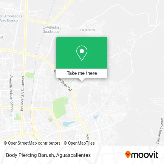
See Body Piercing Barush, Aguascalientes, on the map
Public Transit to Body Piercing Barush in Aguascalientes
Wondering how to get to Body Piercing Barush in Aguascalientes? Moovit helps you find the best way to get to Body Piercing Barush with step-by-step directions from the nearest public transit station.
Moovit provides free maps and live directions to help you navigate through your city. View schedules, routes, timetables, and find out how long does it take to get to Body Piercing Barush in real time.
Looking for the nearest stop or station to Body Piercing Barush? Check out this list of stops closest to your destination: Ermita De San Sebastián; Avenida Poliducto.
Bus: RUTA 23, RUTA 37, RUTA 43, RUTA 08, RUTA 30, RUTA 34.
Want to see if there’s another route that gets you there at an earlier time? Moovit helps you find alternative routes or times. Get directions from and directions to Body Piercing Barush easily from the Moovit App or Website.
We make riding to Body Piercing Barush easy, which is why over 1.5 million users, including users in Aguascalientes, trust Moovit as the best app for public transit. You don’t need to download an individual bus app or train app, Moovit is your all-in-one transit app that helps you find the best bus time or train time available.
For information on prices of bus, costs and ride fares to Body Piercing Barush, please check the Moovit app.
Use the app to navigate to popular places including to the airport, hospital, stadium, grocery store, mall, coffee shop, school, college, and university.
Body Piercing Barush Address: Calle Ramón Fernández Moreno 218, Ntra Sra de la Asunción Sector Gpe, 20126 Aguascalientes, Aguasca street in Aguascalientes
- El Tacazzo,
- Tenis Usados,
- Botanas La Oruga,
- Venta de Peliculas sin Nombre,
- Tacos de Colores Don Balta,
- Abarrotes Cuatro Hermanos,
- Floreia y Regalos Aura,
- Abarrotes Calavera,
- Kiko's Pizza,
- Game Star,
- Gorditas y Tacos,
- Tacos San Juan,
- Barbarelle Barber Shop,
- Carniceria Turin,
- Pozoleria,
- Villas de Nuestra Señora de la Asunción,
- Secundaria General No. 34 Mahatma Gandhi,
- Reparacion de Celulares,
- La Herradura,
- Carniceria La Herradura
Places Near Body Piercing Barush (Aguascalientes)
- ESPACIOS, Aguascalientes,
- Villas de Nuestra Señora de la Asunción, Aguascalientes,
- Hospital Imss No. 3, Aguascalientes,
- Villasuncion, Aguascalientes,
- La Isla San Marcos, Aguascalientes,
- Centro, Aguascalientes,
- Centro Comercial Altaria, Aguascalientes,
- Jesús María, Aguascalientes,
- Terminal De Combis, Aguascalientes,
- Parque Las Tres Centurias, Aguascalientes,
- Agropecuario, Aguascalientes,
- Universidad Autónoma de Aguascalientes, Aguascalientes,
- Nuevo Hospital Hidalgo, Aguascalientes,
- Aeropuerto de Aguascalientes S.A. de C.V., Aguascalientes,
- clinica 3 uaa, Aguascalientes,
- Imss Clinica 1, Aguascalientes,
- Central De Autobuses, Aguascalientes,
- Isla San Marcos, Aguascalientes,
- Blvd. Luis Donaldo Colosio, Aguascalientes,
- Ciudad industrial, Aguascalientes
How to get to popular places in Aguascalientes with public transit
Get around Aguascalientes by public transit!
Traveling around Aguascalientes has never been so easy. See step by step directions as you travel to any attraction, street or major public transit station. View bus and train schedules, arrival times, service alerts and detailed routes on a map, so you know exactly how to get to anywhere in Aguascalientes.
When traveling to any destination around Aguascalientes use Moovit's Live Directions with Get Off Notifications to know exactly where and how far to walk, how long to wait for your line, and how many stops are left. Moovit will alert you when it's time to get off — no need to constantly re-check whether yours is the next stop.
Wondering how to use public transit in Aguascalientes or how to pay for public transit in Aguascalientes? Moovit public transit app can help you navigate your way with public transit easily, and at minimum cost. It includes public transit fees, ticket prices, and costs. Looking for a map of Aguascalientes public transit lines? Moovit public transit app shows all public transit maps in Aguascalientes with all bus routes and stops on an interactive map.
Aguascalientes has 1 transit type(s), including: bus, operated by several transit agencies, including Coordinación General de Movilidad