Directions to Bojangles Statue (Richmond) with public transportation
The following transit lines have routes that pass near Bojangles Statue
 Bus: 1, 14, 3B, FLIXBUS N2601, 3A.
- Train: NORTHEAST REGIONAL.
How to get to Bojangles Statue by bus?
Click on the bus route to see step by step directions with maps, line arrival times and updated time schedules.
From Lorton, VA - Amtrak Auto Train Station (LOR), Fairfax County
221 minFrom Potomac Mills Mall, Prince William County
206 minFrom Rose Gaming Resort, Prince William County
231 minFrom Busch Gardens Williamsburg (Employee Parking Lot), James City County
147 minFrom Hampton University, Hampton
304 minFrom Lorton, VA, Fairfax County
215 minFrom Amazon Fulfillment Center-Ric3, Richmond
56 minFrom UVA Hospital Medical Center, Charlottesville
295 minFrom Woodbridge, VA, Prince William County
148 min
How to get to Bojangles Statue by train?
Click on the train route to see step by step directions with maps, line arrival times and updated time schedules.
Bus stops near Bojangles Statue in Richmond
Train station near Bojangles Statue in Richmond
- Pathrichmond Main Street Amtrak Station, 13 min walk,VIEW
Bus lines to Bojangles Statue in Richmond
- 1, Chamberlayne/Azalea,VIEW
- 3A, HIGHLAND PARK/U.S. 1/HARWOOD,VIEW
- 3B, HIGHLAND PARK/U.S. 1/BRIGHTPOINT,VIEW
- 3C, HIGHLAND PARK/HARWOOD/U.S. 1,VIEW
- 14, HERMITAGE/EAST MAIN,VIEW
- 50, BROAD STREET,VIEW
- 78, CARY/MAYMONT,VIEW
- BRT, Broad/Main/Rocketts,VIEW
- 2A, Forest Hill/North Ave,VIEW
- 2B, Jahnke/Forest Hill/North Ave,VIEW
- 2C, Semmes/Midlothian/Belt Blvd,VIEW
What are the closest stations to Bojangles Statue?
The closest stations to Bojangles Statue are:
- Chamberlayne + Price is 30 yards away, 1 min walk.
- Broad & Adams is 57 yards away, 1 min walk.
- Arts District Westbound Station is 100 yards away, 2 min walk.
- 1st + Marshall is 302 yards away, 4 min walk.
- Pathrichmond Main Street Amtrak Station is 1059 yards away, 13 min walk.
Which bus lines stop near Bojangles Statue?
These bus lines stop near Bojangles Statue: 1, 14, 3B, FLIXBUS N2601.
Which train line stops near Bojangles Statue?
NORTHEAST REGIONAL (Newport News)
What’s the nearest train station to Bojangles Statue in Richmond?
The nearest train station to Bojangles Statue in Richmond is Pathrichmond Main Street Amtrak Station. It’s a 13 min walk away.
What’s the nearest bus station to Bojangles Statue in Richmond?
The nearest bus stations to Bojangles Statue in Richmond are Chamberlayne + Price and Broad & Adams. The closest one is a 1 min walk away.
What time is the first train to Bojangles Statue in Richmond?
The NORTHEAST REGIONAL is the first train that goes to Bojangles Statue in Richmond. It stops nearby at 5:19 AM.
What time is the last train to Bojangles Statue in Richmond?
The NORTHEAST REGIONAL is the last train that goes to Bojangles Statue in Richmond. It stops nearby at 6:52 PM.
What time is the first bus to Bojangles Statue in Richmond?
The 1 is the first bus that goes to Bojangles Statue in Richmond. It stops nearby at 5:01 AM.
What time is the last bus to Bojangles Statue in Richmond?
The 2C is the last bus that goes to Bojangles Statue in Richmond. It stops nearby at 1:38 AM.
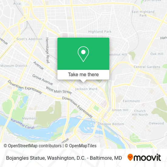
See Bojangles Statue, Richmond, on the map
Public Transit to Bojangles Statue in Richmond
Wondering how to get to Bojangles Statue in Richmond? Moovit helps you find the best way to get to Bojangles Statue with step-by-step directions from the nearest public transit station.
Moovit provides free maps and live directions to help you navigate through your city. View schedules, routes, timetables, and find out how long does it take to get to Bojangles Statue in real time.
Looking for the nearest stop or station to Bojangles Statue? Check out this list of stops closest to your destination: Chamberlayne + Price; Broad & Adams; Arts District Westbound Station; 1st + Marshall; Pathrichmond Main Street Amtrak Station.
Bus: 1, 14, 3B, FLIXBUS N2601, 3A, 3C, 50, BRT, 2A, 2B, 2C.Train: NORTHEAST REGIONAL.
Want to see if there’s another route that gets you there at an earlier time? Moovit helps you find alternative routes or times. Get directions from and directions to Bojangles Statue easily from the Moovit App or Website.
We make riding to Bojangles Statue easy, which is why over 1.5 million users, including users in Richmond, trust Moovit as the best app for public transit. You don’t need to download an individual bus app or train app, Moovit is your all-in-one transit app that helps you find the best bus time or train time available.
For information on prices of bus and train, costs and ride fares to Bojangles Statue, please check the Moovit app.
Use the app to navigate to popular places including to the airport, hospital, stadium, grocery store, mall, coffee shop, school, college, and university.
Bojangles Statue Address: Price St Richmond, VA 23220 street in Richmond
- Bojangles Triangle Park,
- Bill Bojangles Robinson Statue,
- Spartan Academy,
- Adult Career Development Center,
- Richmond Alternative,
- Parking Lot,
- Bojangles Monument,
- Fabianlance,
- Black History Museum & Cultural Center of Virginia,
- Commonwealth Construction Company of Virginia,
- Corinthian Construction,
- Koger Law Group,
- Miracle Church of Our Lord Jesus Christ of the Apostolic Faith,
- One West Jackson,
- Poston Locksmithing,
- Ebenezer Baptist Church,
- Nightowl Promotional Solutions,
- Mahogany Sweets,
- Hood Temple A M E Zion Church,
- Abner Clay Park
Places Near Bojangles Statue (Richmond)
- Amazon Hq2, Arlington County,
- M&T Bank Stadium, Baltimore,
- Pennsylvania Ave NW (3rd st and pennsylvania), Washington,
- National Museum of African American History and Culture, Washington,
- Capital One Arena, Washington,
- PG Mall, Prince George's County,
- Museum Of The Bible, Washington,
- Westfield Montgomery Mall, Montgomery County,
- Warner Theatre, Washington,
- Marriott Marquis Washington, DC, Washington,
- The Anthem, Washington,
- Basilica of the National Shrine, Washington,
- Rock Creek Tennis Center, Washington,
- National Zoo, Washington,
- Washington DC VA Medical Center, Washington,
- Georgetown, Washington,
- Washington National Cathedral, Washington,
- Sibley Memorial Hospital, Washington,
- Camden Yards, Baltimore,
- National Mall, Washington
How to get to popular places in Washington, D.C. - Baltimore, MD with public transit
Get around Richmond by public transit!
Traveling around Richmond has never been so easy. See step by step directions as you travel to any attraction, street or major public transit station. View bus and train schedules, arrival times, service alerts and detailed routes on a map, so you know exactly how to get to anywhere in Richmond.
When traveling to any destination around Richmond use Moovit's Live Directions with Get Off Notifications to know exactly where and how far to walk, how long to wait for your line, and how many stops are left. Moovit will alert you when it's time to get off — no need to constantly re-check whether yours is the next stop.
Wondering how to use public transit in Richmond or how to pay for public transit in Richmond? Moovit public transit app can help you navigate your way with public transit easily, and at minimum cost. It includes public transit fees, ticket prices, and costs. Looking for a map of Richmond public transit lines? Moovit public transit app shows all public transit maps in Richmond with all Bus, Train, Metro, Light Rail and Ferry routes and stops on an interactive map.
Washington, D.C. - Baltimore, MD has 5 transit type(s), including: Bus, Train, Metro, Light Rail and Ferry, operated by several transit agencies, including WMATA, Montgomery County Ride On, Fairfax Connector, TheBus, PRTC, DASH - Alexandria, Arlington Transit (ART), RTA of Central Maryland, MDOT MTA, MDOT MTA Light RailLink, MDOT MTA Commuter Bus, MDOT MTA Local Bus, FXBGO!, Virginia Railway Express (VRE) and MARC