How to get to Bon Secours by bus?
Click on the bus route to see step by step directions with maps, line arrival times and updated time schedules.
From Busch Gardens Williamsburg (Employee Parking Lot), James City County
154 minFrom Rose Gaming Resort, Prince William County
238 minFrom Potomac Mills Mall, Prince William County
213 minFrom Lorton, VA - Amtrak Auto Train Station (LOR), Fairfax County
228 minFrom Lorton, VA, Fairfax County
222 minFrom Woodbridge, VA, Prince William County
157 minFrom UVA Hospital Medical Center, Charlottesville
302 minFrom Amazon Fulfillment Center-Ric3, Richmond
67 min
Bus stops near Bon Secours in Richmond
Train station near Bon Secours in Richmond
- Pathrichmond Main Street Amtrak Station, 28 min walk,VIEW
Bus lines to Bon Secours in Richmond
What are the closest stations to Bon Secours?
The closest stations to Bon Secours are:
- Dmv Drive & Leigh is 237 yards away, 3 min walk.
- Science Museum Eastbound Station is 557 yards away, 7 min walk.
- Boulevard + Clay is 599 yards away, 8 min walk.
- Broad + Boulevard is 652 yards away, 8 min walk.
- Pathrichmond Main Street Amtrak Station is 2374 yards away, 28 min walk.
Which bus lines stop near Bon Secours?
These bus lines stop near Bon Secours: 18, BRT.
What’s the nearest train station to Bon Secours in Richmond?
The nearest train station to Bon Secours in Richmond is Pathrichmond Main Street Amtrak Station. It’s a 28 min walk away.
What’s the nearest bus station to Bon Secours in Richmond?
The nearest bus station to Bon Secours in Richmond is Dmv Drive & Leigh. It’s a 3 min walk away.
What time is the first train to Bon Secours in Richmond?
The NORTHEAST REGIONAL is the first train that goes to Bon Secours in Richmond. It stops nearby at 5:19 AM.
What time is the last train to Bon Secours in Richmond?
The NORTHEAST REGIONAL is the last train that goes to Bon Secours in Richmond. It stops nearby at 6:52 PM.
What time is the first bus to Bon Secours in Richmond?
The 20 is the first bus that goes to Bon Secours in Richmond. It stops nearby at 5:08 AM.
What time is the last bus to Bon Secours in Richmond?
The BRT is the last bus that goes to Bon Secours in Richmond. It stops nearby at 1:26 AM.
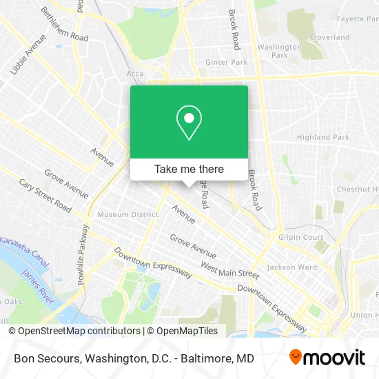
See Bon Secours, Richmond, on the map
Public Transit to Bon Secours in Richmond
Wondering how to get to Bon Secours in Richmond? Moovit helps you find the best way to get to Bon Secours with step-by-step directions from the nearest public transit station.
Moovit provides free maps and live directions to help you navigate through your city. View schedules, routes, timetables, and find out how long does it take to get to Bon Secours in real time.
Looking for the nearest stop or station to Bon Secours? Check out this list of stops closest to your destination: Dmv Drive & Leigh; Science Museum Eastbound Station; Boulevard + Clay; Broad + Boulevard; Pathrichmond Main Street Amtrak Station.
Bus: 18, BRT, 76, 20, 50.Train: NORTHEAST REGIONAL.
Want to see if there’s another route that gets you there at an earlier time? Moovit helps you find alternative routes or times. Get directions from and directions to Bon Secours easily from the Moovit App or Website.
We make riding to Bon Secours easy, which is why over 1.5 million users, including users in Richmond, trust Moovit as the best app for public transit. You don’t need to download an individual bus app or train app, Moovit is your all-in-one transit app that helps you find the best bus time or train time available.
For information on prices of bus and train, costs and ride fares to Bon Secours, please check the Moovit app.
Use the app to navigate to popular places including to the airport, hospital, stadium, grocery store, mall, coffee shop, school, college, and university.
Bon Secours Address: 2401 W Leigh St Richmond, VA 23220 street in Richmond
- Rishi Bala, MD Caqsm RMSK,
- Roderick E. Haithcock, MD,
- Trainingcenterevents,
- Training Center Events Rva,
- Bon Secours Washington Redskins Training Center,
- Richmond Broad Street Station,
- Virginia Workers Compensation,
- Virginia Workers Compensation Lawyers,
- Commonwealth of Virginia,
- The Dome at the Science Museum Of Virginia,
- Science Museum of Virginia,
- Fleet Management,
- Commonwealth of Virginia General Services Dept,
- EV Charging Station,
- Bon Secours Foundation,
- Virginia Mentoring Partnership,
- BSMH Associates Gift Planning,
- Ethyl Imax Dome & Planetarium,
- Museum Cafe,
- Carpenter Science Theatre Company
Places Near Bon Secours (Richmond)
- The Anthem, Washington,
- Georgetown, Washington,
- Washington National Cathedral, Washington,
- Camden Yards, Baltimore,
- National Zoo, Washington,
- Rock Creek Tennis Center, Washington,
- Washington DC VA Medical Center, Washington,
- Westfield Montgomery Mall, Montgomery County,
- Marriott Marquis Washington, DC, Washington,
- Amazon Hq2, Arlington County,
- Pennsylvania Ave NW (3rd st and pennsylvania), Washington,
- Basilica of the National Shrine, Washington,
- PG Mall, Prince George's County,
- National Mall, Washington,
- Capital One Arena, Washington,
- Sibley Memorial Hospital, Washington,
- Museum Of The Bible, Washington,
- National Museum of African American History and Culture, Washington,
- M&T Bank Stadium, Baltimore,
- Warner Theatre, Washington
How to get to popular places in Washington, D.C. - Baltimore, MD with public transit
Get around Richmond by public transit!
Traveling around Richmond has never been so easy. See step by step directions as you travel to any attraction, street or major public transit station. View bus and train schedules, arrival times, service alerts and detailed routes on a map, so you know exactly how to get to anywhere in Richmond.
When traveling to any destination around Richmond use Moovit's Live Directions with Get Off Notifications to know exactly where and how far to walk, how long to wait for your line, and how many stops are left. Moovit will alert you when it's time to get off — no need to constantly re-check whether yours is the next stop.
Wondering how to use public transit in Richmond or how to pay for public transit in Richmond? Moovit public transit app can help you navigate your way with public transit easily, and at minimum cost. It includes public transit fees, ticket prices, and costs. Looking for a map of Richmond public transit lines? Moovit public transit app shows all public transit maps in Richmond with all Bus, Train, Metro, Light Rail and Ferry routes and stops on an interactive map.
Washington, D.C. - Baltimore, MD has 5 transit type(s), including: Bus, Train, Metro, Light Rail and Ferry, operated by several transit agencies, including WMATA, Montgomery County Ride On, Fairfax Connector, TheBus, PRTC, DASH - Alexandria, Arlington Transit (ART), RTA of Central Maryland, MDOT MTA, MDOT MTA Light RailLink, MDOT MTA Commuter Bus, MDOT MTA Local Bus, FXBGO!, Virginia Railway Express (VRE) and MARC