Directions to Bonacci (Ocoyucan) with public transportation
The following transit lines have routes that pass near Bonacci
 Bus: A6, RUTA 14A, RUTA AZTECA B, RUTA AZTECA C, RUTA MALACATEPEC B.
How to get to Bonacci by bus?
Click on the bus route to see step by step directions with maps, line arrival times and updated time schedules.
From Templo Espiritual Trinitario Mariano La Redención, Puebla
45 minFrom Nuestro DIF Cuautlancingo, San Pedro Cholula
62 minFrom Registro Agrario Nacional, San Andrés Cholula
35 minFrom Plazas de Guadalupe, Puebla
56 minFrom El Gallito, Puebla
54 minFrom Colonia América Sur, Puebla
51 minFrom Avenida 18 Poniente & Diagonal Defensores de la República, San Andrés Cholula
38 minFrom Centro de Atencion a Clientes Movistar, San Andrés Cholula
27 minFrom Hospital Gral Rafael Moreno Valle-UR, San Pedro Cholula
50 minFrom Arboledas Guadalupe, Puebla
54 min
Bus stops near Bonacci in Ocoyucan
Bus lines to Bonacci in Ocoyucan
- CORREDOR ATLIXCAYOTL, Lomas de Angelopolis - Via Atlixcayotl - Av. Juarez (Circular),VIEW
- RUTA AZTECA B, Ramal 1, Lomas Flor Del Bosque - Villa De Los Ángeles (Regreso),VIEW
- RUTA MALACATEPEC B, Ramal 1, Santiago Coltzingo - Puebla,VIEW
- RUTA TLAXCALANCINGO, Ramal 1, Tlaxcalancingo - Veinte De Noviembre,VIEW
- A6 - A, Ciudad Judicial - Estadios,VIEW
- RUTA AZTECA C, Ramal 1, San Esteban - Villa De Los Ángeles,VIEW
- RUTA MALACATEPEC A, Ramal 2, Fco. Sarabia - Centro,VIEW
- TRANSPORTE NOCTURNO, Paseo Bravo - Caseta Atlixco (Circuito),VIEW
- A6, Estadios,VIEW
- RUTA 14A, Ramal 1, 20 De Nov. - Paseo De San Andrés,VIEW
- LÍNEA PERIFÉRICO, Ramal Finsa - Buap (Circuito),VIEW
- RUTA PUEBLA, Ramal Puebla - Izucar De Matamoros,VIEW
- LINEA 4, Valsequillo - FINSA,VIEW
- RUTA SAN ANDRÉS CHOLULA, Ramal 2, Ciudad Judicial,VIEW
- RUTA SUBURBANA PIRÁMIDES, Ramal 2, Barrio De San Miguel - Ciudad Judicial,VIEW
- RUTA 29, Ramal 2 El Molinito - Coronel Miguel Auza,VIEW
What are the closest stations to Bonacci?
The closest stations to Bonacci are:
- Vía Atlixcáyotl Y Fraccionamiento La Vista is 113 meters away, 2 min walk.
- Vía Atlixcáyotl is 388 meters away, 5 min walk.
- Atlixcáyotl is 734 meters away, 10 min walk.
- Acuario, 2 is 1723 meters away, 22 min walk.
- Paseos Del Ángel is 1806 meters away, 24 min walk.
Which bus lines stop near Bonacci?
These bus lines stop near Bonacci: A6, RUTA 14A, RUTA AZTECA B, RUTA AZTECA C, RUTA MALACATEPEC B, RUTA TLAXCALANCINGO.
What’s the nearest bus station to Bonacci in Ocoyucan?
The nearest bus station to Bonacci in Ocoyucan is Vía Atlixcáyotl Y Fraccionamiento La Vista. It’s a 2 min walk away.
What time is the first bus to Bonacci in Ocoyucan?
The TRANSPORTE NOCTURNO is the first bus that goes to Bonacci in Ocoyucan. It stops nearby at 3:04 AM.
What time is the last bus to Bonacci in Ocoyucan?
The TRANSPORTE NOCTURNO is the last bus that goes to Bonacci in Ocoyucan. It stops nearby at 2:20 AM.
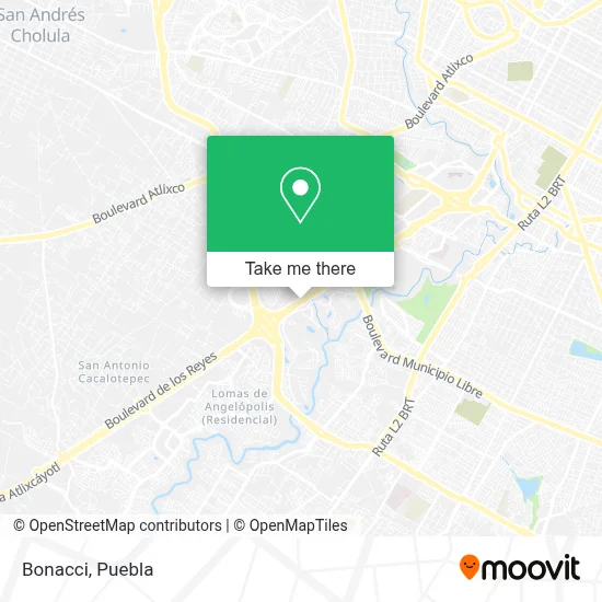
See Bonacci, Ocoyucan, on the map
Public Transit to Bonacci in Ocoyucan
Wondering how to get to Bonacci in Ocoyucan? Moovit helps you find the best way to get to Bonacci with step-by-step directions from the nearest public transit station.
Moovit provides free maps and live directions to help you navigate through your city. View schedules, routes, timetables, and find out how long does it take to get to Bonacci in real time.
Looking for the nearest stop or station to Bonacci? Check out this list of stops closest to your destination: Vía Atlixcáyotl Y Fraccionamiento La Vista; Vía Atlixcáyotl; Atlixcáyotl; Acuario; Paseos Del Ángel.
Bus: A6, RUTA 14A, RUTA AZTECA B, RUTA AZTECA C, RUTA MALACATEPEC B, RUTA TLAXCALANCINGO, CORREDOR ATLIXCAYOTL, A6 - A, RUTA MALACATEPEC A, TRANSPORTE NOCTURNO, LÍNEA PERIFÉRICO, RUTA PUEBLA, LINEA 4, RUTA SAN ANDRÉS CHOLULA, RUTA SUBURBANA PIRÁMIDES, RUTA 29.
Want to see if there’s another route that gets you there at an earlier time? Moovit helps you find alternative routes or times. Get directions from and directions to Bonacci easily from the Moovit App or Website.
We make riding to Bonacci easy, which is why over 1.5 million users, including users in Ocoyucan, trust Moovit as the best app for public transit. You don’t need to download an individual bus app or train app, Moovit is your all-in-one transit app that helps you find the best bus time or train time available.
For information on prices of bus, costs and ride fares to Bonacci, please check the Moovit app.
Use the app to navigate to popular places including to the airport, hospital, stadium, grocery store, mall, coffee shop, school, college, and university.
Bonacci Address: Boulevard Atlixcáyotl, Tlaxcalancingo, 72821 San Andrés Cholula, Puebla street in Ocoyucan
- Sonora Querida Meat Boutique,
- Formula Angelópolis SA de CV,
- Regio Norte,
- Creafam Puebla,
- MITSUBISHI Angelopolis,
- Reyes Huerta Puebla,
- Mr. sin,
- Cercas y Alambrados Romero,
- Match Point Pádel Indoor Puebla,
- Match Point Padel Indoor,
- Nissan,
- Administracion La Vista Country Club,
- Autopista Atlixco - Izucar de Matamoros,
- NISSAN PUE ANGELOPOLIS,
- Fraccionamiento Santa Fe,
- Finvivir,
- Buffalo Wild Wings,
- Granjas Ryc,
- Soho Beauty Studio,
- Sherwin-Williams
Places Near Bonacci (Ocoyucan)
- Hospital General Regional 36 IMSS San Alejandro, San Andrés Cholula,
- Centro Comercial Angelópolis, San Andrés Cholula,
- Complejo Cultural Universitario, Ocoyucan,
- Parque Puebla, Puebla,
- Estadio Cuauhtémoc, Puebla,
- Hospital Traumatología y Ortopedia de Puebla, San Pedro Cholula,
- Zona de los Fuertes, Puebla,
- Plaza Dorada Centro Comercial, Puebla,
- 25 Zona Militar, Puebla,
- Secretaria de Finanzas, Puebla,
- Hospital Imss La Margarita, Puebla,
- Tres Cruces, Puebla,
- Galerías Serdán, San Pedro Cholula,
- Parque Ecologico, Pue., San Andrés Cholula,
- SAT, San Andrés Cholula,
- Ciudad Judicial del Estado de Puebla, San Andrés Cholula,
- Plaza Las Animas, Puebla,
- Centro Integral de Servicios CIS, San Andrés Cholula,
- Ciudad Universitaria, Puebla,
- Centro de Desarrollo Comunitario Tres Cruces, Puebla
How to get to popular places in Puebla with public transit
Get around Ocoyucan by public transit!
Traveling around Ocoyucan has never been so easy. See step by step directions as you travel to any attraction, street or major public transit station. View bus and train schedules, arrival times, service alerts and detailed routes on a map, so you know exactly how to get to anywhere in Ocoyucan.
When traveling to any destination around Ocoyucan use Moovit's Live Directions with Get Off Notifications to know exactly where and how far to walk, how long to wait for your line, and how many stops are left. Moovit will alert you when it's time to get off — no need to constantly re-check whether yours is the next stop.
Wondering how to use public transit in Ocoyucan or how to pay for public transit in Ocoyucan? Moovit public transit app can help you navigate your way with public transit easily, and at minimum cost. It includes public transit fees, ticket prices, and costs. Looking for a map of Ocoyucan public transit lines? Moovit public transit app shows all public transit maps in Ocoyucan with all bus routes and stops on an interactive map.
Puebla has 1 transit type(s), including: bus, operated by several transit agencies, including RUTA, RUTA Alimentadoras, Rutas Convencionales and Líneas temporales