Directions to Bonneau, SC with public transportation
The following transit lines have routes that pass near Bonneau, SC
 Bus: B104.
How to get to Bonneau, SC by bus?
Click on the bus route to see step by step directions with maps, line arrival times and updated time schedules.
Bus stops near Bonneau, SC
- Bonneau Town Hall Park & Ride, 422 Municipal Ln, Bonneau, Sc, 6 min walk,
Bus lines to Bonneau, SC
- B104, B104,
What are the closest stations to Bonneau, SC?
The closest stations to Bonneau, SC are:
- Bonneau Town Hall Park & Ride, 422 Municipal Ln, Bonneau, Sc stop is 292 yards away, 6 min walk.
Which bus line stops near Bonneau, SC?
B104 (B104)
What’s the nearest bus station to Bonneau, SC?
The nearest bus station to Bonneau, SC is Bonneau Town Hall Park & Ride, 422 Municipal Ln, Bonneau, Sc. It’s a 6 min walk away.
What time is the first bus to Bonneau, SC?
The B104 is the first bus that goes to Bonneau, SC. It stops nearby at 4:25 PM.
What time is the last bus to Bonneau, SC?
The B104 is the last bus that goes to Bonneau, SC. It stops nearby at 6:55 PM.
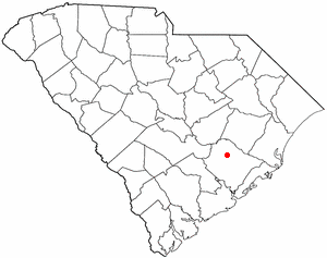
See Bonneau, SC on the map
Public Transportation to Bonneau, SC
Wondering how to get to Bonneau, SC? Moovit helps you find the best way to get to Bonneau, SC with step-by-step directions from the nearest public transit station.
Moovit provides free maps and live directions to help you navigate through your city. View schedules, routes, timetables, and find out how long does it take to get to Bonneau, SC in real time.
Looking for the nearest stop or station to Bonneau, SC? Check out this list of stops closest to your destination: Bonneau Town Hall Park & Ride.
Bus: B104.
Want to see if there’s another route that gets you there at an earlier time? Moovit helps you find alternative routes or times. Get directions from and directions to Bonneau, SC easily from the Moovit App or Website.
We make riding to Bonneau, SC easy, which is why over 1.7 billion users, including users in Bonneau, trust Moovit as the best app for public transit. You don’t need to download an individual bus app or train app, Moovit is your all-in-one transit app that helps you find the best bus time or train time available.
For information on prices of bus, costs and ride fares to Bonneau, SC, please check the Moovit app.
Use the app to navigate to popular places including to the airport, hospital, stadium, grocery store, mall, coffee shop, school, college, and university.
Location: Bonneau, Charleston, SC
Popular routes to Bonneau, SC
- From Spruill Ave / Echo Ave,
- From Calhoun St / Jonathan Lucas St (Near Side),
- From Reynolds Ave / Spruill Ave,
- From Remount Rd / Allison Ave,
- From Constitution Ave / Ranger Dr,
- From Meeting Street Rd / Groveland Ave,
- From Meeting St / Huger St,
- From Azalea Dr / Meridian Rd,
- From Spruill Ave / Gullah Ave,
- From King St / Heriot St
- Hope Medical Transport and Training,
- Mixtacos,
- Saint Stephen, SC,
- Moncks Corner, SC,
- Berkeley Community Federal Credit Union,
- Roper St Francis Medical Center Berkeley,
- Page's Okra Grill - Moncks Corner,
- Berkeley Electric Cooperative,
- First Baptist Church Missionary Parsonage,
- Cypress Gardens Arts Foundation,
- Trident Tech Berkeley Campus,
- Spring Head (historical),
- Adat Netzer Matai,
- Cane Bay Elementary,
- Cane Bay High School,
- Cane Bay Elementary School,
- Cane Bay Middle School Cobras,
- Cane Bay Middle,
- Huger,
- Hwy 178 & Hwy 17A
Places Near Bonneau, SC
- Boeing's Welcome Center, North Charleston,
- Johns Island,
- Rainbow Row, Charleston Central,
- Patriots Point Naval & Maritime Museum, Mount Pleasant,
- SPAWAR (BLDG 3112), Goose Creek-Hanahan,
- Pineapple Fountain At Waterfront Park, Charleston Central,
- I-26 & Ashley Phosphate (Exit 209), North Charleston,
- Charleston Amtrak Station, North Charleston,
- Tanger Outlets Charleston, North Charleston,
- King Street in Charleston South Carolina, Charleston Central,
- Trident Medical Center Ambulatory Care Center, North Charleston,
- Boeing Bldg. 88-20, North Charleston,
- Boone Hall Plantation, Mount Pleasant,
- Medical University of South Carolina (MUSC), Charleston Central,
- Red Light District, West Ashley,
- hookers and hoodlums, North Charleston,
- Ralph H. Johnson VA Medical Center, Charleston Central,
- Daniel Island,
- 25 Courtenay Drive, Charleston Central,
- CARTA Bus Stop - Route 12, Summerville
How to get to popular places in Charleston, SC with public transit
Get around Bonneau by public transit!
Traveling around Bonneau has never been so easy. See step by step directions as you travel to any attraction, street or major public transit station. View bus and train schedules, arrival times, service alerts and detailed routes on a map, so you know exactly how to get to anywhere in Bonneau.
When traveling to any destination around Bonneau use Moovit's Live Directions with Get Off Notifications to know exactly where and how far to walk, how long to wait for your line, and how many stops are left. Moovit will alert you when it's time to get off — no need to constantly re-check whether yours is the next stop.
Wondering how to use public transit in Bonneau or how to pay for public transit in Bonneau? Moovit public transit app can help you navigate your way with public transit easily, and at minimum cost. It includes public transit fees, ticket prices, and costs. Looking for a map of Bonneau public transit lines? Moovit public transit app shows all public transit maps in Bonneau with all bus routes and stops on an interactive map.
Charleston, SC has 1 transit type(s), including: bus, operated by several transit agencies, including Charleston Area Regional Transportation Authority, TriCounty Link and Palmetto Breeze Transit