How to get to Bonobos by bus?
Click on the bus route to see step by step directions with maps, line arrival times and updated time schedules.
From U.S. Naval Research Laboratory - NRL, Washington
112 minFrom Consulado General de El Salvador en El Dmv, Montgomery County
71 minFrom Basilica of the National Shrine, Washington
64 minFrom Thompson Washington D.C., Washington
50 minFrom Cia Headquarters, Fairfax County
57 minFrom Folger Shakespeare Library, Washington
47 minFrom Old Town Trolley Tours, Washington
46 minFrom F.B.I, Washington
46 minFrom Washington Costco DC, Washington
72 minFrom Naval Research Lab, Washington
112 min
How to get to Bonobos by metro?
Click on the metro route to see step by step directions with maps, line arrival times and updated time schedules.
Metro stations near Bonobos in Washington
Bus stops near Bonobos in Washington
Bus lines to Bonobos in Washington
What are the closest stations to Bonobos?
The closest stations to Bonobos are:
- Dupont Circle Metro Station is 60 yards away, 1 min walk.
- NW M St & NW 34th St is 140 yards away, 2 min walk.
- Prospect St Nw+36 St NW is 433 yards away, 6 min walk.
- M St NW & Wisconsin Ave NW is 467 yards away, 6 min walk.
- Q St Nw+33 St NW is 843 yards away, 11 min walk.
- Foggy Bottom Gwu Kennedy Center Metro Station is 1305 yards away, 16 min walk.
Which bus lines stop near Bonobos?
These bus lines stop near Bonobos: A58, D80.
Which metro lines stop near Bonobos?
These metro lines stop near Bonobos: BLUE, ORANGE.
What’s the nearest metro station to Bonobos in Washington?
The nearest metro station to Bonobos in Washington is Dupont Circle Metro Station. It’s a 1 min walk away.
What’s the nearest bus station to Bonobos in Washington?
The nearest bus station to Bonobos in Washington is NW M St & NW 34th St. It’s a 2 min walk away.
What time is the first metro to Bonobos in Washington?
The ORANGE is the first metro that goes to Bonobos in Washington. It stops nearby at 5:19 AM.
What time is the last metro to Bonobos in Washington?
The BLUE is the last metro that goes to Bonobos in Washington. It stops nearby at 12:18 AM.
What time is the first bus to Bonobos in Washington?
The D80 is the first bus that goes to Bonobos in Washington. It stops nearby at 3:10 AM.
What time is the last bus to Bonobos in Washington?
The D80 is the last bus that goes to Bonobos in Washington. It stops nearby at 3:11 AM.
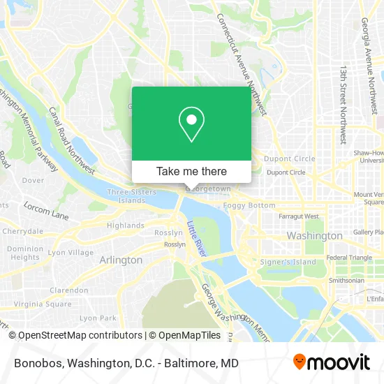
See Bonobos, Washington, on the map
Public Transit to Bonobos in Washington
Wondering how to get to Bonobos in Washington? Moovit helps you find the best way to get to Bonobos with step-by-step directions from the nearest public transit station.
Moovit provides free maps and live directions to help you navigate through your city. View schedules, routes, timetables, and find out how long does it take to get to Bonobos in real time.
Looking for the nearest stop or station to Bonobos? Check out this list of stops closest to your destination: Dupont Circle Metro Station; NW M St & NW 34th St; Prospect St Nw+36 St NW; M St NW & Wisconsin Ave NW; Q St Nw+33 St NW; Foggy Bottom Gwu Kennedy Center Metro Station.
Bus: A58, D80, C85, C91, D82, D94, D96.Metro: BLUE, ORANGE, RED, SILVER.
Want to see if there’s another route that gets you there at an earlier time? Moovit helps you find alternative routes or times. Get directions from and directions to Bonobos easily from the Moovit App or Website.
We make riding to Bonobos easy, which is why over 1.5 million users, including users in Washington, trust Moovit as the best app for public transit. You don’t need to download an individual bus app or train app, Moovit is your all-in-one transit app that helps you find the best bus time or train time available.
For information on prices of bus and metro, costs and ride fares to Bonobos, please check the Moovit app.
Use the app to navigate to popular places including to the airport, hospital, stadium, grocery store, mall, coffee shop, school, college, and university.
Bonobos Address: 3320 Cadys Aly NW street in Washington
- Kafè Leopold,
- Kyojin Sushi,
- Kafe Leopold (Leopold's Kafe),
- Maxalto Boffi,
- KKP,
- Sleepy Hollow,
- Skims Georgetown,
- EVgo,
- Lot 787 - Waterfront Center,
- Ev A Team,
- Waldron Private Wealth,
- Prolash & Pmu,
- Rimtang,
- Rug Refringing,
- DMS Perla,
- Pmi Location,
- Scout Flagship Store,
- Georgetown Cupcake,
- Embassy of Ukraine DC USA,
- The Tavern-Sweetgreen
Places Near Bonobos (Washington)
- Camden Yards, Baltimore,
- PG Mall, Prince George's County,
- Warner Theatre, Washington,
- Georgetown, Washington,
- National Zoo, Washington,
- Amazon Hq2, Arlington County,
- The Anthem, Washington,
- Capital One Arena, Washington,
- Rock Creek Tennis Center, Washington,
- Museum Of The Bible, Washington,
- National Museum of African American History and Culture, Washington,
- Sibley Memorial Hospital, Washington,
- National Mall, Washington,
- Washington DC VA Medical Center, Washington,
- Pennsylvania Ave NW (3rd st and pennsylvania), Washington,
- Westfield Montgomery Mall, Montgomery County,
- M&T Bank Stadium, Baltimore,
- Washington National Cathedral, Washington,
- Marriott Marquis Washington, DC, Washington,
- Basilica of the National Shrine, Washington
How to get to popular places in Washington, D.C. - Baltimore, MD with public transit
Get around Washington by public transit!
Traveling around Washington has never been so easy. See step by step directions as you travel to any attraction, street or major public transit station. View bus and train schedules, arrival times, service alerts and detailed routes on a map, so you know exactly how to get to anywhere in Washington.
When traveling to any destination around Washington use Moovit's Live Directions with Get Off Notifications to know exactly where and how far to walk, how long to wait for your line, and how many stops are left. Moovit will alert you when it's time to get off — no need to constantly re-check whether yours is the next stop.
Wondering how to use public transit in Washington or how to pay for public transit in Washington? Moovit public transit app can help you navigate your way with public transit easily, and at minimum cost. It includes public transit fees, ticket prices, and costs. Looking for a map of Washington public transit lines? Moovit public transit app shows all public transit maps in Washington with all Bus, Train, Metro, Light Rail and Ferry routes and stops on an interactive map.
Washington, D.C. - Baltimore, MD has 5 transit type(s), including: Bus, Train, Metro, Light Rail and Ferry, operated by several transit agencies, including WMATA, Montgomery County Ride On, Fairfax Connector, TheBus, PRTC, DASH - Alexandria, Arlington Transit (ART), RTA of Central Maryland, MDOT MTA, MDOT MTA Light RailLink, MDOT MTA Commuter Bus, MDOT MTA Local Bus, FXBGO!, Virginia Railway Express (VRE) and MARC