How to get to Boston Market by bus?
Click on the bus route to see step by step directions with maps, line arrival times and updated time schedules.
From Inova employee Shuttle, Fairfax County
34 minFrom Inova Fairfax Hospital North Tower Building, Fairfax County
36 minFrom Defense Health Headquarters (DHHQ), Fairfax County
50 minFrom Dulles Expo Center, Fairfax County
61 minFrom Falls Church Marriott Fairview Park, Fairfax County
56 minFrom Chantilly, VA, Fairfax County
40 minFrom Hollywood Casino at Charles Town Races, Fairfax County
45 minFrom Defense Health Agency Headquarters, Fairfax County
51 minFrom Arabx Com Inc, Fairfax County
41 min
Bus stops near Boston Market in Fairfax
Bus lines to Boston Market in Fairfax
What are the closest stations to Boston Market?
The closest stations to Boston Market are:
- Jermantown Rd at Lee Highway is 142 yards away, 2 min walk.
- Jermantown Rd + Rt 29 Lee Hwy is 171 yards away, 3 min walk.
- Main St+Jermantown Rd is 246 yards away, 4 min walk.
- Route 29 @ Jermantown Rd is 260 yards away, 4 min walk.
Which bus lines stop near Boston Market?
These bus lines stop near Boston Market: 610, 625, F60.
What’s the nearest bus station to Boston Market in Fairfax?
The nearest bus station to Boston Market in Fairfax is Jermantown Rd at Lee Highway. It’s a 2 min walk away.
What time is the first bus to Boston Market in Fairfax?
The F60 is the first bus that goes to Boston Market in Fairfax. It stops nearby at 5:09 AM.
What time is the last bus to Boston Market in Fairfax?
The GOLD 1 is the last bus that goes to Boston Market in Fairfax. It stops nearby at 10:50 PM.
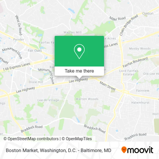
See Boston Market, Fairfax, on the map
Public Transit to Boston Market in Fairfax
Wondering how to get to Boston Market in Fairfax? Moovit helps you find the best way to get to Boston Market with step-by-step directions from the nearest public transit station.
Moovit provides free maps and live directions to help you navigate through your city. View schedules, routes, timetables, and find out how long does it take to get to Boston Market in real time.
Looking for the nearest stop or station to Boston Market? Check out this list of stops closest to your destination: Jermantown Rd at Lee Highway; Jermantown Rd + Rt 29 Lee Hwy; Main St+Jermantown Rd; Route 29 @ Jermantown Rd.
Bus: 610, 625, F60, GOLD 2, GOLD 1.
Want to see if there’s another route that gets you there at an earlier time? Moovit helps you find alternative routes or times. Get directions from and directions to Boston Market easily from the Moovit App or Website.
We make riding to Boston Market easy, which is why over 1.5 million users, including users in Fairfax, trust Moovit as the best app for public transit. You don’t need to download an individual bus app or train app, Moovit is your all-in-one transit app that helps you find the best bus time or train time available.
For information on prices of bus, costs and ride fares to Boston Market, please check the Moovit app.
Use the app to navigate to popular places including to the airport, hospital, stadium, grocery store, mall, coffee shop, school, college, and university.
Boston Market Address: Lee Highway street in Fairfax
- Viet House,
- Vegetarian Friendly,
- Fairfax Lowe's,
- Green Basil Dimsum & Pho,
- Service Employee International Union,
- Centreville Square Florist,
- Shish Kabob Express Fairfax,
- First Horizon Bank,
- Minute Key,
- Oasis Wellness Center,
- Waples Mobile Home Estates,
- Kase Securities Management,
- Credit Union 1,
- Christine Chung Flowers,
- Navy Federal Credit Union,
- Livlight Weight Loss,
- Livlight Weight Loss: A Modern Wellness & Infrared Studio,
- Fish Window Cleaning,
- Miso Restaurant,
- Business
Places Near Boston Market (Fairfax)
- Georgetown, Washington,
- National Mall, Washington,
- Westfield Montgomery Mall, Montgomery County,
- Camden Yards, Baltimore,
- Washington National Cathedral, Washington,
- Rock Creek Tennis Center, Washington,
- Pennsylvania Ave NW (3rd st and pennsylvania), Washington,
- National Zoo, Washington,
- Washington DC VA Medical Center, Washington,
- National Museum of African American History and Culture, Washington,
- Amazon Hq2, Arlington County,
- Marriott Marquis Washington, DC, Washington,
- M&T Bank Stadium, Baltimore,
- Sibley Memorial Hospital, Washington,
- Warner Theatre, Washington,
- The Anthem, Washington,
- PG Mall, Prince George's County,
- Capital One Arena, Washington,
- Basilica of the National Shrine, Washington,
- Museum Of The Bible, Washington
How to get to popular places in Washington, D.C. - Baltimore, MD with public transit
Get around Fairfax by public transit!
Traveling around Fairfax has never been so easy. See step by step directions as you travel to any attraction, street or major public transit station. View bus and train schedules, arrival times, service alerts and detailed routes on a map, so you know exactly how to get to anywhere in Fairfax.
When traveling to any destination around Fairfax use Moovit's Live Directions with Get Off Notifications to know exactly where and how far to walk, how long to wait for your line, and how many stops are left. Moovit will alert you when it's time to get off — no need to constantly re-check whether yours is the next stop.
Wondering how to use public transit in Fairfax or how to pay for public transit in Fairfax? Moovit public transit app can help you navigate your way with public transit easily, and at minimum cost. It includes public transit fees, ticket prices, and costs. Looking for a map of Fairfax public transit lines? Moovit public transit app shows all public transit maps in Fairfax with all Bus, Train, Metro, Light Rail and Ferry routes and stops on an interactive map.
Washington, D.C. - Baltimore, MD has 5 transit type(s), including: Bus, Train, Metro, Light Rail and Ferry, operated by several transit agencies, including WMATA, Montgomery County Ride On, Fairfax Connector, TheBus, PRTC, DASH - Alexandria, Arlington Transit (ART), RTA of Central Maryland, MDOT MTA, MDOT MTA Light RailLink, MDOT MTA Commuter Bus, MDOT MTA Local Bus, FXBGO!, Virginia Railway Express (VRE) and MARC