How to get to Botanica Yemaya Y Chango by bus?
Click on the bus route to see step by step directions with maps, line arrival times and updated time schedules.
From MDT Metrorail - Government Center Station, Miami
44 minFrom Miami Dade College Medical Campus, Miami
70 minFrom La Quinta Inn & Suites-Miami, Miami
53 minFrom Downtown Miami, Miami
44 minFrom Miami Downtown Bus Terminal, Miami
45 minFrom Haitian Consulate General, Miami
51 minFrom Government Center Metromover Station 1st Floor, Miami
44 minFrom Calle Ocho, Miami
23 minFrom Imater Academy Charter Middle/High School, Hialeah
71 minFrom Turkish Consulate General in Miami, Miami
48 min
Bus stops near Botanica Yemaya Y Chango in Miami
Bus lines to Botanica Yemaya Y Chango in Miami
What are the closest stations to Botanica Yemaya Y Chango?
The closest stations to Botanica Yemaya Y Chango are:
- Sw 8 St & Sw 62 Av is 104 yards away, 2 min walk.
- Sw 8 St & Sw 63 Av is 339 yards away, 5 min walk.
- Sw 57 Av@sw 8 St is 862 yards away, 11 min walk.
Which bus lines stop near Botanica Yemaya Y Chango?
These bus lines stop near Botanica Yemaya Y Chango: 211, 8, MIAFLAG.
What’s the nearest bus station to Botanica Yemaya Y Chango in Miami?
The nearest bus station to Botanica Yemaya Y Chango in Miami is Sw 8 St & Sw 62 Av. It’s a 2 min walk away.
What time is the first bus to Botanica Yemaya Y Chango in Miami?
The 8 is the first bus that goes to Botanica Yemaya Y Chango in Miami. It stops nearby at 4:32 AM.
What time is the last bus to Botanica Yemaya Y Chango in Miami?
The 8 is the last bus that goes to Botanica Yemaya Y Chango in Miami. It stops nearby at 1:05 AM.
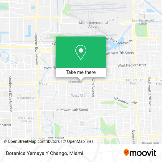
See Botanica Yemaya Y Chango, Miami, on the map
Public Transit to Botanica Yemaya Y Chango in Miami
Wondering how to get to Botanica Yemaya Y Chango in Miami? Moovit helps you find the best way to get to Botanica Yemaya Y Chango with step-by-step directions from the nearest public transit station.
Moovit provides free maps and live directions to help you navigate through your city. View schedules, routes, timetables, and find out how long does it take to get to Botanica Yemaya Y Chango in real time.
Looking for the nearest stop or station to Botanica Yemaya Y Chango? Check out this list of stops closest to your destination: Sw 8 St & Sw 62 Av; Sw 8 St & Sw 63 Av; Sw 57 Av@sw 8 St.
Bus: 211, 8, MIAFLAG, 57.
Want to see if there’s another route that gets you there at an earlier time? Moovit helps you find alternative routes or times. Get directions from and directions to Botanica Yemaya Y Chango easily from the Moovit App or Website.
We make riding to Botanica Yemaya Y Chango easy, which is why over 1.5 million users, including users in Miami, trust Moovit as the best app for public transit. You don’t need to download an individual bus app or train app, Moovit is your all-in-one transit app that helps you find the best bus time or train time available.
For information on prices of bus, costs and ride fares to Botanica Yemaya Y Chango, please check the Moovit app.
Use the app to navigate to popular places including to the airport, hospital, stadium, grocery store, mall, coffee shop, school, college, and university.
Botanica Yemaya Y Chango Address: 6111 SW 8th St street in Miami
- Rd Salon & Spa,
- Sebanda Insurance,
- Super Cleaners,
- SW 8th St / SW 62nd Ave,
- Sabor Tropical Supermarket,
- Don Ramon Pizzeria,
- IGA,
- Mely's Fashion Sense,
- Miripadi Intl,
- Fumee Smokeshop & Lounge,
- City of West Miami,
- South Miami Audiology Consultants,
- Hilbert Mohibir Shores Enterprises,
- Sergia Perez,
- Rubi Petspahotel,
- Rafer Enterprises,
- Oleleo Day Spa,
- Jorge L. Luaces Pediatrics,
- ATM,
- Browista Beauty
Places Near Botanica Yemaya Y Chango (Miami)
- Port of Miami Cruise Terminal, Miami,
- Sawgrass Mall, Miami,
- Miami Freedom Park, Miami,
- Aventura Mall, Miami Beach,
- Dolphin Mall, Miami,
- Little Havana, Miami,
- Richard E. Gerstein Justice Building, Miami,
- Bayside Marketplace, Miami,
- Dolphin Mall Bus, Miami,
- Wynwood, Miami,
- Hard Rock Stadium, Miami Gardens,
- Zoo Miami, Miami,
- Brickell City Centre, Miami,
- Miami Design District, Miami,
- Aventura Mall, Miami,
- Marlins Park, Miami,
- Sawgrass mall ( FL ), Miami Beach,
- Miami-Dade County Courthouse, Miami,
- Miami VA Hospital, Miami,
- Keiser University Flagship Campus, West Palm Beach
How to get to popular places in Miami with public transit
Get around Miami by public transit!
Traveling around Miami has never been so easy. See step by step directions as you travel to any attraction, street or major public transit station. View bus and train schedules, arrival times, service alerts and detailed routes on a map, so you know exactly how to get to anywhere in Miami.
When traveling to any destination around Miami use Moovit's Live Directions with Get Off Notifications to know exactly where and how far to walk, how long to wait for your line, and how many stops are left. Moovit will alert you when it's time to get off — no need to constantly re-check whether yours is the next stop.
Wondering how to use public transit in Miami or how to pay for public transit in Miami? Moovit public transit app can help you navigate your way with public transit easily, and at minimum cost. It includes public transit fees, ticket prices, and costs. Looking for a map of Miami public transit lines? Moovit public transit app shows all public transit maps in Miami with all Bus, Train, Light Rail and Ferry routes and stops on an interactive map.
Miami has 4 transit type(s), including: Bus, Train, Light Rail and Ferry, operated by several transit agencies, including Broward County Transit, Miami-Dade Transit, Metrorail, Palm Tran, Tri-Rail, Brightline, MARTY, City of Homestead Trolley, Key West Transit, Treasure Coast Connector, GoLine IRT, Amtrak, Greyhound-us, FlixBus-us and Aventura Express Shuttle Bus