How to get to Botica Cofarma by bus?
Click on the bus route to see step by step directions with maps, line arrival times and updated time schedules.
From Clínica Sanna El Golf, San Isidro
52 minFrom Ministerio de Transportes y Comunicaciones - MTC, Lima
30 minFrom Salaverry, Los Olivos
44 minFrom Sodimac San Juan de Lurigancho, San Juan D
43 minFrom I.E. Melitón Carvajal, Lince
51 minFrom Oficina de Registro Militar 034, Comas
38 minFrom Hospital Guillermo Almenara - Neurocirugía, La Victori
41 minFrom Salaverry, San Miguel
47 minFrom Hospital Nacional Hipólito Unanue, El Agustin
45 minFrom Essalud Cap III Alfredo Piazza Roberts, Lince
51 min
Bus stops near Botica Cofarma in Los Olivos
Bus lines to Botica Cofarma in Los Olivos
- 1326 SX, Galerías San Lazaro (Independencia) - Aeropuerto (Callao) ,VIEW
- 1031, San Martín de Porres - Jesús María [La 29],VIEW
- 1199, San Martín de Porres - Chorrillos [36],VIEW
- 1275, S.M.P - Surco [R],VIEW
- 2203, San Martín de Porres - San Martín de Porres,VIEW
- CR42, Independencia - La Perla,VIEW
- IM08, Independencia - Callao,VIEW
- IO45, Callao - Independencia,VIEW
- 1008, Sucre (Magdalena Del Mar) - Villa Club (Carabayllo),VIEW
- 1011, Carabayllo - Pueblo Libre,VIEW
- 1013, Jesús María - Carabayllo,VIEW
- 1015, Carabayllo - Lince - Carabayllo,VIEW
- 1021, Mercado (Magdalena Del Mar) - Torre Blanca (Carabayllo),VIEW
- 1023, Centro Poblado Rio Seco (Carabayllo) - Colonial (Callao) ,VIEW
- 1038, Petit Thouars (Lince),VIEW
- 1138, Carabayllo - Caquetá - Faucett - Carabayllo,VIEW
- 1182, San Juan de Miraflores - Carabayllo,VIEW
- 1236, San Pedro (Carabayllo) - Pachacutec (Villa El Salvador),VIEW
- 1336, Torreblanca (Carabayllo) - Universitaria (San Miguel),VIEW
- 1337, Villa Club (Carabayllo) - La Marina (San Miguel),VIEW
What are the closest stations to Botica Cofarma?
The closest stations to Botica Cofarma are:
- Universitaria is 187 meters away, 3 min walk.
- Tomás Valle is 208 meters away, 3 min walk.
- Antares is 436 meters away, 6 min walk.
Which bus lines stop near Botica Cofarma?
These bus lines stop near Botica Cofarma: 1138, 1182, 1231, 1236, 1338, 1471, IM08.
What’s the nearest bus station to Botica Cofarma in Los Olivos?
The nearest bus stations to Botica Cofarma in Los Olivos are Universitaria and Tomás Valle. The closest one is a 3 min walk away.
What time is the first bus to Botica Cofarma in Los Olivos?
The 1471 is the first bus that goes to Botica Cofarma in Los Olivos. It stops nearby at 3:41 AM.
What time is the last bus to Botica Cofarma in Los Olivos?
The 1326 SX is the last bus that goes to Botica Cofarma in Los Olivos. It stops nearby at 2:13 AM.
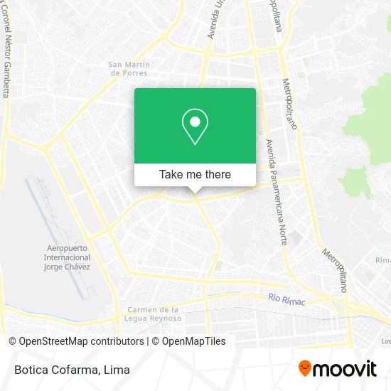
See Botica Cofarma, Los Olivos, on the map
Public Transit to Botica Cofarma in Los Olivos
Wondering how to get to Botica Cofarma in Los Olivos? Moovit helps you find the best way to get to Botica Cofarma with step-by-step directions from the nearest public transit station.
Moovit provides free maps and live directions to help you navigate through your city. View schedules, routes, timetables, and find out how long does it take to get to Botica Cofarma in real time.
Looking for the nearest stop or station to Botica Cofarma? Check out this list of stops closest to your destination: Universitaria; Tomás Valle; Antares.
Bus: 1138, 1182, 1231, 1236, 1338, 1471, IM08, 1326 SX, 1031, 1199, 1275, 2203, CR42, 1008, 1011, 1013, 1015, 1021, CR43.
Want to see if there’s another route that gets you there at an earlier time? Moovit helps you find alternative routes or times. Get directions from and directions to Botica Cofarma easily from the Moovit App or Website.
We make riding to Botica Cofarma easy, which is why over 1.5 million users, including users in Los Olivos, trust Moovit as the best app for public transit. You don’t need to download an individual bus app or train app, Moovit is your all-in-one transit app that helps you find the best bus time or train time available.
For information on prices of bus, costs and ride fares to Botica Cofarma, please check the Moovit app.
Use the app to navigate to popular places including to the airport, hospital, stadium, grocery store, mall, coffee shop, school, college, and university.
Botica Cofarma Address: Avenida Universitaria N Aa.Hh. Daniel Alcides Carrión, 15302 Los Olivos street in Los Olivos
- clínica Dental Care,
- Bodega El Valentino,
- Grupo Copitec S.A.C,
- San bartolomé,
- Bodega Bazar Candyluz,
- Taxi AH,
- Plaza Vea Universitaria,
- Universitaria con Tomas Valle,
- globalnet,
- Interbank,
- Plaza Vea,
- La Pishcota,
- El Granjero,
- Montalvo For Men,
- Farma Life,
- Calle Daniel Alcides Carrion,
- Boticas BTL,
- Hilton,
- av universitaria 1612,
- Polleria Chifa El Mana
Places Near Botica Cofarma (Los Olivos)
- Centro Comercial Plaza Norte, Independen,
- Circuito Mágico Del Agua, Lima,
- Parque Kennedy, Miraflores,
- Hospital Edgardo Rebagliati Martins, Jesus Mari,
- Parque de las Leyendas, San Miguel,
- Barranco, Barranco,
- Gamarra,
- Real Plaza Puruchuco, Ate,
- Larcomar, Miraflores,
- Jockey Plaza, Santiago D,
- av arequipa, Lima,
- Plaza San Miguel, San Miguel,
- Aeropuerto Internacional Jorge Chávez, Ventanilla,
- Miraflores, Miraflores,
- Paradero Av.Brasil,
- Av. La Marina, San Miguel,
- Av. Salaverry, Jesus Mari,
- Pontificia Universidad Católica del Perú - PUCP, San Miguel,
- Mall Del Sur,
- Av. Abancay, Lima
How to get to popular places in Lima with public transit
Get around Los Olivos by public transit!
Traveling around Los Olivos has never been so easy. See step by step directions as you travel to any attraction, street or major public transit station. View bus and train schedules, arrival times, service alerts and detailed routes on a map, so you know exactly how to get to anywhere in Los Olivos.
When traveling to any destination around Los Olivos use Moovit's Live Directions with Get Off Notifications to know exactly where and how far to walk, how long to wait for your line, and how many stops are left. Moovit will alert you when it's time to get off — no need to constantly re-check whether yours is the next stop.
Wondering how to use public transit in Los Olivos or how to pay for public transit in Los Olivos? Moovit public transit app can help you navigate your way with public transit easily, and at minimum cost. It includes public transit fees, ticket prices, and costs. Looking for a map of Los Olivos public transit lines? Moovit public transit app shows all public transit maps in Los Olivos with all Bus, Metro and Ferry routes and stops on an interactive map.
Lima has 3 transit type(s), including: Bus, Metro and Ferry, operated by several transit agencies, including Metro de Lima Línea 2 , Metro de Lima, Corredor Rojo, Metropolitano, Metropolitano - Alimentadores, Corredor Morado, Corredor Azul, Rutas Tradicionales, Transportes y Servicios La Esperanza S.A., Las Flores S.A., Virgen de la Asunción S.A., Consorcio HAM, Transportes y Service Canadá S.A., ETUL4SA and ETUCHISA