How to get to Boyer Cook by bus?
Click on the bus route to see step by step directions with maps, line arrival times and updated time schedules.
From Amazon Web Services - IAD21, Fairfax County
136 minFrom Hookers & Blow, Fairfax County
112 minFrom Northern Virginia Community College - Loudoun Campus, Loudoun County
89 minFrom Amazon Iad28, Fairfax County
116 minFrom Dulles Discovery, Fairfax County
126 minFrom Ashby Ponds, Loudoun County
78 minFrom Reston Town Center, Fairfax County
129 minFrom Sterling VA USA, Loudoun County
109 min
Bus stops near Boyer Cook in Loudoun County
Bus lines to Boyer Cook in Loudoun County
What are the closest stations to Boyer Cook?
The closest stations to Boyer Cook are:
- Exeter Fieldstone Apartments is 1388 yards away, 17 min walk.
- Target Near Edwards Ferry Rd is 2720 yards away, 32 min walk.
- Shenandoah Building is 3165 yards away, 37 min walk.
Which bus lines stop near Boyer Cook?
These bus lines stop near Boyer Cook: 351, 54, 55, 70.
What time is the first bus to Boyer Cook in Loudoun County?
The 54 is the first bus that goes to Boyer Cook in Loudoun County. It stops nearby at 7:00 AM.
What time is the last bus to Boyer Cook in Loudoun County?
The 70 is the last bus that goes to Boyer Cook in Loudoun County. It stops nearby at 9:50 PM.
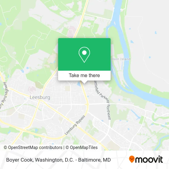
See Boyer Cook, Loudoun County, on the map
Public Transit to Boyer Cook in Loudoun County
Wondering how to get to Boyer Cook in Loudoun County? Moovit helps you find the best way to get to Boyer Cook with step-by-step directions from the nearest public transit station.
Moovit provides free maps and live directions to help you navigate through your city. View schedules, routes, timetables, and find out how long does it take to get to Boyer Cook in real time.
Looking for the nearest stop or station to Boyer Cook? Check out this list of stops closest to your destination: Exeter Fieldstone Apartments; Target Near Edwards Ferry Rd; Shenandoah Building.
Bus: 351, 54, 55, 70, 57.
Want to see if there’s another route that gets you there at an earlier time? Moovit helps you find alternative routes or times. Get directions from and directions to Boyer Cook easily from the Moovit App or Website.
We make riding to Boyer Cook easy, which is why over 1.5 million users, including users in Loudoun County, trust Moovit as the best app for public transit. You don’t need to download an individual bus app or train app, Moovit is your all-in-one transit app that helps you find the best bus time or train time available.
For information on prices of bus and metro, costs and ride fares to Boyer Cook, please check the Moovit app.
Use the app to navigate to popular places including to the airport, hospital, stadium, grocery store, mall, coffee shop, school, college, and university.
Boyer Cook Address: 838 Balls Bluff Rd NE Leesburg, VA 20176 street in Loudoun County
- Primrose Schools,
- Mt Olive Baptist Church,
- Time To Talk,
- Telos,
- Monkeebox,
- Battlefield Pkwy NE,
- Independent Recruiting Consultants,
- Bimini Savior,
- DMD Home Improvement Servises,
- Walmart,
- Solo NY Pizza,
- Rosie's Riveting S,
- Vila C Verde,
- Plumb Crazy, Inc.,
- Stone Clubhouse,
- Avana Fieldstone,
- Aht Insurance,
- Taco Bell,
- Vira Borys,
- Costco Gas
Places Near Boyer Cook (Loudoun County)
- National Zoo, Washington,
- Sibley Memorial Hospital, Washington,
- Rock Creek Tennis Center, Washington,
- Warner Theatre, Washington,
- Washington National Cathedral, Washington,
- M&T Bank Stadium, Baltimore,
- PG Mall, Prince George's County,
- Camden Yards, Baltimore,
- The Anthem, Washington,
- Capital One Arena, Washington,
- Basilica of the National Shrine, Washington,
- Westfield Montgomery Mall, Montgomery County,
- National Mall, Washington,
- Georgetown, Washington,
- Museum Of The Bible, Washington,
- National Museum of African American History and Culture, Washington,
- Marriott Marquis Washington, DC, Washington,
- Pennsylvania Ave NW (3rd st and pennsylvania), Washington,
- Amazon Hq2, Arlington County,
- Washington DC VA Medical Center, Washington
How to get to popular places in Washington, D.C. - Baltimore, MD with public transit
Get around Loudoun County by public transit!
Traveling around Loudoun County has never been so easy. See step by step directions as you travel to any attraction, street or major public transit station. View bus and train schedules, arrival times, service alerts and detailed routes on a map, so you know exactly how to get to anywhere in Loudoun County.
When traveling to any destination around Loudoun County use Moovit's Live Directions with Get Off Notifications to know exactly where and how far to walk, how long to wait for your line, and how many stops are left. Moovit will alert you when it's time to get off — no need to constantly re-check whether yours is the next stop.
Wondering how to use public transit in Loudoun County or how to pay for public transit in Loudoun County? Moovit public transit app can help you navigate your way with public transit easily, and at minimum cost. It includes public transit fees, ticket prices, and costs. Looking for a map of Loudoun County public transit lines? Moovit public transit app shows all public transit maps in Loudoun County with all Bus, Train, Metro, Light Rail and Ferry routes and stops on an interactive map.
Washington, D.C. - Baltimore, MD has 5 transit type(s), including: Bus, Train, Metro, Light Rail and Ferry, operated by several transit agencies, including WMATA, Montgomery County Ride On, Fairfax Connector, TheBus, PRTC, DASH - Alexandria, Arlington Transit (ART), RTA of Central Maryland, MDOT MTA, MDOT MTA Light RailLink, MDOT MTA Commuter Bus, MDOT MTA Local Bus, FXBGO!, Virginia Railway Express (VRE) and MARC