How to get to Breakwater Insurance by bus?
Click on the bus route to see step by step directions with maps, line arrival times and updated time schedules.
From Clover Park, Port St. Lucie
108 minFrom Indian River State College, Fort Pierce
42 minFrom Stuart, Florida, Stuart
100 minFrom CVS Pharmacy - (Lyngate Dr), Port St. Lucie
51 minFrom US-1, Fort Pierce
18 minFrom US-1 / SE Port St Lucie Blvd, Port St. Lucie
60 minFrom Tradition Park, Port St. Lucie
109 minFrom Suncoast High School, Riviera Beach
559 min
Bus stops near Breakwater Insurance in Fort Pierce
Bus lines to Breakwater Insurance in Fort Pierce
What are the closest stations to Breakwater Insurance?
The closest stations to Breakwater Insurance are:
- Atlantic Ave & US Hwy 1 is 256 yards away, 4 min walk.
- N 7th St & Avenue B is 436 yards away, 6 min walk.
- Avenue D & N 8th St is 933 yards away, 12 min walk.
Which bus lines stop near Breakwater Insurance?
These bus lines stop near Breakwater Insurance: 1, 3.
What’s the nearest bus station to Breakwater Insurance in Fort Pierce?
The nearest bus station to Breakwater Insurance in Fort Pierce is Atlantic Ave & US Hwy 1. It’s a 4 min walk away.
What time is the first bus to Breakwater Insurance in Fort Pierce?
The 3 is the first bus that goes to Breakwater Insurance in Fort Pierce. It stops nearby at 6:00 AM.
What time is the last bus to Breakwater Insurance in Fort Pierce?
The 3 is the last bus that goes to Breakwater Insurance in Fort Pierce. It stops nearby at 8:00 PM.
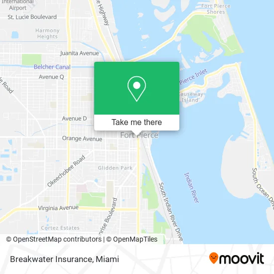
See Breakwater Insurance, Fort Pierce, on the map
Public Transit to Breakwater Insurance in Fort Pierce
Wondering how to get to Breakwater Insurance in Fort Pierce? Moovit helps you find the best way to get to Breakwater Insurance with step-by-step directions from the nearest public transit station.
Moovit provides free maps and live directions to help you navigate through your city. View schedules, routes, timetables, and find out how long does it take to get to Breakwater Insurance in real time.
Looking for the nearest stop or station to Breakwater Insurance? Check out this list of stops closest to your destination: Atlantic Ave & US Hwy 1; N 7th St & Avenue B; Avenue D & N 8th St.
Bus: 1, 3, 2, 7, 8.
Want to see if there’s another route that gets you there at an earlier time? Moovit helps you find alternative routes or times. Get directions from and directions to Breakwater Insurance easily from the Moovit App or Website.
We make riding to Breakwater Insurance easy, which is why over 1.5 million users, including users in Fort Pierce, trust Moovit as the best app for public transit. You don’t need to download an individual bus app or train app, Moovit is your all-in-one transit app that helps you find the best bus time or train time available.
For information on prices of bus, costs and ride fares to Breakwater Insurance, please check the Moovit app.
Use the app to navigate to popular places including to the airport, hospital, stadium, grocery store, mall, coffee shop, school, college, and university.
Breakwater Insurance Address: 101 N US-1 Fort Pierce, FL 34950 street in Fort Pierce
- Mind Body Soulutions, LLC,
- Jeremiah Lyons Investigations,
- Kessler Law Firm,
- F Torres Juan III Pa,
- Balanced Beauty,
- Art Connection of Fort Pierce,
- Hairbyali.C,
- The Fort Pierce City Commission,
- Heritage Action for America,
- My Pretty Face Skincare Studio,
- Virgin of Guadalupe,
- United States District Court,
- Downtown Fort Pierce Parking Garage,
- Florida Guardian Ad Litem Office of the Treasure Coast,
- US District Court,
- 100 N US-1 Garage,
- Hyshe Consignment,
- German American Trading and Tourism,
- Cad-Con Design,
- The S&S
Places Near Breakwater Insurance (Fort Pierce)
- Hard Rock Stadium, Miami Gardens,
- Keiser University Flagship Campus, West Palm Beach,
- Wynwood, Miami,
- Dolphin Mall Bus, Miami,
- Dolphin Mall, Miami,
- Aventura Mall, Miami,
- Miami Design District, Miami,
- Port of Miami Cruise Terminal, Miami,
- Brickell City Centre, Miami,
- Sawgrass Mall, Miami,
- Zoo Miami, Miami,
- Little Havana, Miami,
- Miami Freedom Park, Miami,
- Bayside Marketplace, Miami,
- Richard E. Gerstein Justice Building, Miami,
- Sawgrass mall ( FL ), Miami Beach,
- Miami VA Hospital, Miami,
- Miami-Dade County Courthouse, Miami,
- Aventura Mall, Miami Beach,
- Marlins Park, Miami
How to get to popular places in Miami with public transit
Get around Fort Pierce by public transit!
Traveling around Fort Pierce has never been so easy. See step by step directions as you travel to any attraction, street or major public transit station. View bus and train schedules, arrival times, service alerts and detailed routes on a map, so you know exactly how to get to anywhere in Fort Pierce.
When traveling to any destination around Fort Pierce use Moovit's Live Directions with Get Off Notifications to know exactly where and how far to walk, how long to wait for your line, and how many stops are left. Moovit will alert you when it's time to get off — no need to constantly re-check whether yours is the next stop.
Wondering how to use public transit in Fort Pierce or how to pay for public transit in Fort Pierce? Moovit public transit app can help you navigate your way with public transit easily, and at minimum cost. It includes public transit fees, ticket prices, and costs. Looking for a map of Fort Pierce public transit lines? Moovit public transit app shows all public transit maps in Fort Pierce with all Bus, Train, Light Rail and Ferry routes and stops on an interactive map.
Miami has 4 transit type(s), including: Bus, Train, Light Rail and Ferry, operated by several transit agencies, including Broward County Transit, Miami-Dade Transit, Metrorail, Palm Tran, Tri-Rail, Brightline, MARTY, City of Homestead Trolley, Key West Transit, Treasure Coast Connector, GoLine IRT, Amtrak, Greyhound-us, FlixBus-us and Aventura Express Shuttle Bus