Directions to Breskin Development (Water Mill) with public transportation
The following transit lines have routes that pass near Breskin Development
 Bus: 92, HAMPTON JITNEY MONTAUK.
- Train: MONTAUK BRANCH.
How to get to Breskin Development by bus?
Click on the bus route to see step by step directions with maps, line arrival times and updated time schedules.
From Hauppauge ny, Hauppauge
186 minFrom Tanger Outlets, Riverhead, Calverton
106 minFrom Orient Point, Orient
199 minFrom Jake's 58 Casino, Islandia
197 minFrom Splish Splash Waterpark, Calverton
109 minFrom Wolffer Estate Vineyards, Sagaponack
66 minFrom Brentwood, NY, Brentwood
210 minFrom Hartford Healthcare Amphitheater, Bridgeport
551 min
Bus stops near Breskin Development in Water Mill
Train station near Breskin Development in Water Mill
- Southampton, 11 min walk,VIEW
Bus lines to Breskin Development in Water Mill
What are the closest stations to Breskin Development?
The closest stations to Breskin Development are:
- Montauk Hwy/Station Rd is 482 yards away, 6 min walk.
- Water Mill Westbound is 493 yards away, 6 min walk.
- Southampton is 877 yards away, 11 min walk.
Which bus lines stop near Breskin Development?
These bus lines stop near Breskin Development: 92, HAMPTON JITNEY MONTAUK.
What’s the nearest train station to Breskin Development in Water Mill?
The nearest train station to Breskin Development in Water Mill is Southampton. It’s a 11 min walk away.
What’s the nearest bus station to Breskin Development in Water Mill?
The nearest bus stations to Breskin Development in Water Mill are Montauk Hwy/Station Rd and Water Mill Westbound. The closest one is a 6 min walk away.
What time is the first train to Breskin Development in Water Mill?
The MONTAUK BRANCH is the first train that goes to Breskin Development in Water Mill. It stops nearby at 3:12 AM.
What time is the last train to Breskin Development in Water Mill?
The MONTAUK BRANCH is the last train that goes to Breskin Development in Water Mill. It stops nearby at 3:57 AM.
What time is the first bus to Breskin Development in Water Mill?
The 92 is the first bus that goes to Breskin Development in Water Mill. It stops nearby at 4:57 AM.
What time is the last bus to Breskin Development in Water Mill?
The HAMPTON JITNEY MONTAUK is the last bus that goes to Breskin Development in Water Mill. It stops nearby at 12:31 AM.
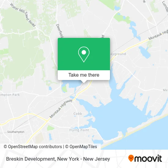
See Breskin Development, Water Mill, on the map
Public Transit to Breskin Development in Water Mill
Wondering how to get to Breskin Development in Water Mill? Moovit helps you find the best way to get to Breskin Development with step-by-step directions from the nearest public transit station.
Moovit provides free maps and live directions to help you navigate through your city. View schedules, routes, timetables, and find out how long does it take to get to Breskin Development in real time.
Looking for the nearest stop or station to Breskin Development? Check out this list of stops closest to your destination: Montauk Hwy/Station Rd; Water Mill Westbound; Southampton.
Bus: 92, HAMPTON JITNEY MONTAUK.Train: MONTAUK BRANCH.
Want to see if there’s another route that gets you there at an earlier time? Moovit helps you find alternative routes or times. Get directions from and directions to Breskin Development easily from the Moovit App or Website.
We make riding to Breskin Development easy, which is why over 1.5 million users, including users in Water Mill, trust Moovit as the best app for public transit. You don’t need to download an individual bus app or train app, Moovit is your all-in-one transit app that helps you find the best bus time or train time available.
For information on prices of bus and train, costs and ride fares to Breskin Development, please check the Moovit app.
Use the app to navigate to popular places including to the airport, hospital, stadium, grocery store, mall, coffee shop, school, college, and university.
Breskin Development Address: 50 Station Rd street in Water Mill
- Nyc Wallpapering Solutions,
- Phre Professional Haircare That Respects the Environment,
- Ameriprise Financial,
- Protect Kids and Their Wealth Vm Gokea Law,
- Balance Chiropractic / Balance Integrated Wellness - Janet Cirrone Lac, Dc,
- Peter Goldberg - Financial Advisor, Ameriprise Financial Services, Llc,
- Halcyon Financial Partners - Ameriprise Financial Services, Llc,
- Bob Sutton - Financial Advisor, Ameriprise Financial Services, Llc,
- Shine Design and Distribution,
- The Inheritance Lawyer,
- Southampton Pool Contractors,
- Custom Oriented Printing,
- Wbaz,
- Simonetti & Associates,
- Meeting House Lane Medical Practice,
- Core Dynamics Gym,
- One Ocean Yoga,
- Muse Restaurant & Aquatic Lounge,
- Iconic Modern Home,
- Water Mill Wine and Spirits
Places Near Breskin Development (Water Mill)
- 1 Police Plaza, Manhattan,
- Mountainside Hospital, Glen Ridge,
- Chinatown, Manhattan,
- SoHo, Manhattan,
- 66 John Street, Manhattan,
- Katz's Deli, Manhattan,
- Times Square, Manhattan,
- 26 Federal Plaza, Manhattan,
- 376 Hudson Street, Manhattan,
- Pier 83, Manhattan,
- Hudson Yards, Manhattan,
- 3 Stone St, Manhattan,
- 111 Centre New York City Supreme Court, Manhattan,
- Bellevue Hospital, Manhattan,
- Queens Center Mall, Queens,
- 911 Memorial, Manhattan,
- Rockefeller Center, Manhattan,
- qqqq, Manhattan,
- San Gennaro Feast, Manhattan,
- Wall Street, Manhattan
How to get to popular places in New York - New Jersey with public transit
Get around Water Mill by public transit!
Traveling around Water Mill has never been so easy. See step by step directions as you travel to any attraction, street or major public transit station. View bus and train schedules, arrival times, service alerts and detailed routes on a map, so you know exactly how to get to anywhere in Water Mill.
When traveling to any destination around Water Mill use Moovit's Live Directions with Get Off Notifications to know exactly where and how far to walk, how long to wait for your line, and how many stops are left. Moovit will alert you when it's time to get off — no need to constantly re-check whether yours is the next stop.
Wondering how to use public transit in Water Mill or how to pay for public transit in Water Mill? Moovit public transit app can help you navigate your way with public transit easily, and at minimum cost. It includes public transit fees, ticket prices, and costs. Looking for a map of Water Mill public transit lines? Moovit public transit app shows all public transit maps in Water Mill with all Bus, Train, Subway, Light Rail, Ferry and Cable Car routes and stops on an interactive map.
New York - New Jersey has 6 transit type(s), including: Bus, Train, Subway, Light Rail, Ferry and Cable Car, operated by several transit agencies, including MTA Subway, Metro-North Railroad, LIRR, PATH, MTA New York City Transit - Express routes, MTA Bus, NJ Transit, NYC Ferry, NICE bus, Bee-Line Bus, NJ Transit Rail, Norwalk Transit District, Hartford Line, River Valley Transit and HART