How to get to Bright Infra System by bus?
Click on the bus route to see step by step directions with maps, line arrival times and updated time schedules.
How to get to Bright Infra System by train?
Click on the train route to see step by step directions with maps, line arrival times and updated time schedules.
Bus stops near Bright Infra System in Vasai
Train station near Bright Infra System in Vasai
- Virar, 21 min walk,VIEW
Bus lines to Bright Infra System in Vasai
- 326, Virar (W),VIEW
- 308, Virar (E) - Ambadi,VIEW
- 310, Virar (E) - Shirsad Phata,VIEW
- 321, Arnala,VIEW
- 323, Navapur,VIEW
- 324, Virar (W),VIEW
- 328, Virar (W) Via Mhada Colony (Ring Route),VIEW
- 329, Arnala,VIEW
- 110, Vasai (E) - Virar (E),VIEW
- 205, Nalasopara (E) - Virar (E),VIEW
- 302, Virar (E) - Fulpada Dam,VIEW
- 304, Virar (E) - Sativali,VIEW
- 305, Virar (E) - Shree Swami Samarth Nagar,VIEW
- 306, Virar (E) - Vasai Court Tehsil Office,VIEW
What are the closest stations to Bright Infra System?
The closest stations to Bright Infra System are:
- Old Viva College is 38 meters away, 1 min walk.
- Shankar Mandir is 860 meters away, 12 min walk.
- Highway Phata is 896 meters away, 12 min walk.
- Virar (E) is 1531 meters away, 20 min walk.
- Virar is 1608 meters away, 21 min walk.
Which bus lines stop near Bright Infra System?
These bus lines stop near Bright Infra System: 304, 306, 308.
Which train lines stop near Bright Infra System?
These train lines stop near Bright Infra System: CGDR, WR.
What’s the nearest train station to Bright Infra System in Vasai?
The nearest train station to Bright Infra System in Vasai is Virar. It’s a 21 min walk away.
What’s the nearest bus station to Bright Infra System in Vasai?
The nearest bus station to Bright Infra System in Vasai is Old Viva College. It’s a 1 min walk away.
What time is the first train to Bright Infra System in Vasai?
The WR is the first train that goes to Bright Infra System in Vasai. It stops nearby at 3:25 AM.
What time is the last train to Bright Infra System in Vasai?
The WR is the last train that goes to Bright Infra System in Vasai. It stops nearby at 2:34 AM.
What time is the first bus to Bright Infra System in Vasai?
The 324 is the first bus that goes to Bright Infra System in Vasai. It stops nearby at 4:50 AM.
What time is the last bus to Bright Infra System in Vasai?
The 321 is the last bus that goes to Bright Infra System in Vasai. It stops nearby at 11:30 PM.
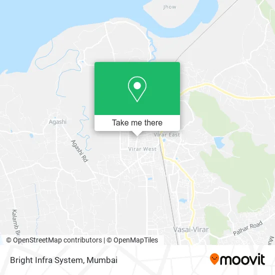
See Bright Infra System, Vasai, on the map
Public Transit to Bright Infra System in Vasai
Wondering how to get to Bright Infra System in Vasai? Moovit helps you find the best way to get to Bright Infra System with step-by-step directions from the nearest public transit station.
Moovit provides free maps and live directions to help you navigate through your city. View schedules, routes, timetables, and find out how long does it take to get to Bright Infra System in real time.
Looking for the nearest stop or station to Bright Infra System? Check out this list of stops closest to your destination: Old Viva College; Shankar Mandir; Highway Phata; Virar (E); Virar.
Bus: 304, 306, 308, 326, 310, 321, 323, 324, 328, 329, 110, 205, 302, 305.Train: CGDR, WR, BVDR, MEMU, VDR.
Want to see if there’s another route that gets you there at an earlier time? Moovit helps you find alternative routes or times. Get directions from and directions to Bright Infra System easily from the Moovit App or Website.
We make riding to Bright Infra System easy, which is why over 1.5 million users, including users in Vasai, trust Moovit as the best app for public transit. You don’t need to download an individual bus app or train app, Moovit is your all-in-one transit app that helps you find the best bus time or train time available.
For information on prices of bus and train, costs and ride fares to Bright Infra System, please check the Moovit app.
Use the app to navigate to popular places including to the airport, hospital, stadium, grocery store, mall, coffee shop, school, college, and university.
Bright Infra System Address: 200 FT Road Virar 401303 MH street in Vasai
- Bubble Bee,
- Cafe Brosten,
- Ribbons and Balloons the Cake Shop,
- Cafe Coffee Day,
- Domino's,
- Raj SUBWAY Residency,
- Jockey,
- Sandwizza,
- T.J.S.B Bank,
- Jivdani Kripa,
- Ashutosh D Vidwans & Co Chartered Accountants,
- Milestone Certification Services,
- Muthoot Fincorp Gold Loan,
- UNITED COLORS OF BENETTON,
- Vasai Vikas Sahakari Bank-Bolinj,
- Idfc First Bank,
- Robin Arts,
- The Post Office Restaurant & Bar (Post Office Hotel),
- The J,
- Saithack Taste of Kulhad
Places Near Bright Infra System (Vasai)
- Rani Baug, Byculla,
- Worli Sea Face,
- NESCO, Goregaon,
- J. J. Hospital, Byculla,
- Bombay Exhibition Center, Goregaon,
- Oberoi Sky City, Borivali East,
- Mumbai University, Kalina,
- R CITY MALL, Ghatkopar East,
- Gateway Of India,
- INFINITI Mall (Infinity Mall, andheri), Versova,
- Inorbit Mall, Malad West,
- Dome @ Nsci - Svp Stadium Mumbai, Worli,
- TCS Olympus, Thane,
- Juhu Beach,
- Malabar Hill, Malabar Hill,
- Bhaucha Dhakka,
- Ikea, Worli,
- Govardhan Ecovillage, Palghar (St),
- Oberoi Mall, Dindoshi,
- Hinduja Hospital, Mahim
How to get to popular places in Mumbai with public transit
Get around Vasai by public transit!
Traveling around Vasai has never been so easy. See step by step directions as you travel to any attraction, street or major public transit station. View bus and train schedules, arrival times, service alerts and detailed routes on a map, so you know exactly how to get to anywhere in Vasai.
When traveling to any destination around Vasai use Moovit's Live Directions with Get Off Notifications to know exactly where and how far to walk, how long to wait for your line, and how many stops are left. Moovit will alert you when it's time to get off — no need to constantly re-check whether yours is the next stop.
Wondering how to use public transit in Vasai or how to pay for public transit in Vasai? Moovit public transit app can help you navigate your way with public transit easily, and at minimum cost. It includes public transit fees, ticket prices, and costs. Looking for a map of Vasai public transit lines? Moovit public transit app shows all public transit maps in Vasai with all Bus, Train, Metro and Ferry routes and stops on an interactive map.
Mumbai has 4 transit type(s), including: Bus, Train, Metro and Ferry, operated by several transit agencies, including MMMOCL (Maha Mumbai Metro Operation Corporation Ltd.), NMM CIDCO (Navi Mumbai Metro Maha Metro), Reliance Mumbai Metro, MMRCL (Mumbai Metro Rail Corporation Ltd), BEST (Brihanmumbai Electricity Supply & Transport), BEST AC Services, A.C.Trains (Air-Conditioning Trains), W.R. (Western Railways), C.R. (Central Railways), C.R.MEMU (Central Railways Shuttle MEMU Trains), H.R. (Harbour Railways), T.R.(Trans Harbour Railways), U.R.(Uran-Ulwe Railways), I.R.(Indian Railways) and TMT (Thane Municipal Transport)