How to get to Brigitte Badell by bus?
Click on the bus route to see step by step directions with maps, line arrival times and updated time schedules.
From Baptist Hospital of Miami, Kendall-Palmetto Bay
59 minFrom Turnpike Exit @ Doral Blvd. (NW 41 Street), North Westside
69 minFrom Miami Dade College West Campus, North Westside
84 minFrom Bascom Palmer Eye Institute, Miami
71 minFrom US1, Miami
71 minFrom Biltmore Hotel Miami Coral Gables, Miami
51 minFrom The Lennar Foundation Medical Center, Miami
71 minFrom Sylvester Comprehensive Cancer Center, Miami
71 minFrom Flagler & 57 Ave, Miami
67 minFrom SW 8th St / SW 62nd Ave, Miami
46 min
Bus stops near Brigitte Badell in South Westside
Bus lines to Brigitte Badell in South Westside
What are the closest stations to Brigitte Badell?
The closest stations to Brigitte Badell are:
- Sw 40 St @ Sw 115 Blk is 112 yards away, 2 min walk.
- Sw 112 Av & 40 St is 652 yards away, 8 min walk.
Which bus lines stop near Brigitte Badell?
These bus lines stop near Brigitte Badell: 107, 40.
What’s the nearest bus station to Brigitte Badell in South Westside?
The nearest bus station to Brigitte Badell in South Westside is Sw 40 St @ Sw 115 Blk. It’s a 2 min walk away.
What time is the first bus to Brigitte Badell in South Westside?
The 40 is the first bus that goes to Brigitte Badell in South Westside. It stops nearby at 5:24 AM.
What time is the last bus to Brigitte Badell in South Westside?
The 107 is the last bus that goes to Brigitte Badell in South Westside. It stops nearby at 12:25 AM.
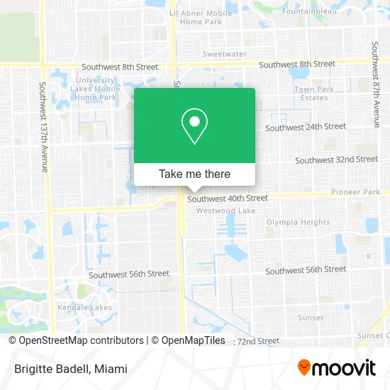
See Brigitte Badell, South Westside, on the map
Public Transit to Brigitte Badell in South Westside
Wondering how to get to Brigitte Badell in South Westside? Moovit helps you find the best way to get to Brigitte Badell with step-by-step directions from the nearest public transit station.
Moovit provides free maps and live directions to help you navigate through your city. View schedules, routes, timetables, and find out how long does it take to get to Brigitte Badell in real time.
Looking for the nearest stop or station to Brigitte Badell? Check out this list of stops closest to your destination: Sw 40 St @ Sw 115 Blk; Sw 112 Av & 40 St.
Bus: 107, 40.
Want to see if there’s another route that gets you there at an earlier time? Moovit helps you find alternative routes or times. Get directions from and directions to Brigitte Badell easily from the Moovit App or Website.
We make riding to Brigitte Badell easy, which is why over 1.5 million users, including users in South Westside, trust Moovit as the best app for public transit. You don’t need to download an individual bus app or train app, Moovit is your all-in-one transit app that helps you find the best bus time or train time available.
For information on prices of bus and train, costs and ride fares to Brigitte Badell, please check the Moovit app.
Use the app to navigate to popular places including to the airport, hospital, stadium, grocery store, mall, coffee shop, school, college, and university.
Brigitte Badell Address: 11401 SW 40th St Miami, FL 33165 street in South Westside
- Cigar Package Design,
- The Law Office,
- Jahel Ferreira,
- Anaisse Gomez,
- Cruise Rewards,
- Janice McCarthy,
- Steve Echeverri,
- De M A N D A Seguro,
- Alvaro Rodriguez,
- Raquel Orellana,
- Marilyn Orozco,
- Denise Farradaz,
- New Horizon Research Center,
- Maria Balloveras,
- Jenny Llorens,
- Twenty Seven Insurance,
- Michelle Gomez,
- Patricia Magallanes,
- Victor Arantes,
- Pedro Rivera
Places Near Brigitte Badell (South Westside)
- Keiser University Flagship Campus, West Palm Beach,
- Hard Rock Stadium, Miami Gardens,
- Sawgrass Mall, Miami,
- Dolphin Mall Bus, Miami,
- Miami Design District, Miami,
- Dolphin Mall, Miami,
- Miami-Dade County Courthouse, Miami,
- Port of Miami Cruise Terminal, Miami,
- Aventura Mall, Miami,
- Marlins Park, Miami,
- Bayside Marketplace, Miami,
- 1351 NW 12th St, Miami,
- Brickell City Centre, Miami,
- Wynwood, Miami,
- Little Havana, Miami,
- Miami Freedom Park, Miami,
- Richard E. Gerstein Justice Building, Miami,
- Sawgrass mall ( FL ), Miami Beach,
- Zoo Miami, Miami,
- Aventura Mall, Miami Beach
How to get to popular places in Miami with public transit
Get around South Westside by public transit!
Traveling around South Westside has never been so easy. See step by step directions as you travel to any attraction, street or major public transit station. View bus and train schedules, arrival times, service alerts and detailed routes on a map, so you know exactly how to get to anywhere in South Westside.
When traveling to any destination around South Westside use Moovit's Live Directions with Get Off Notifications to know exactly where and how far to walk, how long to wait for your line, and how many stops are left. Moovit will alert you when it's time to get off — no need to constantly re-check whether yours is the next stop.
Wondering how to use public transit in South Westside or how to pay for public transit in South Westside? Moovit public transit app can help you navigate your way with public transit easily, and at minimum cost. It includes public transit fees, ticket prices, and costs. Looking for a map of South Westside public transit lines? Moovit public transit app shows all public transit maps in South Westside with all Bus, Train, Light Rail and Ferry routes and stops on an interactive map.
Miami has 4 transit type(s), including: Bus, Train, Light Rail and Ferry, operated by several transit agencies, including Broward County Transit, Miami-Dade Transit, Metrorail, Palm Tran, Tri-Rail, Brightline, MARTY, City of Homestead Trolley, Key West Transit, Treasure Coast Connector, GoLine IRT, Amtrak, Greyhound-us, FlixBus-us and Aventura Express Shuttle Bus