Directions to Brittany's Learning Center (Suffolk) with public transportation
The following transit lines have routes that pass near Brittany's Learning Center
 Bus: PI.
How to get to Brittany's Learning Center by bus?
Click on the bus route to see step by step directions with maps, line arrival times and updated time schedules.
Bus stop near Brittany's Learning Center in Suffolk
- Progress & Qvc Outbound, 27 min walk,VIEW
Bus lines to Brittany's Learning Center in Suffolk
- PI, Inbound,VIEW
What are the closest stations to Brittany's Learning Center?
The closest stations to Brittany's Learning Center are:
- Progress & Qvc Outbound is 2255 yards away, 27 min walk.
Which bus line stops near Brittany's Learning Center?
PI (Inbound)
What time is the first bus to Brittany's Learning Center in Suffolk?
The PI is the first bus that goes to Brittany's Learning Center in Suffolk. It stops nearby at 6:41 AM.
What time is the last bus to Brittany's Learning Center in Suffolk?
The PI is the last bus that goes to Brittany's Learning Center in Suffolk. It stops nearby at 7:26 PM.
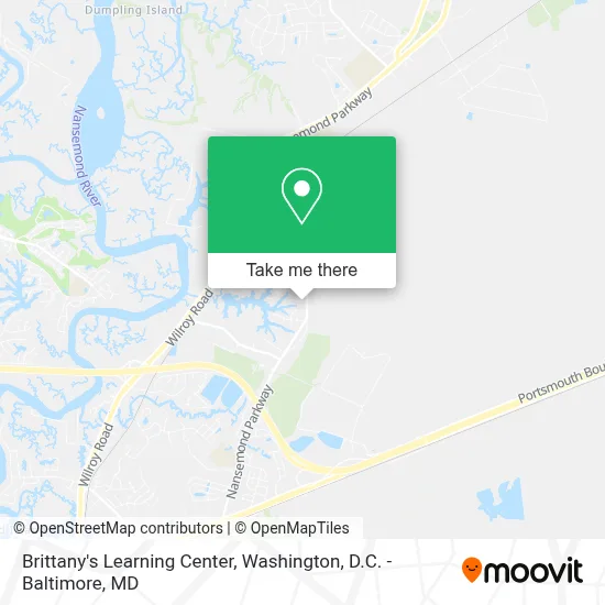
See Brittany's Learning Center, Suffolk, on the map
Public Transit to Brittany's Learning Center in Suffolk
Wondering how to get to Brittany's Learning Center in Suffolk? Moovit helps you find the best way to get to Brittany's Learning Center with step-by-step directions from the nearest public transit station.
Moovit provides free maps and live directions to help you navigate through your city. View schedules, routes, timetables, and find out how long does it take to get to Brittany's Learning Center in real time.
Looking for the nearest stop or station to Brittany's Learning Center? Check out this list of stops closest to your destination: Progress & Qvc Outbound.
Bus: PI.
Want to see if there’s another route that gets you there at an earlier time? Moovit helps you find alternative routes or times. Get directions from and directions to Brittany's Learning Center easily from the Moovit App or Website.
We make riding to Brittany's Learning Center easy, which is why over 1.7 million users, including users in Suffolk, trust Moovit as the best app for public transit. You don’t need to download an individual bus app or train app, Moovit is your all-in-one transit app that helps you find the best bus time or train time available.
For information on prices of bus, costs and ride fares to Brittany's Learning Center, please check the Moovit app.
Use the app to navigate to popular places including to the airport, hospital, stadium, grocery store, mall, coffee shop, school, college, and university.
Brittany's Learning Center Address: 2525 Cedar Lake Dr street in Suffolk
- Lake Forest,
- Canaan Cemetery,
- Cedar Lake,
- Flexa,
- Lyotech Mechanical,
- Cedar Lake Shores,
- Nansemond,
- Womble Generator Service,
- Halsey Mechanic,
- Beam Tool & Die Inc,
- Pump Station 14,
- Schawn,
- Packing Services,
- Saralee,
- Amark Industrial Contractor,
- Berry Plastics Design,
- Golden State Food,
- Pepperdine Corp,
- Suffolk Parks & Recreation,
- Business Technologies
Places Near Brittany's Learning Center (Suffolk)
- Capital One Arena, Washington,
- Marriott Marquis Washington, DC, Washington,
- Sibley Memorial Hospital, Washington,
- The Anthem, Washington,
- M&T Bank Stadium, Baltimore,
- Georgetown, Washington,
- Amazon Hq2, Arlington County,
- National Theatre, Washington,
- Rock Creek Tennis Center, Washington,
- National Museum of African American History and Culture, Washington,
- Basilica of the National Shrine, Washington,
- Washington DC VA Medical Center, Washington,
- Washington National Cathedral, Washington,
- PG Mall, Prince George's County,
- Warner Theatre, Washington,
- Westfield Montgomery Mall, Montgomery County,
- National Zoo, Washington,
- Pennsylvania Ave NW (3rd st and pennsylvania), Washington,
- Museum Of The Bible, Washington,
- Camden Yards, Baltimore
How to get to popular places in Washington, D.C. - Baltimore, MD with public transit
Get around Suffolk by public transit!
Traveling around Suffolk has never been so easy. See step by step directions as you travel to any attraction, street or major public transit station. View bus and train schedules, arrival times, service alerts and detailed routes on a map, so you know exactly how to get to anywhere in Suffolk.
When traveling to any destination around Suffolk use Moovit's Live Directions with Get Off Notifications to know exactly where and how far to walk, how long to wait for your line, and how many stops are left. Moovit will alert you when it's time to get off — no need to constantly re-check whether yours is the next stop.
Wondering how to use public transit in Suffolk or how to pay for public transit in Suffolk? Moovit public transit app can help you navigate your way with public transit easily, and at minimum cost. It includes public transit fees, ticket prices, and costs. Looking for a map of Suffolk public transit lines? Moovit public transit app shows all public transit maps in Suffolk with all Bus, Train, Metro, Light Rail and Ferry routes and stops on an interactive map.
Washington, D.C. - Baltimore, MD has 5 transit type(s), including: Bus, Train, Metro, Light Rail and Ferry, operated by several transit agencies, including WMATA, Montgomery County Ride On, Fairfax Connector, TheBus, PRTC, DASH - Alexandria, Arlington Transit (ART), RTA of Central Maryland, MDOT MTA, MDOT MTA Light RailLink, MDOT MTA Commuter Bus, MDOT MTA Local Bus, FXBGO!, Virginia Railway Express (VRE) and MARC