How to get to Broadsoft by bus?
Click on the bus route to see step by step directions with maps, line arrival times and updated time schedules.
From Wag N' Walk, Tulsa
45 minFrom BMO Bank of Montreal, Tulsa
30 minFrom Justin Thompson Catering, Tulsa
35 minFrom Parlour Salon & Spa, Tulsa
35 minFrom Tacos, Tulsa
36 minFrom Hillcrest Medical Center, Tulsa
48 minFrom Lockhart Grill, Tulsa
77 minFrom Abc Equipment Rental Storage Building, Tulsa
44 minFrom Nathan Hale High School, Tulsa
88 min
Bus stops near Broadsoft in Tulsa
Bus lines to Broadsoft in Tulsa
What are the closest stations to Broadsoft?
The closest stations to Broadsoft are:
- (8017) Lewis Ave & Billy Joe Daughterty is 220 yards away, 4 min walk.
- (7173) 71st St & Yorktown Ave Eb is 429 yards away, 6 min walk.
Which bus lines stop near Broadsoft?
These bus lines stop near Broadsoft: 410, 490, 700.
What’s the nearest bus station to Broadsoft in Tulsa?
The nearest bus station to Broadsoft in Tulsa is (8017) Lewis Ave & Billy Joe Daughterty. It’s a 4 min walk away.
What time is the first bus to Broadsoft in Tulsa?
The 700 is the first bus that goes to Broadsoft in Tulsa. It stops nearby at 5:24 AM.
What time is the last bus to Broadsoft in Tulsa?
The 700 is the last bus that goes to Broadsoft in Tulsa. It stops nearby at 10:34 PM.
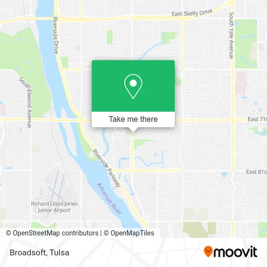
See Broadsoft, Tulsa, on the map
Public Transit to Broadsoft in Tulsa
Wondering how to get to Broadsoft in Tulsa? Moovit helps you find the best way to get to Broadsoft with step-by-step directions from the nearest public transit station.
Moovit provides free maps and live directions to help you navigate through your city. View schedules, routes, timetables, and find out how long does it take to get to Broadsoft in real time.
Looking for the nearest stop or station to Broadsoft? Check out this list of stops closest to your destination: (8017) Lewis Ave & Billy Joe Daughterty; (7173) 71st St & Yorktown Ave Eb.
Bus: 410, 490, 700.
Want to see if there’s another route that gets you there at an earlier time? Moovit helps you find alternative routes or times. Get directions from and directions to Broadsoft easily from the Moovit App or Website.
We make riding to Broadsoft easy, which is why over 1.5 million users, including users in Tulsa, trust Moovit as the best app for public transit. You don’t need to download an individual bus app or train app, Moovit is your all-in-one transit app that helps you find the best bus time or train time available.
For information on prices of bus, costs and ride fares to Broadsoft, please check the Moovit app.
Use the app to navigate to popular places including to the airport, hospital, stadium, grocery store, mall, coffee shop, school, college, and university.
Broadsoft Address: 7335 S Lewis Ave Tulsa, OK 74136 street in Tulsa
- Branch Communications,
- Swift Staffing Solutions,
- Stricklands Office,
- Project Orphans,
- Pinnacle Management Group,
- Lacourse Joel A Attorney,
- Daran Tucker,
- Burrito Concepts,
- Richard Gordon MD,
- Dr Lindsey King, MD,
- Cathryn Merideth Arnp,
- DCH Financial Services, Inc.,
- Anthony D McDoulett CPA,
- Viersen Oil & Gas Co.,
- The Blanchard Law Firm,
- Julie Spencer,
- Teena Arnold,
- Rusty Gaylor Mortgage Loan Officer,
- American Natural Energy Co.,
- Pool
Places Near Broadsoft (Tulsa)
- Woodland Hills Mall, Tulsa,
- Tulsa Ok, Tulsa,
- Alagon Spa (Olympus Spa), Tulsa,
- S Garnett Rd / E 21st St, Tulsa,
- Osage Casino, Tulsa,
- Saint Francis Hospital, Tulsa,
- Broken Arrow, OK, Broken Arrow,
- Tulsa Zoo, Tulsa,
- River Spirit Casino, Tulsa,
- 71st & Memorial, Tulsa,
- Amazon Fulfillment Center-TUL2, Tulsa,
- Bixby, OK, Bixby,
- Walmart, Tulsa,
- St Francis South Cardinal Building, Tulsa,
- Zavala Plus, Tulsa,
- Plaza Santa Cecilia, Tulsa,
- St. Francis Hospital Outpatient Infusion, Tulsa,
- Tulsa State Fair, Tulsa,
- Fallout Shelter, Tulsa,
- Hard Rock Casino, Tulsa
How to get to popular places in Tulsa with public transit
Get around Tulsa by public transit!
Traveling around Tulsa has never been so easy. See step by step directions as you travel to any attraction, street or major public transit station. View bus and train schedules, arrival times, service alerts and detailed routes on a map, so you know exactly how to get to anywhere in Tulsa.
When traveling to any destination around Tulsa use Moovit's Live Directions with Get Off Notifications to know exactly where and how far to walk, how long to wait for your line, and how many stops are left. Moovit will alert you when it's time to get off — no need to constantly re-check whether yours is the next stop.
Wondering how to use public transit in Tulsa or how to pay for public transit in Tulsa? Moovit public transit app can help you navigate your way with public transit easily, and at minimum cost. It includes public transit fees, ticket prices, and costs. Looking for a map of Tulsa public transit lines? Moovit public transit app shows all public transit maps in Tulsa with all bus routes and stops on an interactive map.
Tulsa has 1 transit type(s), including: bus, operated by several transit agencies, including MetroLink Tulsa and Greyhound-us