How to get to Broadway @ 32nd St by bus?
Click on the bus route to see step by step directions with maps, line arrival times and updated time schedules.
From Mar A Lago Building, West Palm Beach
72 minFrom Keiser University-West Palm Beach, Royal Palm Beach-West Jupiter
61 minFrom Lake Worth, FL, Lake Worth
67 minFrom John I. Leonard High School, Lake Worth
89 minFrom Mar a Lago, West Palm Beach
73 minFrom The Ballpark of the Palm Beaches, West Palm Beach
55 minFrom Amazon Fulfillment Center-DMI7, West Palm Beach
72 minFrom Lake Worth Tri Rail Station, Lake Worth
85 minFrom 1661B South Congress Avenue, Lake Worth
49 minFrom West Palm Beach Palm Beach Airport PBI, West Palm Beach
60 min
How to get to Broadway @ 32nd St by train?
Click on the train route to see step by step directions with maps, line arrival times and updated time schedules.
Bus stops near Broadway @ 32nd St in West Palm Beach
Train stations near Broadway @ 32nd St in West Palm Beach
Bus lines to Broadway @ 32nd St in West Palm Beach
What are the closest stations to Broadway @ 32nd St?
The closest stations to Broadway @ 32nd St are:
- BROADWAY at 36TH ST is 360 yards away, 5 min walk.
- 25TH ST at 25TH CT is 1374 yards away, 17 min walk.
- West Palm Beach is 3086 yards away, 37 min walk.
- West Palm Beach Station is 3753 yards away, 44 min walk.
- West Palm Beach Amtrak Station is 3789 yards away, 45 min walk.
Which bus lines stop near Broadway @ 32nd St?
These bus lines stop near Broadway @ 32nd St: 1, 31.
Which train line stops near Broadway @ 32nd St?
TRIRAIL (Northbound To Mangonia Park)
What’s the nearest bus station to Broadway @ 32nd St in West Palm Beach?
The nearest bus station to Broadway @ 32nd St in West Palm Beach is BROADWAY at 36TH ST. It’s a 5 min walk away.
What time is the first train to Broadway @ 32nd St in West Palm Beach?
The TRIRAIL is the first train that goes to Broadway @ 32nd St in West Palm Beach. It stops nearby at 3:50 AM.
What time is the last train to Broadway @ 32nd St in West Palm Beach?
The FLORIDIAN is the last train that goes to Broadway @ 32nd St in West Palm Beach. It stops nearby at 4:16 PM.
What time is the first bus to Broadway @ 32nd St in West Palm Beach?
The 31 is the first bus that goes to Broadway @ 32nd St in West Palm Beach. It stops nearby at 5:20 AM.
What time is the last bus to Broadway @ 32nd St in West Palm Beach?
The 1 is the last bus that goes to Broadway @ 32nd St in West Palm Beach. It stops nearby at 9:54 PM.
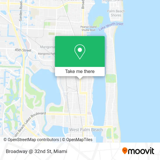
See Broadway @ 32nd St, West Palm Beach, on the map
Public Transit to Broadway @ 32nd St in West Palm Beach
Wondering how to get to Broadway @ 32nd St in West Palm Beach? Moovit helps you find the best way to get to Broadway @ 32nd St with step-by-step directions from the nearest public transit station.
Moovit provides free maps and live directions to help you navigate through your city. View schedules, routes, timetables, and find out how long does it take to get to Broadway @ 32nd St in real time.
Looking for the nearest stop or station to Broadway @ 32nd St? Check out this list of stops closest to your destination: BROADWAY at 36TH ST; 25TH ST at 25TH CT; West Palm Beach; West Palm Beach Station; West Palm Beach Amtrak Station.
Bus: 1, 31.Train: TRIRAIL, BLFM, FLORIDIAN, SILVER METEOR.
Want to see if there’s another route that gets you there at an earlier time? Moovit helps you find alternative routes or times. Get directions from and directions to Broadway @ 32nd St easily from the Moovit App or Website.
We make riding to Broadway @ 32nd St easy, which is why over 1.5 million users, including users in West Palm Beach, trust Moovit as the best app for public transit. You don’t need to download an individual bus app or train app, Moovit is your all-in-one transit app that helps you find the best bus time or train time available.
For information on prices of bus and train, costs and ride fares to Broadway @ 32nd St, please check the Moovit app.
Use the app to navigate to popular places including to the airport, hospital, stadium, grocery store, mall, coffee shop, school, college, and university.
Broadway @ 32nd St Address: 3311 Broadway West Palm Beach, FL 33407 street in West Palm Beach
- 3348 Florida A1A,
- Florida Power & Light Co Riviera Plant,
- Treasure House of Jesus Christ,
- Tanjinika Family Home Daycare,
- Haston Photography,
- Tri-County Commuter Rail Service,
- Aarons Locksmith Co,
- Shamballah Center,
- Daniel's Family Owned Child Care,
- Rob King Enterprises,
- N Dixie Hwy,
- Isla Palma West Palm Beach,
- Palm Beach County School District,
- Vinadoo,
- Jyoti Mohanty, MD,
- Little Blossoms Learning Center,
- Fina Couture,
- Robert Delmore Licensed Massage Therapist,
- Trinity Relocation Group,
- Triple Waves
Places Near Broadway @ 32nd St (West Palm Beach)
- Miami-Dade County Courthouse, Miami,
- Sawgrass Mall, Miami,
- Miami VA Hospital, Miami,
- Little Havana, Miami,
- Marlins Park, Miami,
- Richard E. Gerstein Justice Building, Miami,
- Dolphin Mall, Miami,
- Port of Miami Cruise Terminal, Miami,
- Miami Design District, Miami,
- Wynwood, Miami,
- Aventura Mall, Miami,
- Hard Rock Stadium, Miami Gardens,
- Brickell City Centre, Miami,
- Keiser University Flagship Campus, West Palm Beach,
- Aventura Mall, Miami Beach,
- Dolphin Mall Bus, Miami,
- Zoo Miami, Miami,
- Miami Freedom Park, Miami,
- Bayside Marketplace, Miami,
- Sawgrass mall ( FL ), Miami Beach
How to get to popular places in Miami with public transit
Get around West Palm Beach by public transit!
Traveling around West Palm Beach has never been so easy. See step by step directions as you travel to any attraction, street or major public transit station. View bus and train schedules, arrival times, service alerts and detailed routes on a map, so you know exactly how to get to anywhere in West Palm Beach.
When traveling to any destination around West Palm Beach use Moovit's Live Directions with Get Off Notifications to know exactly where and how far to walk, how long to wait for your line, and how many stops are left. Moovit will alert you when it's time to get off — no need to constantly re-check whether yours is the next stop.
Wondering how to use public transit in West Palm Beach or how to pay for public transit in West Palm Beach? Moovit public transit app can help you navigate your way with public transit easily, and at minimum cost. It includes public transit fees, ticket prices, and costs. Looking for a map of West Palm Beach public transit lines? Moovit public transit app shows all public transit maps in West Palm Beach with all Bus, Train, Light Rail and Ferry routes and stops on an interactive map.
Miami has 4 transit type(s), including: Bus, Train, Light Rail and Ferry, operated by several transit agencies, including Broward County Transit, Miami-Dade Transit, Metrorail, Palm Tran, Tri-Rail, Brightline, MARTY, City of Homestead Trolley, Key West Transit, Treasure Coast Connector, GoLine IRT, Amtrak, Greyhound-us, FlixBus-us and Aventura Express Shuttle Bus