Directions to Brooklyn Collaborative Studies (New York - New Jersey) with public transportation
The following transit lines have routes that pass near Brooklyn Collaborative Studies
 Bus: B37, B57, B61, B62, SIM2.
- Train: CITY TERMINAL ZONE, HEMPSTEAD BRANCH.
- Subway: F, G.
- Ferry: SB.
How to get to Brooklyn Collaborative Studies by bus?
Click on the bus route to see step by step directions with maps, line arrival times and updated time schedules.
From Consulado del Ecuador en Nueva York, Manhattan
108 minFrom Terminal 5, Manhattan
119 minFrom MTA Subway - 59th St/Columbus Circle (A/B/C/D/1), Manhattan
122 minFrom Angelika Film Center, Manhattan
90 minFrom Roosevelt Island Tramway, Manhattan
101 minFrom Wollman Rink, Manhattan
116 minFrom 880 Third Avenue, Manhattan
111 minFrom 32-20 northern blvd, Queens
101 minFrom 300 E 66th street, Manhattan
111 minFrom The Shed, Manhattan
114 min
How to get to Brooklyn Collaborative Studies by train?
Click on the train route to see step by step directions with maps, line arrival times and updated time schedules.
From Consulado del Ecuador en Nueva York, Manhattan
97 minFrom MTA Subway - 59th St/Columbus Circle (A/B/C/D/1), Manhattan
108 minFrom Angelika Film Center, Manhattan
124 minFrom Roosevelt Island Tramway, Manhattan
108 minFrom Wollman Rink, Manhattan
114 minFrom 880 Third Avenue, Manhattan
95 minFrom 300 E 66th street, Manhattan
115 minFrom The Shed, Manhattan
91 min
How to get to Brooklyn Collaborative Studies by subway?
Click on the subway route to see step by step directions with maps, line arrival times and updated time schedules.
From Consulado del Ecuador en Nueva York, Manhattan
44 minFrom Terminal 5, Manhattan
52 minFrom MTA Subway - 59th St/Columbus Circle (A/B/C/D/1), Manhattan
39 minFrom Angelika Film Center, Manhattan
29 minFrom Roosevelt Island Tramway, Manhattan
51 minFrom Wollman Rink, Manhattan
52 minFrom 880 Third Avenue, Manhattan
43 minFrom 32-20 northern blvd, Queens
52 minFrom 300 E 66th street, Manhattan
57 minFrom The Shed, Manhattan
51 min
Bus stops near Brooklyn Collaborative Studies in New York - New Jersey
Subway station near Brooklyn Collaborative Studies in New York - New Jersey
- Carroll St, 9 min walk,VIEW
Ferry stations near Brooklyn Collaborative Studies in New York - New Jersey
Bus lines to Brooklyn Collaborative Studies in New York - New Jersey
- SIM2, Tottenville - Lower Manhattan Express,VIEW
- SIM4, Eltingville - Lower Manhattan Express,VIEW
- SIM4C, Huguenot - Manhattan Express,VIEW
- SIM5, Eltingville - Lower Manhattan Express,VIEW
- SIM31, Eltingville - Midtown Manhattan Express,VIEW
- SIM34, Mariners Harbor - Lower Manhattan Express,VIEW
- SIM35, Port Richmond - Lower Manhattan Express,VIEW
- B57, Red Hook Ikea,VIEW
- X37, Midtown 57 St Via Fdr-23 St Via Madison,VIEW
- B61, Park Slope 20 St Via Red Hook,VIEW
What are the closest stations to Brooklyn Collaborative Studies?
The closest stations to Brooklyn Collaborative Studies are:
- Gowanus Exp./Hicks St (N.B.) is 342 yards away, 5 min walk.
- Court St/3 Pl is 456 yards away, 6 min walk.
- Gowanus Expwy/Woodhull St is 563 yards away, 8 min walk.
- Mill St/Clinton St is 643 yards away, 8 min walk.
- Carroll St is 717 yards away, 9 min walk.
- Red Hook is 1625 yards away, 20 min walk.
- Atlantic Ave/Bbp Pier 6 is 2096 yards away, 26 min walk.
Which bus lines stop near Brooklyn Collaborative Studies?
These bus lines stop near Brooklyn Collaborative Studies: B37, B57, B61, B62.
Which train lines stop near Brooklyn Collaborative Studies?
These train lines stop near Brooklyn Collaborative Studies: CITY TERMINAL ZONE, HEMPSTEAD BRANCH.
Which subway line stops near Brooklyn Collaborative Studies?
F (Downtown & Brooklyn)
What’s the nearest subway station to Brooklyn Collaborative Studies in New York - New Jersey?
The nearest subway station to Brooklyn Collaborative Studies in New York - New Jersey is Carroll St. It’s a 9 min walk away.
What’s the nearest bus station to Brooklyn Collaborative Studies in New York - New Jersey?
The nearest bus station to Brooklyn Collaborative Studies in New York - New Jersey is Gowanus Exp./Hicks St (N.B.). It’s a 5 min walk away.
What’s the nearest ferry station to Brooklyn Collaborative Studies in New York - New Jersey?
The nearest ferry station to Brooklyn Collaborative Studies in New York - New Jersey is Red Hook. It’s a 20 min walk away.
What time is the first subway to Brooklyn Collaborative Studies in New York - New Jersey?
The F is the first subway that goes to Brooklyn Collaborative Studies in New York - New Jersey. It stops nearby at 3:09 AM.
What time is the last subway to Brooklyn Collaborative Studies in New York - New Jersey?
The F is the last subway that goes to Brooklyn Collaborative Studies in New York - New Jersey. It stops nearby at 4:13 AM.
What time is the first bus to Brooklyn Collaborative Studies in New York - New Jersey?
The B61 is the first bus that goes to Brooklyn Collaborative Studies in New York - New Jersey. It stops nearby at 3:09 AM.
What time is the last bus to Brooklyn Collaborative Studies in New York - New Jersey?
The B61 is the last bus that goes to Brooklyn Collaborative Studies in New York - New Jersey. It stops nearby at 2:45 AM.
What time is the first ferry to Brooklyn Collaborative Studies in New York - New Jersey?
The SG is the first ferry that goes to Brooklyn Collaborative Studies in New York - New Jersey. It stops nearby at 6:22 AM.
What time is the last ferry to Brooklyn Collaborative Studies in New York - New Jersey?
The SG is the last ferry that goes to Brooklyn Collaborative Studies in New York - New Jersey. It stops nearby at 10:04 PM.
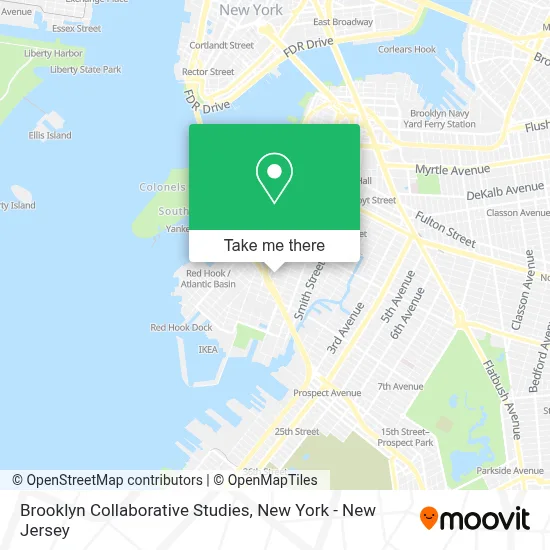
See Brooklyn Collaborative Studies, New York - New Jersey, on the map
Public Transit to Brooklyn Collaborative Studies in New York - New Jersey
Wondering how to get to Brooklyn Collaborative Studies in New York - New Jersey? Moovit helps you find the best way to get to Brooklyn Collaborative Studies with step-by-step directions from the nearest public transit station.
Moovit provides free maps and live directions to help you navigate through your city. View schedules, routes, timetables, and find out how long does it take to get to Brooklyn Collaborative Studies in real time.
Looking for the nearest stop or station to Brooklyn Collaborative Studies? Check out this list of stops closest to your destination: Gowanus Exp./Hicks St (N.B.); Court St/3 Pl; Gowanus Expwy/Woodhull St; Mill St/Clinton St; Carroll St; Red Hook; Atlantic Ave/Bbp Pier 6.
Bus: B37, B57, B61, B62, SIM2, SIM4, SIM4C, SIM5, SIM31, X37.Train: CITY TERMINAL ZONE, HEMPSTEAD BRANCH.Subway: F, G.Ferry: SB.
Want to see if there’s another route that gets you there at an earlier time? Moovit helps you find alternative routes or times. Get directions from and directions to Brooklyn Collaborative Studies easily from the Moovit App or Website.
We make riding to Brooklyn Collaborative Studies easy, which is why over 1.5 million users, including users in New York - New Jersey, trust Moovit as the best app for public transit. You don’t need to download an individual bus app or train app, Moovit is your all-in-one transit app that helps you find the best bus time or train time available.
For information on prices of subway, bus and train, costs and ride fares to Brooklyn Collaborative Studies, please check the Moovit app.
Use the app to navigate to popular places including to the airport, hospital, stadium, grocery store, mall, coffee shop, school, college, and university.
Brooklyn Collaborative Studies Address: 610 Henry St street in New York - New Jersey
- Brooklyn New School P.S. 146,
- PS 142,
- Dimattina Dog Run,
- Di Mattina Baseball Field,
- Liberty Warehouse,
- Facelift Contracting,
- Alejandro Munevar Llc,
- Exit 26 BQE,
- Energy Solutions 360,
- Fix It Perfect Nyc,
- Fixitperfect.Com,
- Painting School,
- Carroll Gardens,
- Panda Bubble Tea,
- Redhook Recovery,
- Mary McDowell Friends School,
- Olbos Studio,
- Horizon Star Services,
- St Stephens Youth Center,
- Whipped Pastry Boutique
Places Near Brooklyn Collaborative Studies (New York - New Jersey)
- Hudson Yards, Manhattan,
- Chinatown, Manhattan,
- qqqq, Manhattan,
- Queens Center Mall, Queens,
- 1 Police Plaza, Manhattan,
- Bellevue Hospital, Manhattan,
- San Gennaro Feast, Manhattan,
- Wall Street, Manhattan,
- 376 Hudson Street, Manhattan,
- Mountainside Hospital, Glen Ridge,
- 66 John Street, Manhattan,
- 111 Centre New York City Supreme Court, Manhattan,
- SoHo, Manhattan,
- 911 Memorial, Manhattan,
- Pier 83, Manhattan,
- Katz's Deli, Manhattan,
- 3 Stone St, Manhattan,
- Times Square, Manhattan,
- 26 Federal Plaza, Manhattan,
- Rockefeller Center, Manhattan
How to get to popular places in New York - New Jersey with public transit
Get around New York - New Jersey by public transit!
Traveling around New York - New Jersey has never been so easy. See step by step directions as you travel to any attraction, street or major public transit station. View bus and train schedules, arrival times, service alerts and detailed routes on a map, so you know exactly how to get to anywhere in New York - New Jersey.
When traveling to any destination around New York - New Jersey use Moovit's Live Directions with Get Off Notifications to know exactly where and how far to walk, how long to wait for your line, and how many stops are left. Moovit will alert you when it's time to get off — no need to constantly re-check whether yours is the next stop.
Wondering how to use public transit in New York - New Jersey or how to pay for public transit in New York - New Jersey? Moovit public transit app can help you navigate your way with public transit easily, and at minimum cost. It includes public transit fees, ticket prices, and costs. Looking for a map of New York - New Jersey public transit lines? Moovit public transit app shows all public transit maps in New York - New Jersey with all Bus, Train, Subway, Light Rail, Ferry and Cable Car routes and stops on an interactive map.
New York - New Jersey has 6 transit type(s), including: Bus, Train, Subway, Light Rail, Ferry and Cable Car, operated by several transit agencies, including MTA Subway, Metro-North Railroad, LIRR, PATH, MTA New York City Transit - Express routes, MTA Bus, NJ Transit, NYC Ferry, NICE bus, Bee-Line Bus, NJ Transit Rail, Norwalk Transit District, Hartford Line, River Valley Transit and HART