Bryne Stasjon station - Tuesday schedule
| Line | Direction | Time |
|---|---|---|
| L5 | Egersund | 5:01 AM |
| L5 | Stavanger | 5:09 AM |
| L5 | Egersund | 5:39 AM |
| L5 | Stavanger | 5:41 AM |
| L5 | Egersund | 6:12 AM |
| L5 | Stavanger | 6:16 AM |
| L5 | Nærbø | 6:44 AM |
| L5 | Stavanger | 6:51 AM |
| F5 | Oslo S | 6:54 AM |
| L5 | Egersund | 7:11 AM |
| F5 | Stavanger | 7:17 AM |
| L5 | Stavanger | 7:19 AM |
| L5 | Stavanger | 7:25 AM |
| L5 | Nærbø | 7:52 AM |
| L5 | Stavanger | 7:57 AM |
| L5 | Egersund | 8:22 AM |
| L5 | Stavanger | 8:24 AM |
| L5 | Nærbø | 8:52 AM |
| L5 | Stavanger | 8:57 AM |
| F5 | Oslo S | 9:11 AM |
| L5 | Egersund | 9:22 AM |
| L5 | Stavanger | 9:29 AM |
| L5 | Nærbø | 9:52 AM |
| L5 | Stavanger | 9:56 AM |
| L5 | Egersund | 10:20 AM |
Directions to Bryne Stasjon station (Klepp) with public transit
The following transit lines have routes that pass near Bryne Stasjon
 Bus: 52, 58, SK2003, SK2008, SK2107.
- Train: L5.
How to get to Bryne Stasjon station by bus?
Click on the bus route to see step by step directions with maps, line arrival times and updated time schedules.
How to get to Bryne Stasjon station by train?
Click on the train route to see step by step directions with maps, line arrival times and updated time schedules.
Bus stops near Bryne Stasjon stop in Klepp
- Skaret, 5 min walk,
- Bryne Ungdomsskule, 13 min walk,
- Rosselandsvegen, 13 min walk,
- Bryne Kro & Hotell, 14 min walk,
- Mølledammen, 16 min walk,
Bus lines to Bryne Stasjon station in Klepp
- 58, Bryne Via Kleppekrossen,
- SK2003, Bryne Via Klepp Ung.Sk-Horpestad,
- SK2008, Saltebakken Via Orre Skule,
- SK2107, Mauland Via Hognestad,
- 50, Bryne Via Lendekrossen,
- 53, Øksnavadporten Via Kvernaland,
- 56, Undheim,
- N94, Lyefjell Via Bryne,
- SK2100, Bryne Via Kvernaland,
- SK2102, Bryne,
- 52, Bryne,
- 62, Bryne Via Kleppekrossen,
- 54, Hognestad,
- 57, Bryne Via Pollestad,
What are the closest stations to Bryne Stasjon?
The closest stations to Bryne Stasjon are:
- Skaret stop is 289 meters away, 5 min walk.
- Bryne Ungdomsskule stop is 922 meters away, 13 min walk.
- Rosselandsvegen stop is 998 meters away, 13 min walk.
- Bryne Kro & Hotell stop is 1009 meters away, 14 min walk.
- Mølledammen stop is 1231 meters away, 16 min walk.
Which bus line stops near Bryne Stasjon?
52 (Bryne)
Which train line stops near Bryne Stasjon?
L5 (Nærbø)
What’s the nearest bus station to Bryne Stasjon in Klepp?
The nearest bus station to Bryne Stasjon in Klepp is Skaret. It’s a 5 min walk away.
What time is the first bus to Bryne Stasjon in Klepp?
The 50 is the first bus that goes to Bryne Stasjon in Klepp. It stops nearby at 5:35 AM.
What time is the last bus to Bryne Stasjon in Klepp?
The 50 is the last bus that goes to Bryne Stasjon in Klepp. It stops nearby at 12:20 AM.
See Bryne Stasjon station, Klepp, on the map
Public transit to Bryne Stasjon station in Klepp
Looking for directions to Bryne Stasjon in Klepp, Norway?
Download the Moovit App to find the current schedule and step-by-step directions for Bus or Train routes that pass through Bryne Stasjon.
Looking for the nearest stops closest to Bryne Stasjon ? Check out this list of closest stops to your destination: Skaret; Bryne Ungdomsskule; Rosselandsvegen; Bryne Kro & Hotell; Mølledammen.
Bus: 52, 58, SK2003, SK2008, SK2107, 50, 53, 56, N94, SK2100, 62, 54, 57.Train: L5.
We make riding on public transit to Bryne Stasjon easy, which is why over 1.7 billion users, including users in Klepp trust Moovit as the best app for public transit.
Use the app to navigate to popular places including to the airport, hospital, stadium, grocery store, mall, coffee shop, school, college, and university.
The station has the following entrances: Jernbanegata and Bryne
The first line to this station is L5, at 5:01 AM, and the last line is F5 at 4:37 AM.
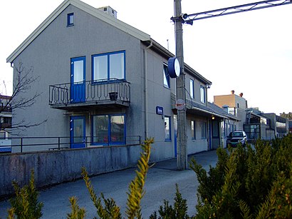
Jernbanegata 8, Bryne, Norway
This station serves Go-Ahead Norge AS’s lines
- Skaret,
- Bryne Ungdomsskule,
- Rosselandsvegen,
- Bryne Kro & Hotell,
- Mølledammen
Bus stops near Bryne Stasjon stop
- Nesvik Ferjekai,
- Brekstad Hurtigbåtkai,
- Kolbotn Torg,
- Hunderfossen Stasjon,
- Ladeveien,
- Olav Kyrres Gate,
- Hjelle,
- Kristiansund Hurtigbåtkai,
- Trondheim Lufthavn,
- Viskjer,
- Lunde Stasjon,
- Vinderen,
- Åsjordet,
- Haltdalen Stasjon,
- Jektevik Terminal,
- Bergen Busstasjon,
- Rissa Skysstasjon,
- Dovre Stasjon,
- Vettre
Popular public transit stations in Klepp
Get around Klepp by public transit!
Traveling around Klepp has never been so easy. See step by step directions as you travel to any attraction, street or major public transit station. View bus and train schedules, arrival times, service alerts and detailed routes on a map, so you know exactly how to get to anywhere in Klepp.
When traveling to any destination around Klepp use Moovit's Live Directions with Get Off Notifications to know exactly where and how far to walk, how long to wait for your line, and how many stops are left. Moovit will alert you when it's time to get off — no need to constantly re-check whether yours is the next stop.
Wondering how to use public transit in Klepp or how to pay for public transit in Klepp? Moovit public transit app can help you navigate your way with public transit easily, and at minimum cost. It includes public transit fees, ticket prices, and costs. Looking for a map of Klepp public transit lines? Moovit public transit app shows all public transit maps in Klepp with all Bus, Train, Subway, Light Rail, Ferry and Cable Car routes and stops on an interactive map.
Norway has 6 transit type(s), including: Bus, Train, Subway, Light Rail, Ferry and Cable Car, operated by several transit agencies, including Ruter, Skyss, AtB, Flytoget, Vy Tåg, SJ, Go-Ahead Norge AS, SJ Nord, Vestfold Kollektivtrafikk as, Snelandia, Innlandstrafikk, FRAM, FlixBus, Kolumbus and Brakar