How to get to Bucktail Charters by bus?
Click on the bus route to see step by step directions with maps, line arrival times and updated time schedules.
Bus stop near Bucktail Charters in Accomack County
- Curtis Merritt Harbor, 10 min walk,VIEW
Bus lines to Bucktail Charters in Accomack County
- RED ROUTE, Museum Of Chincoteague,VIEW
What are the closest stations to Bucktail Charters?
The closest stations to Bucktail Charters are:
- Curtis Merritt Harbor is 827 yards away, 10 min walk.
Which bus line stops near Bucktail Charters?
SILVER
What’s the nearest bus station to Bucktail Charters in Accomack County?
The nearest bus station to Bucktail Charters in Accomack County is Curtis Merritt Harbor. It’s a 10 min walk away.
What time is the first bus to Bucktail Charters in Accomack County?
The RED ROUTE is the first bus that goes to Bucktail Charters in Accomack County. It stops nearby at 6:00 PM.
What time is the last bus to Bucktail Charters in Accomack County?
The RED ROUTE is the last bus that goes to Bucktail Charters in Accomack County. It stops nearby at 10:00 PM.
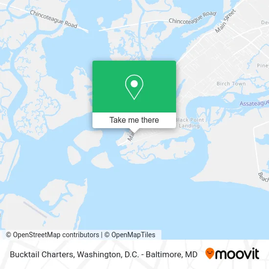
See Bucktail Charters, Accomack County, on the map
Public Transit to Bucktail Charters in Accomack County
Wondering how to get to Bucktail Charters in Accomack County? Moovit helps you find the best way to get to Bucktail Charters with step-by-step directions from the nearest public transit station.
Moovit provides free maps and live directions to help you navigate through your city. View schedules, routes, timetables, and find out how long does it take to get to Bucktail Charters in real time.
Looking for the nearest stop or station to Bucktail Charters? Check out this list of stops closest to your destination: Curtis Merritt Harbor.
Bus: SILVER, RED ROUTE.
Want to see if there’s another route that gets you there at an earlier time? Moovit helps you find alternative routes or times. Get directions from and directions to Bucktail Charters easily from the Moovit App or Website.
We make riding to Bucktail Charters easy, which is why over 1.5 million users, including users in Accomack County, trust Moovit as the best app for public transit. You don’t need to download an individual bus app or train app, Moovit is your all-in-one transit app that helps you find the best bus time or train time available.
For information on prices of bus and train, costs and ride fares to Bucktail Charters, please check the Moovit app.
Use the app to navigate to popular places including to the airport, hospital, stadium, grocery store, mall, coffee shop, school, college, and university.
Bucktail Charters Address: 8268 Bay Front Ln Chincoteague, VA 23336 street in Accomack County
- Bill Craig Marketing,
- Sea Rocket Chincoteague Island,
- Blufin Bungalows & Marina,
- Sun Outdoors Chincoteague Bay,
- Cowboy Cruise Company,
- Fishawn Charters,
- Assateague Adventure,
- Captain Pete's Fish Tales,
- Saltwater Pony Tours,
- Captain Casey's Island Cruises,
- Up the Bay Pony Tours,
- Island Queen Inland Charters,
- East Side Cruisin,
- Tom's Cove Campground,
- ATM,
- Toms Cove Auqa Farm,
- Mason Oil,
- Ridge Road Pit Stop L,
- Libertyx Bitcoin ATM,
- MR. Baldy's Family Restaurant
Places Near Bucktail Charters (Accomack County)
- Washington National Cathedral, Washington,
- PG Mall, Prince George's County,
- National Zoo, Washington,
- Rock Creek Tennis Center, Washington,
- Marriott Marquis Washington, DC, Washington,
- Washington DC VA Medical Center, Washington,
- National Mall, Washington,
- National Museum of African American History and Culture, Washington,
- Warner Theatre, Washington,
- Westfield Montgomery Mall, Montgomery County,
- Pennsylvania Ave NW (3rd st and pennsylvania), Washington,
- Basilica of the National Shrine, Washington,
- Camden Yards, Baltimore,
- Sibley Memorial Hospital, Washington,
- Museum Of The Bible, Washington,
- Capital One Arena, Washington,
- Georgetown, Washington,
- The Anthem, Washington,
- M&T Bank Stadium, Baltimore,
- Amazon Hq2, Arlington County
How to get to popular places in Washington, D.C. - Baltimore, MD with public transit
Get around Accomack County by public transit!
Traveling around Accomack County has never been so easy. See step by step directions as you travel to any attraction, street or major public transit station. View bus and train schedules, arrival times, service alerts and detailed routes on a map, so you know exactly how to get to anywhere in Accomack County.
When traveling to any destination around Accomack County use Moovit's Live Directions with Get Off Notifications to know exactly where and how far to walk, how long to wait for your line, and how many stops are left. Moovit will alert you when it's time to get off — no need to constantly re-check whether yours is the next stop.
Wondering how to use public transit in Accomack County or how to pay for public transit in Accomack County? Moovit public transit app can help you navigate your way with public transit easily, and at minimum cost. It includes public transit fees, ticket prices, and costs. Looking for a map of Accomack County public transit lines? Moovit public transit app shows all public transit maps in Accomack County with all Bus, Train, Metro, Light Rail and Ferry routes and stops on an interactive map.
Washington, D.C. - Baltimore, MD has 5 transit type(s), including: Bus, Train, Metro, Light Rail and Ferry, operated by several transit agencies, including WMATA, Montgomery County Ride On, Fairfax Connector, TheBus, PRTC, DASH - Alexandria, Arlington Transit (ART), RTA of Central Maryland, MDOT MTA, MDOT MTA Light RailLink, MDOT MTA Commuter Bus, MDOT MTA Local Bus, FXBGO!, Virginia Railway Express (VRE) and MARC