Directions to Buenos Informatica- Cwb (Sítio Cercado) with public transportation
The following transit lines have routes that pass near Buenos Informatica- Cwb
How to get to Buenos Informatica- Cwb by bus?
Click on the bus route to see step by step directions with maps, line arrival times and updated time schedules.
From Hospital e Maternidade São José, São José Dos Pinhais
63 minFrom Estação Tubo Rebouças - Templo Maior, Rebouças
68 minFrom Avenida Nossa Senhora Aparecida 1, Seminário
70 minFrom Rua Engenheiros Rebouças, Rebouças
70 minFrom Rua Juvenal Carvalho 127, Fazendinha
56 minFrom Rua Voluntários da Pátria, São José Dos Pinhais
52 minFrom Rua Francisco Rocha, Batel
57 minFrom Jardim São Judas Tadeu, São José Dos Pinhais
76 minFrom Rua Minas Gerais 261, Guaíra
57 minFrom Rua Desembargador Westphalen, Rebouças
65 min
Bus stops near Buenos Informatica- Cwb in Sítio Cercado
Bus lines to Buenos Informatica- Cwb in Sítio Cercado
What are the closest stations to Buenos Informatica- Cwb?
The closest stations to Buenos Informatica- Cwb are:
- R. Francisco Claudino Ferreira, 30 is 139 meters away, 2 min walk.
- R. Marte 648 is 374 meters away, 5 min walk.
Which bus lines stop near Buenos Informatica- Cwb?
These bus lines stop near Buenos Informatica- Cwb: 507 SÍTIO CERCADO (HORÁRIO), 545 TRABALHADOR, 633 MARIA ANGÉLICA.
What’s the nearest bus station to Buenos Informatica- Cwb in Sítio Cercado?
The nearest bus station to Buenos Informatica- Cwb in Sítio Cercado is R. Francisco Claudino Ferreira, 30. It’s a 2 min walk away.
What time is the first bus to Buenos Informatica- Cwb in Sítio Cercado?
The 633 MARIA ANGÉLICA is the first bus that goes to Buenos Informatica- Cwb in Sítio Cercado. It stops nearby at 4:49 AM.
What time is the last bus to Buenos Informatica- Cwb in Sítio Cercado?
The 633 MARIA ANGÉLICA is the last bus that goes to Buenos Informatica- Cwb in Sítio Cercado. It stops nearby at 12:42 AM.
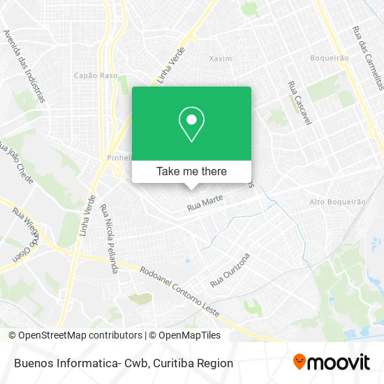
See Buenos Informatica- Cwb, Sítio Cercado, on the map
Public Transit to Buenos Informatica- Cwb in Sítio Cercado
Wondering how to get to Buenos Informatica- Cwb in Sítio Cercado? Moovit helps you find the best way to get to Buenos Informatica- Cwb with step-by-step directions from the nearest public transit station.
Moovit provides free maps and live directions to help you navigate through your city. View schedules, routes, timetables, and find out how long does it take to get to Buenos Informatica- Cwb in real time.
Looking for the nearest stop or station to Buenos Informatica- Cwb? Check out this list of stops closest to your destination: R. Francisco Claudino Ferreira; R. Marte 648.
Bus: 507 SÍTIO CERCADO (HORÁRIO), 545 TRABALHADOR, 633 MARIA ANGÉLICA, 649 PIRINEUS.
Want to see if there’s another route that gets you there at an earlier time? Moovit helps you find alternative routes or times. Get directions from and directions to Buenos Informatica- Cwb easily from the Moovit App or Website.
We make riding to Buenos Informatica- Cwb easy, which is why over 1.5 million users, including users in Sítio Cercado, trust Moovit as the best app for public transit. You don’t need to download an individual bus app or train app, Moovit is your all-in-one transit app that helps you find the best bus time or train time available.
For information on prices of bus, costs and ride fares to Buenos Informatica- Cwb, please check the Moovit app.
Use the app to navigate to popular places including to the airport, hospital, stadium, grocery store, mall, coffee shop, school, college, and university.
Buenos Informatica- Cwb Address: Rua Sérgio Mercer, 119 Sítio Cercado Curitiba-PR 81900-746 street in Sítio Cercado
- M. R. Transportes,
- Diogo de Oliveira da Silva,
- Mercado Vieira,
- Adn Calhas,
- West Company,
- Igreja Evangelica Assembleia de Deus Missionaria Parana B,
- Mestre Emilio Arte e Raca,
- Acar,
- Sítio Cercado V C M e I,
- Gasmaiscuritiba,
- Rua Sérgio Mercer 111,
- Castro Fashion Star,
- Givanetipereirade,
- Poema,
- Beto's Garage Auto Center e Escapamentos,
- Tm3 Sistemas de Informações,
- R. Francisco Claudino Ferreira, 399 - Pinheirinho,
- Rogerkalinoskidos,
- Rua Francisco Claudino Ferreira 1026,
- Moto Boy
Places Near Buenos Informatica- Cwb (Sítio Cercado)
- Hhhhh, Fazendinha,
- Pontifícia Universidade Católica do Paraná (PUCPR), Prado Velho,
- Shopping Estação, Rebouças,
- Jockey Plaza Shopping Center, Tarumã,
- Hospital Angelina Caron, Campina Grande Do Sul,
- Hospital Erasto Gaertner, Jardim Das Américas,
- Hospital de Clínicas (HC - UFPR), Centro,
- Rua Martim Afonso 558, Mercês,
- Parque Barigui, Mercês,
- Jardim Botânico de Curitiba PR, Centro,
- Arena Da Baixada - Curitiba,
- Hospital Universitário Evangélico de Curitiba, Bigorrilho,
- Hospital Da Cruz Vermelha, Batel,
- Park Shopping Barigüi, Mossunguê,
- Shopping Palladium, Portão,
- Rua General Mário Tourinho, Campina Do Siqueira,
- Hospital Nossa Senhora Das Graças, Mercês,
- Hospital do Rocio, Campo,
- Campo Largo, Campo,
- Hospital Madalena Sofia, Bairro Alto
How to get to popular places in Curitiba Region with public transit
Get around Sítio Cercado by public transit!
Traveling around Sítio Cercado has never been so easy. See step by step directions as you travel to any attraction, street or major public transit station. View bus and train schedules, arrival times, service alerts and detailed routes on a map, so you know exactly how to get to anywhere in Sítio Cercado.
When traveling to any destination around Sítio Cercado use Moovit's Live Directions with Get Off Notifications to know exactly where and how far to walk, how long to wait for your line, and how many stops are left. Moovit will alert you when it's time to get off — no need to constantly re-check whether yours is the next stop.
Wondering how to use public transit in Sítio Cercado or how to pay for public transit in Sítio Cercado? Moovit public transit app can help you navigate your way with public transit easily, and at minimum cost. It includes public transit fees, ticket prices, and costs. Looking for a map of Sítio Cercado public transit lines? Moovit public transit app shows all public transit maps in Sítio Cercado with all Bus and Cable Car routes and stops on an interactive map.
Curitiba Region has 2 transit type(s), including: Bus and Cable Car, operated by several transit agencies, including Sistema Integrado de Mobilidade (URBS), Sistema Integrado de Mobilidade (AMEP), URBS (Cartões bancários e Dinheiro), URBS (Cartões bancários / Cartão URBS), AMEP (Cartões bancários / Cartão MetroCard), AMEP (Cartões bancários / Cartão MetroCard / Dinheiro), Viação Colombo (Dinheiro), TRIAR (Cartão TRIAR / Dinheiro), Empresa Curitiba Cerro Azul (Dinheiro), Expresso Nossa Senhora da Penha (Dinheiro), Empresa Campo Alto Tijucas (Dinheiro), Auto Viação São José (Cartão VEM / Dinheiro), BRT S/A (Cartão VEM / Dinheiro), TransPiedade (Cartão Cidadão / Dinheiro) and Oceânica Sul (Cartão Transporte / Dinheiro)