How to get to Butler Medical Center by bus?
Click on the bus route to see step by step directions with maps, line arrival times and updated time schedules.
From Amazon Fulfillment Center-DMI7, West Palm Beach
67 minFrom Marriott s Ocean Pointe Palm Beach Shores, Riviera Beach
70 minFrom Palm Beach State College, Lake Worth
75 minFrom Lake Worth Tri Rail Station, Lake Worth
79 minFrom Whispers All Girl Staff, West Palm Beach
55 minFrom Mar a Lago, West Palm Beach
68 minFrom Phil Foster Park (Blue Heron Foster Park), Riviera Beach
45 minFrom John I. Leonard High School, Lake Worth
87 minFrom Lake Worth, FL, Lake Worth
61 minFrom Singer Island, Riviera Beach
49 min
How to get to Butler Medical Center by train?
Click on the train route to see step by step directions with maps, line arrival times and updated time schedules.
Bus stops near Butler Medical Center in West Palm Beach
Train stations near Butler Medical Center in West Palm Beach
Bus lines to Butler Medical Center in West Palm Beach
What are the closest stations to Butler Medical Center?
The closest stations to Butler Medical Center are:
- DIXIE HWY at LILAC CT is 218 yards away, 3 min walk.
- TAMARIND AVE at GRANT ST is 746 yards away, 9 min walk.
- West Palm Beach is 2452 yards away, 29 min walk.
- West Palm Beach Station is 3093 yards away, 37 min walk.
- West Palm Beach Amtrak Station is 3155 yards away, 37 min walk.
Which bus line stops near Butler Medical Center?
1 (Rt 1 Northbound)
Which train line stops near Butler Medical Center?
TRIRAIL (Northbound To Mangonia Park)
What’s the nearest train station to Butler Medical Center in West Palm Beach?
The nearest train station to Butler Medical Center in West Palm Beach is West Palm Beach. It’s a 29 min walk away.
What’s the nearest bus station to Butler Medical Center in West Palm Beach?
The nearest bus station to Butler Medical Center in West Palm Beach is DIXIE HWY at LILAC CT. It’s a 3 min walk away.
What time is the first train to Butler Medical Center in West Palm Beach?
The TRIRAIL is the first train that goes to Butler Medical Center in West Palm Beach. It stops nearby at 3:56 AM.
What time is the last train to Butler Medical Center in West Palm Beach?
The FLORIDIAN is the last train that goes to Butler Medical Center in West Palm Beach. It stops nearby at 4:16 PM.
What time is the first bus to Butler Medical Center in West Palm Beach?
The 31 is the first bus that goes to Butler Medical Center in West Palm Beach. It stops nearby at 5:17 AM.
What time is the last bus to Butler Medical Center in West Palm Beach?
The 1 is the last bus that goes to Butler Medical Center in West Palm Beach. It stops nearby at 9:57 PM.
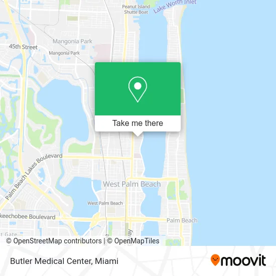
See Butler Medical Center, West Palm Beach, on the map
Public Transit to Butler Medical Center in West Palm Beach
Wondering how to get to Butler Medical Center in West Palm Beach? Moovit helps you find the best way to get to Butler Medical Center with step-by-step directions from the nearest public transit station.
Moovit provides free maps and live directions to help you navigate through your city. View schedules, routes, timetables, and find out how long does it take to get to Butler Medical Center in real time.
Looking for the nearest stop or station to Butler Medical Center? Check out this list of stops closest to your destination: DIXIE HWY at LILAC CT; TAMARIND AVE at GRANT ST; West Palm Beach; West Palm Beach Station; West Palm Beach Amtrak Station.
Bus: 1, 31.Train: TRIRAIL, BLFM, FLORIDIAN, SILVER METEOR.
Want to see if there’s another route that gets you there at an earlier time? Moovit helps you find alternative routes or times. Get directions from and directions to Butler Medical Center easily from the Moovit App or Website.
We make riding to Butler Medical Center easy, which is why over 1.5 million users, including users in West Palm Beach, trust Moovit as the best app for public transit. You don’t need to download an individual bus app or train app, Moovit is your all-in-one transit app that helps you find the best bus time or train time available.
For information on prices of bus and train, costs and ride fares to Butler Medical Center, please check the Moovit app.
Use the app to navigate to popular places including to the airport, hospital, stadium, grocery store, mall, coffee shop, school, college, and university.
Butler Medical Center Address: 200 Butler St West Palm Beach, FL 33407 street in West Palm Beach
- Kravis Performing Arts Center,
- Northwood Village Park,
- Good Samaritan Hospital,
- Brightline,
- Miramar, Florida,
- Blink Charging,
- Internal Revenue Service,
- Sunfest,
- smart Start Ignition Interlock,
- Victoria's Secret,
- The Lords Place,
- 3348 Florida A1A,
- Luo & Waters PLLC,
- Brosbuck Gourmet Catering,
- St Ann Catholic Church ,
- Palm Beach,
- N Australian Ave / Palm Beach Lakes Blvd,
- Palm Beach County Courthouse Jurors Assembly Room,
- Morselife Foundation,
- JFK Medical Center
Places Near Butler Medical Center (West Palm Beach)
- Miami VA Hospital, Miami,
- Brickell City Centre, Miami,
- Little Havana, Miami,
- Aventura Mall, Miami Beach,
- Aventura Mall, Miami,
- Port of Miami Cruise Terminal, Miami,
- Sawgrass Mall, Miami,
- Bayside Marketplace, Miami,
- Miami-Dade County Courthouse, Miami,
- Miami Design District, Miami,
- Dolphin Mall Bus, Miami,
- Sawgrass mall ( FL ), Miami Beach,
- Miami Freedom Park, Miami,
- Keiser University Flagship Campus, West Palm Beach,
- Dolphin Mall, Miami,
- Zoo Miami, Miami,
- Marlins Park, Miami,
- Hard Rock Stadium, Miami Gardens,
- Wynwood, Miami,
- Richard E. Gerstein Justice Building, Miami
How to get to popular places in Miami with public transit
Get around West Palm Beach by public transit!
Traveling around West Palm Beach has never been so easy. See step by step directions as you travel to any attraction, street or major public transit station. View bus and train schedules, arrival times, service alerts and detailed routes on a map, so you know exactly how to get to anywhere in West Palm Beach.
When traveling to any destination around West Palm Beach use Moovit's Live Directions with Get Off Notifications to know exactly where and how far to walk, how long to wait for your line, and how many stops are left. Moovit will alert you when it's time to get off — no need to constantly re-check whether yours is the next stop.
Wondering how to use public transit in West Palm Beach or how to pay for public transit in West Palm Beach? Moovit public transit app can help you navigate your way with public transit easily, and at minimum cost. It includes public transit fees, ticket prices, and costs. Looking for a map of West Palm Beach public transit lines? Moovit public transit app shows all public transit maps in West Palm Beach with all Bus, Train, Light Rail and Ferry routes and stops on an interactive map.
Miami has 4 transit type(s), including: Bus, Train, Light Rail and Ferry, operated by several transit agencies, including Broward County Transit, Miami-Dade Transit, Metrorail, Palm Tran, Tri-Rail, Brightline, MARTY, City of Homestead Trolley, Key West Transit, Treasure Coast Connector, GoLine IRT, Amtrak, Greyhound-us, FlixBus-us and Aventura Express Shuttle Bus