How to get to Bwt Auto Gate by bus?
Click on the bus route to see step by step directions with maps, line arrival times and updated time schedules.
How to get to Bwt Auto Gate by train?
Click on the train route to see step by step directions with maps, line arrival times and updated time schedules.
How to get to Bwt Auto Gate by subway?
Click on the subway route to see step by step directions with maps, line arrival times and updated time schedules.
Bus stops near Bwt Auto Gate in Manhattan
Subway stations near Bwt Auto Gate in Manhattan
Bus lines to Bwt Auto Gate in Manhattan
- SIM1C, Eltingville - Manhattan Express,VIEW
- SIM3, Pt. Richmond - Midtown Manhattan Express,VIEW
- SIM3C, Pt. Richmond - Manhattan Express,VIEW
- SIM4C, Huguenot - Manhattan Express,VIEW
- SIM33C, Mariners Harbor - Greenwich Village Express,VIEW
- M31, Yorkville 91 St Via York Av,VIEW
- M57, West Side Broadway-72 St Crosstown,VIEW
- W44, Midtown / W 39th Street,VIEW
- QM10, Lefrak City,VIEW
- QM12, Midtown 57 St Via 6 Av,VIEW
- QM24, Glendale 73 Pl Via Eliot Av,VIEW
- QM2, Bay Terrace Bell Bl Via Whitestone Exy,VIEW
- QM4, Electchester 164 St Via Jewel Av,VIEW
- QM20, Bay Terrace 211 St Via Willets Pt Bl,VIEW
- M5, Limited Washington Heights Gw Bridge,VIEW
- M7, Harlem 147 St Via 6 Av Via Amsterdam,VIEW
- SIM10, Eltingville Trans Ctr Via Hylan Via Rich,VIEW
- 57TH ST, Midtown / W 39th Street,VIEW
- QM15, Lindenwood - Midtown Express,VIEW
- QM16, Neponsit - Midtown Express,VIEW
What are the closest stations to Bwt Auto Gate?
The closest stations to Bwt Auto Gate are:
- W 57 St/6 Av is 34 yards away, 1 min walk.
- 6 Avenue & 56 St is 59 yards away, 1 min walk.
- 6 Av/W 56 St is 63 yards away, 1 min walk.
- 6 Av/W 55 St is 143 yards away, 2 min walk.
- 57 St-7 Av is 170 yards away, 3 min walk.
- 6 Av/W 57 St is 184 yards away, 3 min walk.
- W 57th St & 6th Ave (Westbound) is 229 yards away, 3 min walk.
- 7 Av is 364 yards away, 5 min walk.
- 57 St is 482 yards away, 6 min walk.
- 5 Av/53 St is 575 yards away, 7 min walk.
Which bus lines stop near Bwt Auto Gate?
These bus lines stop near Bwt Auto Gate: 57TH ST, BM2, BXM10, M1, M31, M5, M7, Q32, QM18.
Which train lines stop near Bwt Auto Gate?
These train lines stop near Bwt Auto Gate: 2, BABYLON BRANCH, WEST HEMPSTEAD BRANCH, YEL.
Which subway lines stop near Bwt Auto Gate?
These subway lines stop near Bwt Auto Gate: 1, A, M, Q, R.
What’s the nearest subway station to Bwt Auto Gate in Manhattan?
The nearest subway station to Bwt Auto Gate in Manhattan is 57 St-7 Av. It’s a 3 min walk away.
What’s the nearest bus station to Bwt Auto Gate in Manhattan?
The nearest bus stations to Bwt Auto Gate in Manhattan are W 57 St/6 Av, 6 Avenue & 56 St and 6 Av/W 56 St. The closest one is a 1 min walk away.
What time is the first subway to Bwt Auto Gate in Manhattan?
The F is the first subway that goes to Bwt Auto Gate in Manhattan. It stops nearby at 3:00 AM.
What time is the last subway to Bwt Auto Gate in Manhattan?
The D is the last subway that goes to Bwt Auto Gate in Manhattan. It stops nearby at 3:55 AM.
What time is the first bus to Bwt Auto Gate in Manhattan?
The SIM1C is the first bus that goes to Bwt Auto Gate in Manhattan. It stops nearby at 3:05 AM.
What time is the last bus to Bwt Auto Gate in Manhattan?
The SIM1C is the last bus that goes to Bwt Auto Gate in Manhattan. It stops nearby at 3:06 AM.
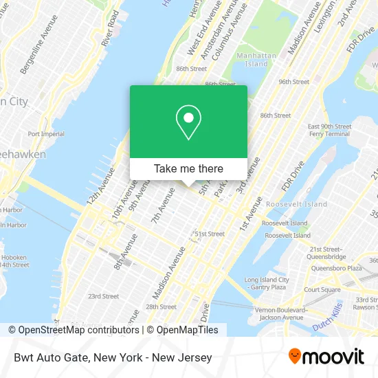
See Bwt Auto Gate, Manhattan, on the map
Public Transit to Bwt Auto Gate in Manhattan
Wondering how to get to Bwt Auto Gate in Manhattan? Moovit helps you find the best way to get to Bwt Auto Gate with step-by-step directions from the nearest public transit station.
Moovit provides free maps and live directions to help you navigate through your city. View schedules, routes, timetables, and find out how long does it take to get to Bwt Auto Gate in real time.
Looking for the nearest stop or station to Bwt Auto Gate? Check out this list of stops closest to your destination: W 57 St/6 Av; 6 Avenue & 56 St; 6 Av/W 56 St; 6 Av/W 55 St; 57 St-7 Av; 6 Av/W 57 St; W 57th St & 6th Ave (Westbound); 7 Av; 57 St; 5 Av/53 St.
Bus: 57TH ST, BM2, BXM10, M1, M31, M5, M7, Q32, QM18, SIM1C, SIM3, SIM3C, SIM4C, SIM33C, M57.Train: 2, BABYLON BRANCH, WEST HEMPSTEAD BRANCH, YEL.Subway: 1, A, M, Q, R, N, W, B, D, E, F, FX.
Want to see if there’s another route that gets you there at an earlier time? Moovit helps you find alternative routes or times. Get directions from and directions to Bwt Auto Gate easily from the Moovit App or Website.
We make riding to Bwt Auto Gate easy, which is why over 1.5 million users, including users in Manhattan, trust Moovit as the best app for public transit. You don’t need to download an individual bus app or train app, Moovit is your all-in-one transit app that helps you find the best bus time or train time available.
For information on prices of subway, bus and train, costs and ride fares to Bwt Auto Gate, please check the Moovit app.
Use the app to navigate to popular places including to the airport, hospital, stadium, grocery store, mall, coffee shop, school, college, and university.
Bwt Auto Gate Address: 46 W 56th St street in Manhattan
- Dh Seo Consulting Services,
- Rachel Brown Jewelry,
- Rue 57,
- Madison Avenue Couture,
- 57th Street Station IND Sixth Avenue Line,
- New Chapter Capital, Inc.,
- 5 Star Commercial Funding,
- Studiomd,
- Joe Costello, Pt, Dpt,
- Mitchell Medical Group,
- Teeth Cleaning Manhattan New York - Paul L. Gregory, Dds,
- Jason Emer Md | New York City,
- Couriers New York,
- Studio 57 Dental,
- E. Feinsot, Mark Cpa,
- Emily Stein, Phd,
- Lefrak Commercial,
- Yvette Foster - Real Estate Broker - Foster Homes Real Estate,
- Skin Loft,
- Mastervoices
Places Near Bwt Auto Gate (Manhattan)
- SoHo, Manhattan,
- 66 John Street, Manhattan,
- qqqq, Manhattan,
- Hudson Yards, Manhattan,
- Katz's Deli, Manhattan,
- Mountainside Hospital, Glen Ridge,
- San Gennaro Feast, Manhattan,
- 376 Hudson Street, Manhattan,
- 3 Stone St, Manhattan,
- 26 Federal Plaza, Manhattan,
- Bellevue Hospital, Manhattan,
- Rockefeller Center, Manhattan,
- Chinatown, Manhattan,
- Times Square, Manhattan,
- Pier 83, Manhattan,
- Queens Center Mall, Queens,
- 911 Memorial, Manhattan,
- 1 Police Plaza, Manhattan,
- 111 Centre New York City Supreme Court, Manhattan,
- Wall Street, Manhattan
How to get to popular places in New York - New Jersey with public transit
Get around Manhattan by public transit!
Traveling around Manhattan has never been so easy. See step by step directions as you travel to any attraction, street or major public transit station. View bus and train schedules, arrival times, service alerts and detailed routes on a map, so you know exactly how to get to anywhere in Manhattan.
When traveling to any destination around Manhattan use Moovit's Live Directions with Get Off Notifications to know exactly where and how far to walk, how long to wait for your line, and how many stops are left. Moovit will alert you when it's time to get off — no need to constantly re-check whether yours is the next stop.
Wondering how to use public transit in Manhattan or how to pay for public transit in Manhattan? Moovit public transit app can help you navigate your way with public transit easily, and at minimum cost. It includes public transit fees, ticket prices, and costs. Looking for a map of Manhattan public transit lines? Moovit public transit app shows all public transit maps in Manhattan with all Bus, Train, Subway, Light Rail, Ferry and Cable Car routes and stops on an interactive map.
New York - New Jersey has 6 transit type(s), including: Bus, Train, Subway, Light Rail, Ferry and Cable Car, operated by several transit agencies, including MTA Subway, Metro-North Railroad, LIRR, PATH, MTA New York City Transit - Express routes, MTA Bus, NJ Transit, NYC Ferry, NICE bus, Bee-Line Bus, NJ Transit Rail, Norwalk Transit District, Hartford Line, River Valley Transit and HART