How to get to Bydcode by bus?
Click on the bus route to see step by step directions with maps, line arrival times and updated time schedules.
How to get to Bydcode by train?
Click on the train route to see step by step directions with maps, line arrival times and updated time schedules.
Bus stops near Bydcode in Warsaw
Light Rail stations near Bydcode in Warsaw
- Andersa - Gieryna, 13 min walk,VIEW
Bus lines to Bydcode in Warsaw
- 32N, Łoskoń Zajezdnia,VIEW
- 69, Tatrzańskie,VIEW
- 74, Fordońska - Wyścigowa,VIEW
- 83, Dworzec Wschód,VIEW
- 89, Brzozowa - Bielicka,VIEW
- 33N, Plac Kościeleckich,VIEW
- 82, Zamczysko - Pętla,VIEW
- 31N, Łoskoń - Dworzec Leśne,VIEW
- 95, Tatrzańskie - Strzelce Górne - Tatrzańskie,VIEW
- 81, Centrum Onkologii,VIEW
- 97, Tatrzańskie,VIEW
- 98, Przylesie,VIEW
- 40, Przylesie,VIEW
- 65, Łoskoń,VIEW
What are the closest stations to Bydcode?
The closest stations to Bydcode are:
- Pelplińska - Jarużyńska is 277 meters away, 4 min walk.
- Wyzwolenia - Derdowskiego is 425 meters away, 6 min walk.
- Tatrzańskie is 565 meters away, 8 min walk.
- Pelplińska - Taterników is 733 meters away, 10 min walk.
- Andersa - Gieryna is 994 meters away, 13 min walk.
- Niepodległości is 1053 meters away, 14 min walk.
Which bus lines stop near Bydcode?
These bus lines stop near Bydcode: 69, 74, 83, 89.
Which train line stops near Bydcode?
BDG—CHE (Chełmża)
What’s the nearest light rail station to Bydcode in Warsaw?
The nearest light rail station to Bydcode in Warsaw is Andersa - Gieryna. It’s a 13 min walk away.
What’s the nearest bus station to Bydcode in Warsaw?
The nearest bus station to Bydcode in Warsaw is Pelplińska - Jarużyńska. It’s a 4 min walk away.
What time is the first light rail to Bydcode in Warsaw?
The 3 is the first light rail that goes to Bydcode in Warsaw. It stops nearby at 4:02 AM.
What time is the last light rail to Bydcode in Warsaw?
The 3 is the last light rail that goes to Bydcode in Warsaw. It stops nearby at 11:54 PM.
What time is the first bus to Bydcode in Warsaw?
The 33N is the first bus that goes to Bydcode in Warsaw. It stops nearby at 3:34 AM.
What time is the last bus to Bydcode in Warsaw?
The 31N is the last bus that goes to Bydcode in Warsaw. It stops nearby at 3:55 AM.
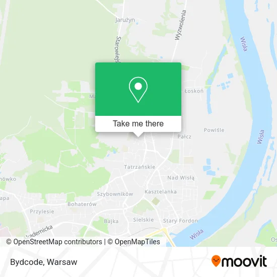
See Bydcode, Warsaw, on the map
Public Transit to Bydcode in Warsaw
Wondering how to get to Bydcode in Warsaw? Moovit helps you find the best way to get to Bydcode with step-by-step directions from the nearest public transit station.
Moovit provides free maps and live directions to help you navigate through your city. View schedules, routes, timetables, and find out how long does it take to get to Bydcode in real time.
Looking for the nearest stop or station to Bydcode? Check out this list of stops closest to your destination: Pelplińska - Jarużyńska; Wyzwolenia - Derdowskiego; Tatrzańskie; Pelplińska - Taterników; Andersa - Gieryna; Niepodległości.
Bus: 69, 74, 83, 89, 32N, 33N, 82, 31N, 95, 81, 97, 98, 40, 65.Train: BDG—CHE.
Want to see if there’s another route that gets you there at an earlier time? Moovit helps you find alternative routes or times. Get directions from and directions to Bydcode easily from the Moovit App or Website.
We make riding to Bydcode easy, which is why over 1.5 million users, including users in Warsaw, trust Moovit as the best app for public transit. You don’t need to download an individual bus app or train app, Moovit is your all-in-one transit app that helps you find the best bus time or train time available.
For information on prices of train and bus, costs and ride fares to Bydcode, please check the Moovit app.
Use the app to navigate to popular places including to the airport, hospital, stadium, grocery store, mall, coffee shop, school, college, and university.
Bydcode Address: ulica Jarużyńska 4, 85-790 Bydgoszcz street in Warsaw
- Europejski Instytut Szkolenia Płetwonurków Tangaroa,
- Prywante Przedsiebiorstwo Produkcyjno Handlowe i Uslug Wielobranzowych Joker,
- Salon Mobilny Madeline M.M Magdalena Modracka,
- PPHU Anna Maria Artur Idec,
- Usługi Wszystkich Branż Dawid Widawski,
- Michał Ruszkiewicz,
- Brodzińska Magdalena. Tłumaczenia,
- Rekultywacja Przemieszczanie Gruntów Jan Kmieciak Kazimierz Kmieciak s.c.,
- Alfa Beta Gama sp. z o.o.,
- Przedsiębiorstwo Wielobranżowe Jacek Orzechowski,
- Darex,
- Agencja Handlowo Usługowa,
- Bro-Spaw Invest Jacek Brodziński,
- Zakład Remontowo - Budowlany,
- Koniecikropka,
- Zakład Usług Finansowo Księgowych Danuta Szukalska,
- PHU Danpol Daniel Brąszkiewicz,
- Osial Jan Jozef Zielone Oko Agencja Uslug Reklamowych,
- PW Justyna Nalewa,
- Przedsiębiorstwo Wielobranżowe Lamarex J R Malec s.c.
Places Near Bydcode (Warsaw)
- Wołoska-Szpital 01, Warsaw,
- Cmentarz Bródnowski, Warsaw,
- Sejm Rp, Warsaw,
- Banacha - Szpital Kliniczny, Warsaw,
- Instytut Kardiologii w Aninie, Warsaw,
- Galeria Mokotów, Warsaw,
- Postępu, Warsaw,
- Szpital Orłowskiego, Warsaw,
- PGE Narodowy, Warsaw,
- Szaserów - Szpital, Warsaw,
- Szpital Bielański, Warsaw,
- Stare Miasto, Warsaw,
- Wołoska, Warsaw,
- Torwar, Warsaw,
- Szpital Czerniakowski, Warsaw,
- Szpital Spartanska, Warsaw,
- Domaniewska, Warsaw,
- Galeria Północna, Warsaw,
- CH Arkadia, Warsaw,
- Centralny Szpital Kliniczny MSWiA ul. Wołoska, Warsaw
How to get to popular places in Warsaw with public transit
Get around Warsaw by public transit!
Traveling around Warsaw has never been so easy. See step by step directions as you travel to any attraction, street or major public transit station. View bus and train schedules, arrival times, service alerts and detailed routes on a map, so you know exactly how to get to anywhere in Warsaw.
When traveling to any destination around Warsaw use Moovit's Live Directions with Get Off Notifications to know exactly where and how far to walk, how long to wait for your line, and how many stops are left. Moovit will alert you when it's time to get off — no need to constantly re-check whether yours is the next stop.
Wondering how to use public transit in Warsaw or how to pay for public transit in Warsaw? Moovit public transit app can help you navigate your way with public transit easily, and at minimum cost. It includes public transit fees, ticket prices, and costs. Looking for a map of Warsaw public transit lines? Moovit public transit app shows all public transit maps in Warsaw with all Bus, Train, Metro, Light Rail, Ferry and Cable Car routes and stops on an interactive map.
Warsaw has 6 transit type(s), including: Bus, Train, Metro, Light Rail, Ferry and Cable Car, operated by several transit agencies, including Warszawski Transport Publiczny, Warszawska Kolej Dojazdowa, Koleje Mazowieckie, ZTP Kraków, Miasto Piastów, Miasto Ząbki, Koleje Małopolskie, Komunikacja Miejska Łomianki, Gmina Pruszków, MPK Wrocław, MZDiK Radom, UM w Grodzisku Mazowieckim, UM w Nowym Dworze Mazowieckim, UM Płońsk and Koleje Dolnośląskie