Directions to C04 (Colombo) with public transportation
The following transit lines have routes that pass near C04
How to get to C04 by bus?
Click on the bus route to see step by step directions with maps, line arrival times and updated time schedules.
From Hospital e Maternidade Santa Madalena Sofia, Bairro Alto
78 minFrom Mauá, Colombo
76 minFrom Congregação Cristã no Brasil - Eugenia Maria, Campina Grande Do Sul
96 minFrom Juvevê, Juvevê
47 minFrom Depósito da Receita Federal, Bacacheri
72 minFrom Museu Oscar Niemeyer (MON), Centro Cívico
73 minFrom Estação Tubo Museu Oscar Niemeyer, Centro Cívico
72 minFrom Rua Augusto Stresser, Juvevê
50 minFrom Rua Alberto Foloni, Juvevê
54 minFrom Parque São Lourenço, São Lourenço
75 min
Bus stops near C04 in Colombo
Bus lines to C04 in Colombo
What are the closest stations to C04?
The closest stations to C04 are:
- Av. Santos Dumont, 1668 is 213 meters away, 4 min walk.
- Jardim Osasco - Rua Rio Araguaia, 42 is 1662 meters away, 22 min walk.
Which bus lines stop near C04?
These bus lines stop near C04: S59 SANTA FÉ / ROÇA GRANDE, U01 SEDE / MARACANÃ.
What’s the nearest bus station to C04 in Colombo?
The nearest bus station to C04 in Colombo is Av. Santos Dumont, 1668. It’s a 4 min walk away.
What time is the first bus to C04 in Colombo?
The S59 SANTA FÉ / ROÇA GRANDE is the first bus that goes to C04 in Colombo. It stops nearby at 4:56 AM.
What time is the last bus to C04 in Colombo?
The S59 SANTA FÉ / ROÇA GRANDE is the last bus that goes to C04 in Colombo. It stops nearby at 11:58 PM.
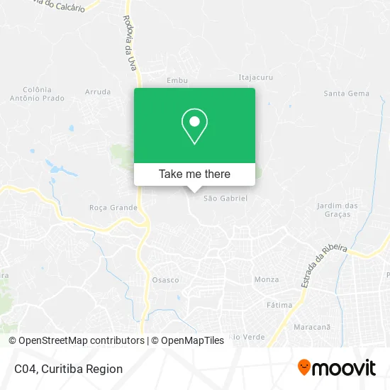
See C04, Colombo, on the map
Public Transit to C04 in Colombo
Wondering how to get to C04 in Colombo? Moovit helps you find the best way to get to C04 with step-by-step directions from the nearest public transit station.
Moovit provides free maps and live directions to help you navigate through your city. View schedules, routes, timetables, and find out how long does it take to get to C04 in real time.
Looking for the nearest stop or station to C04? Check out this list of stops closest to your destination: Av. Santos Dumont; Jardim Osasco - Rua Rio Araguaia.
Bus: S59 SANTA FÉ / ROÇA GRANDE, U01 SEDE / MARACANÃ, B29 ROÇA GRANDE / APDEC (VIA MARACANÃ), B73 JARDIM OSASCO / GUADALUPE.
Want to see if there’s another route that gets you there at an earlier time? Moovit helps you find alternative routes or times. Get directions from and directions to C04 easily from the Moovit App or Website.
We make riding to C04 easy, which is why over 1.5 million users, including users in Colombo, trust Moovit as the best app for public transit. You don’t need to download an individual bus app or train app, Moovit is your all-in-one transit app that helps you find the best bus time or train time available.
For information on prices of bus, costs and ride fares to C04, please check the Moovit app.
Use the app to navigate to popular places including to the airport, hospital, stadium, grocery store, mall, coffee shop, school, college, and university.
C04 Address: Rua Bárbara Socher, 190 São Gabriel Colombo-PR 83403-540 street in Colombo
- C05,
- C28,
- C27,
- C30,
- C29,
- C08,
- Jardim Santa Fe,
- Dani,
- J P Transportes,
- Santa Fé,
- Luana Pet Shop,
- Agilize Serviços de Entregas,
- Avenida Santos Dumont,
- Nortesul Prestadora de Servicos,
- Auto Pecas Betinarde,
- Auto Eletrica Machado,
- Auto Peças Betinardi,
- Parque Anauá,
- Closet Woman,
- Avenida Santos Dumont 1100
Places Near C04 (Colombo)
- Hospital Madalena Sofia, Bairro Alto,
- Hospital Angelina Caron, Campina Grande Do Sul,
- Rua Martim Afonso 558, Mercês,
- Arena Da Baixada - Curitiba,
- Shopping Estação, Rebouças,
- Park Shopping Barigüi, Mossunguê,
- Hospital Erasto Gaertner, Jardim Das Américas,
- Hospital de Clínicas (HC - UFPR), Centro,
- Hospital do Rocio, Campo,
- Hospital Nossa Senhora Das Graças, Mercês,
- Hospital Universitário Evangélico de Curitiba, Bigorrilho,
- Hhhhh, Fazendinha,
- Shopping Palladium, Portão,
- Pontifícia Universidade Católica do Paraná (PUCPR), Prado Velho,
- Jardim Botânico de Curitiba PR, Centro,
- Jockey Plaza Shopping Center, Tarumã,
- Campo Largo, Campo,
- Parque Barigui, Mercês,
- Hospital Da Cruz Vermelha, Batel,
- Rua General Mário Tourinho, Campina Do Siqueira
How to get to popular places in Curitiba Region with public transit
Get around Colombo by public transit!
Traveling around Colombo has never been so easy. See step by step directions as you travel to any attraction, street or major public transit station. View bus and train schedules, arrival times, service alerts and detailed routes on a map, so you know exactly how to get to anywhere in Colombo.
When traveling to any destination around Colombo use Moovit's Live Directions with Get Off Notifications to know exactly where and how far to walk, how long to wait for your line, and how many stops are left. Moovit will alert you when it's time to get off — no need to constantly re-check whether yours is the next stop.
Wondering how to use public transit in Colombo or how to pay for public transit in Colombo? Moovit public transit app can help you navigate your way with public transit easily, and at minimum cost. It includes public transit fees, ticket prices, and costs. Looking for a map of Colombo public transit lines? Moovit public transit app shows all public transit maps in Colombo with all Bus and Cable Car routes and stops on an interactive map.
Curitiba Region has 2 transit type(s), including: Bus and Cable Car, operated by several transit agencies, including Sistema Integrado de Mobilidade (URBS), Sistema Integrado de Mobilidade (AMEP), URBS (Cartões bancários e Dinheiro), URBS (Cartões bancários / Cartão URBS), AMEP (Cartões bancários / Cartão MetroCard), AMEP (Cartões bancários / Cartão MetroCard / Dinheiro), Viação Colombo (Dinheiro), TRIAR (Cartão TRIAR / Dinheiro), Empresa Curitiba Cerro Azul (Dinheiro), Expresso Nossa Senhora da Penha (Dinheiro), Empresa Campo Alto Tijucas (Dinheiro), Auto Viação São José (Cartão VEM / Dinheiro), BRT S/A (Cartão VEM / Dinheiro), TransPiedade (Cartão Cidadão / Dinheiro) and Oceânica Sul (Cartão Transporte / Dinheiro)