How to get to CALLE PATRIOTAS by bus?
Click on the bus route to see step by step directions with maps, line arrival times and updated time schedules.
From Hospital Dos de Mayo, Lima
45 minFrom Instituto Nacional de Ciencias Neurológicas, Lima
56 minFrom Instituto Nacional De Ciencias Neurológicas (Ex Santo Toribio Mogrovejo), Lima
58 minFrom Av. 28 de Julio - La Victoria, La Victori
44 minFrom av carlos izaguirre, Los Olivos
43 minFrom AVENIDA CANTA CALLAO CON AV BERTELLO, Lima
43 minFrom Chongo de Huayta, Los Olivos
46 minFrom Paradero Cdra. 15 Av. Brasil, Jesus Mari
26 minFrom Real Plaza, Lima
39 minFrom Avenida Antunez de Mayolo, Los Olivos
44 min
Bus stops near CALLE PATRIOTAS in San Miguel
Bus lines to CALLE PATRIOTAS in San Miguel
- 204, Faucett (San Miguel) - Manchay (Pachacamac),VIEW
- 1442, Pachacútec (Ventanilla) - La Marina (San Miguel),VIEW
- CR16, Ventanilla - San Miguel,VIEW
- CR34, Comas - San Miguel,VIEW
- CR35, Ventanilla - San Miguel,VIEW
- CR51, Comas - San Miguel,VIEW
- CR69, Carabayllo - San Miguel,VIEW
- IM31, Mi Perú (Ventanilla) - Faucett (San Miguel),VIEW
- IM47, Km. 22 - Faucett - La Marina - Brasil - Caquetá - Km. 22,VIEW
- IO40, Los Olivos - San Miguel,VIEW
- 1315, Jose Galvez (Pachacamac) - Óvalo Centenario (Callao),VIEW
- 1317, Manchay (Pachacamac) - Miguel Grau (Callao),VIEW
- OM19, Chepen (Villa El Salvador),VIEW
- 1030, Canta Callao (San Martin De Porres) - San Diego (San Martin De Porres),VIEW
- CR43, Ventanilla - Carabayllo,VIEW
- 201, Ovalo La Perla (Callao) - Ceres (Ate),VIEW
- 1304, Pachacamac - Callao,VIEW
- 1435, Minka (Callao) - Torre Blanca (Carabayllo),VIEW
- 1228, Ovalo La Perla (Callao) - Huaycán (Ate),VIEW
- 1258, Minka (Callao) - Jicamarca (San Juan De Lurigancho),VIEW
What are the closest stations to CALLE PATRIOTAS?
The closest stations to CALLE PATRIOTAS are:
- La Marina is 156 meters away, 3 min walk.
- La Marina / Faucett is 177 meters away, 3 min walk.
- Insurgentes is 337 meters away, 5 min walk.
- Manuel Ferreyros is 690 meters away, 9 min walk.
Which bus lines stop near CALLE PATRIOTAS?
These bus lines stop near CALLE PATRIOTAS: 1030, 1228, 1317, 1435, CR43.
What’s the nearest bus station to CALLE PATRIOTAS in San Miguel?
The nearest bus stations to CALLE PATRIOTAS in San Miguel are La Marina and La Marina / Faucett. The closest one is a 3 min walk away.
What time is the first bus to CALLE PATRIOTAS in San Miguel?
The 1228 is the first bus that goes to CALLE PATRIOTAS in San Miguel. It stops nearby at 4:04 AM.
What time is the last bus to CALLE PATRIOTAS in San Miguel?
The 1315 is the last bus that goes to CALLE PATRIOTAS in San Miguel. It stops nearby at 1:12 AM.
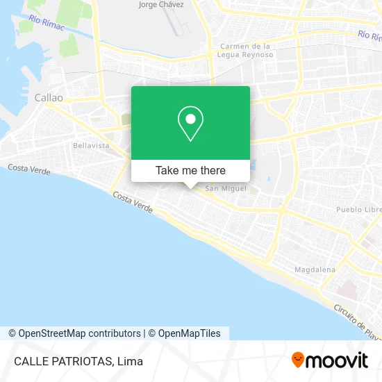
See CALLE PATRIOTAS, San Miguel, on the map
Public Transit to CALLE PATRIOTAS in San Miguel
Wondering how to get to CALLE PATRIOTAS in San Miguel? Moovit helps you find the best way to get to CALLE PATRIOTAS with step-by-step directions from the nearest public transit station.
Moovit provides free maps and live directions to help you navigate through your city. View schedules, routes, timetables, and find out how long does it take to get to CALLE PATRIOTAS in real time.
Looking for the nearest stop or station to CALLE PATRIOTAS? Check out this list of stops closest to your destination: La Marina; La Marina / Faucett; Insurgentes; Manuel Ferreyros.
Bus: 1030, 1228, 1317, 1435, CR43, 204, 1442, CR16, CR34, CR35, 1315, OM19, 201, 1304, 1258.
Want to see if there’s another route that gets you there at an earlier time? Moovit helps you find alternative routes or times. Get directions from and directions to CALLE PATRIOTAS easily from the Moovit App or Website.
We make riding to CALLE PATRIOTAS easy, which is why over 1.5 million users, including users in San Miguel, trust Moovit as the best app for public transit. You don’t need to download an individual bus app or train app, Moovit is your all-in-one transit app that helps you find the best bus time or train time available.
For information on prices of bus, costs and ride fares to CALLE PATRIOTAS, please check the Moovit app.
Use the app to navigate to popular places including to the airport, hospital, stadium, grocery store, mall, coffee shop, school, college, and university.
Location: San Miguel, Lima
- cdra 6 patriotas,
- Calle Monsefú 191 Urb Maranga San Miguel (Esq cuadra 35 Av La Marina),
- Urb Maranga 3era Etapa,
- Calle Monsefú 191 Alt Cdra 34 Av La Marina,
- La Casa del Sancochado,
- Parque Continental,
- Avenida La Marina 3691,
- SAN MIGUEL ALT 36 AV LA MARINA C CUA AV LOS INSURGENTES,
- Cancha La #10,
- Aguanile ' Salsa,
- Chongoyape,
- CALLE CHONGOYAPE ALTURA CDRA 2 SAN MIGUEL,
- Av De los Patriotas N° 857 San Miguel,
- CALLE CHONGOYAPE ALTURA CUADRA 8 DE AVENIDA PATRIOTAS URBANIZACIÓN MARANGA,
- Cancha La 10 Sede San Miguel,
- Peru vial,
- La 10 - Araoz Pinto,
- Parque Medalla Milagrosa,
- El Tronco,
- Restaurante El Tronco
Places Near CALLE PATRIOTAS (San Miguel)
- Aeropuerto Internacional Jorge Chávez, Ventanilla,
- Jockey Plaza, Santiago D,
- Pontificia Universidad Católica del Perú - PUCP, San Miguel,
- av arequipa, Lima,
- Barranco, Barranco,
- Gamarra,
- Parque de las Leyendas, San Miguel,
- Centro Comercial Plaza Norte, Independen,
- Av. Abancay, Lima,
- Paradero Av.Brasil,
- Av. La Marina, San Miguel,
- Real Plaza Puruchuco, Ate,
- Miraflores, Miraflores,
- Larcomar, Miraflores,
- Parque Kennedy, Miraflores,
- Av. Salaverry, Jesus Mari,
- Mall Del Sur,
- Circuito Mágico Del Agua, Lima,
- Plaza San Miguel, San Miguel,
- Hospital Edgardo Rebagliati Martins, Jesus Mari
How to get to popular places in Lima with public transit
Get around San Miguel by public transit!
Traveling around San Miguel has never been so easy. See step by step directions as you travel to any attraction, street or major public transit station. View bus and train schedules, arrival times, service alerts and detailed routes on a map, so you know exactly how to get to anywhere in San Miguel.
When traveling to any destination around San Miguel use Moovit's Live Directions with Get Off Notifications to know exactly where and how far to walk, how long to wait for your line, and how many stops are left. Moovit will alert you when it's time to get off — no need to constantly re-check whether yours is the next stop.
Wondering how to use public transit in San Miguel or how to pay for public transit in San Miguel? Moovit public transit app can help you navigate your way with public transit easily, and at minimum cost. It includes public transit fees, ticket prices, and costs. Looking for a map of San Miguel public transit lines? Moovit public transit app shows all public transit maps in San Miguel with all Bus, Metro and Ferry routes and stops on an interactive map.
Lima has 3 transit type(s), including: Bus, Metro and Ferry, operated by several transit agencies, including Metro de Lima Línea 2 , Metro de Lima, Corredor Rojo, Metropolitano, Metropolitano - Alimentadores, Corredor Morado, Corredor Azul, Rutas Tradicionales, Transportes y Servicios La Esperanza S.A., Las Flores S.A., Virgen de la Asunción S.A., Consorcio HAM, Transportes y Service Canadá S.A., ETUL4SA and ETUCHISA