Directions to CBS Television City (Beverly Grove) with public transportation
The following transit lines have routes that pass near CBS Television City
 Bus: 14/37, 217, 218, DASH.
- Subway: B LINE.
How to get to CBS Television City by bus?
Click on the bus route to see step by step directions with maps, line arrival times and updated time schedules.
Bus stops near CBS Television City in Beverly Grove
- Fairfax Ave & Rosewood (Southbound), 1 min walk,
- Fairfax / Rosewood, 1 min walk,
- Beverly / Fairfax, 5 min walk,
Subway station near CBS Television City in Beverly Grove
- Hollywood / Highland Station, 42 min walk,
Bus lines to CBS Television City in Beverly Grove
- DASH, Eastbound,
- 217, Eagle Rock Plaza,
- 218, Studio City,
- 14/37, Downtown LA,
What are the closest stations to CBS Television City?
The closest stations to CBS Television City are:
- Fairfax Ave & Rosewood (Southbound) is 75 yards away, 1 min walk.
- Fairfax / Rosewood is 75 yards away, 1 min walk.
- Beverly / Fairfax is 387 yards away, 5 min walk.
- Hollywood / Highland Station is 3586 yards away, 42 min walk.
Which bus lines stop near CBS Television City?
These bus lines stop near CBS Television City: 14/37, 217, 218.
What’s the nearest bus station to CBS Television City in Beverly Grove?
The nearest bus stations to CBS Television City in Beverly Grove are Fairfax Ave & Rosewood (Southbound) and Fairfax / Rosewood. The closest one is a 1 min walk away.
What time is the first subway to CBS Television City in Beverly Grove?
The B LINE is the first subway that goes to CBS Television City in Beverly Grove. It stops nearby at 4:33 AM.
What time is the last subway to CBS Television City in Beverly Grove?
The B LINE is the last subway that goes to CBS Television City in Beverly Grove. It stops nearby at 12:25 AM.
What time is the first bus to CBS Television City in Beverly Grove?
The 217 is the first bus that goes to CBS Television City in Beverly Grove. It stops nearby at 3:18 AM.
What time is the last bus to CBS Television City in Beverly Grove?
The 217 is the last bus that goes to CBS Television City in Beverly Grove. It stops nearby at 2:57 AM.
See CBS Television City, Beverly Grove, on the map
Public Transit to CBS Television City in Beverly Grove
Wondering how to get to CBS Television City in Beverly Grove? Moovit helps you find the best way to get to CBS Television City with step-by-step directions from the nearest public transit station.
Moovit provides free maps and live directions to help you navigate through your city. View schedules, routes, timetables, and find out how long does it take to get to CBS Television City in real time.
Looking for the nearest stop or station to CBS Television City? Check out this list of stops closest to your destination: Fairfax Ave & Rosewood (Southbound); Fairfax / Rosewood; Beverly / Fairfax; Hollywood / Highland Station.
Bus: 14/37, 217, 218, DASH.Subway: B LINE.
Want to see if there’s another route that gets you there at an earlier time? Moovit helps you find alternative routes or times. Get directions from and directions to CBS Television City easily from the Moovit App or Website.
We make riding to CBS Television City easy, which is why over 1.5 million users, including users in Beverly Grove, trust Moovit as the best app for public transit. You don’t need to download an individual bus app or train app, Moovit is your all-in-one transit app that helps you find the best bus time or train time available.
For information on prices of bus, subway and light rail, costs and ride fares to CBS Television City, please check the Moovit app.
Use the app to navigate to popular places including to the airport, hospital, stadium, grocery store, mall, coffee shop, school, college, and university.
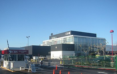
CBS Television City Address: 7080 Beverly BLVD street in Beverly Grove
- Supreme Los Angeles,
- Danny's Cream Pies,
- Canter's Delicatessen,
- Dave's Hot Chicken,
- Banana Bungalow West Hollywood Hotel Hostel Los Angeles,
- Beverly/Fairfax Metro,
- Fairfax, California,
- Fairfax High School,
- Custom Orthopedic Shoes by Roberto,
- Metro Bus - 217 / 218 / 780 (N Fairfax Ave & Melrose Ave),
- Melrose Trading Post,
- CBS Television City Studios,
- Beverly Laurel Motor Hotel,
- Swingers,
- Palihotel Melrose,
- CBS TV Studios - Stage 33,
- Melrose Avenue,
- LF Outlet,
- 7800 Beverly Boulevard,
- Erewhon Natural Foods Market
Places Near CBS Television City (Beverly Grove)
- Crypto.Com Arena, Downtown,
- La Placita Olvera, Downtown,
- Best Corner to get HOOKERS!, Riverside,
- Los Angeles City Hall, Downtown,
- San Manuel Casino, San Bernardino,
- Yyy, Oxnard,
- Big Bear Bald Eagle Cam, Big Bear Lake City,
- Union Station, Downtown,
- Consulado Mexicano Casa Jalisco en Plaza Mexico., Lynwood,
- Rose Bowl Stadium, Pasadena,
- Universal Studios Hollywood, Universal City,
- Muhammad Ali's Star on the Hollywood Walk of Fame, Hollywood,
- los Angeles california, Hollywood,
- Pomona, CA, Pomona,
- California State University, Fullerton, Fullerton,
- Santa Monica Pier, Santa Monica,
- Citadel Outlets, Commerce,
- Brazzers, Downtown,
- Downtown Los Angeles, Downtown,
- Sofi Stadium, Inglewood
How to get to popular places in Los Angeles with public transit
Get around Beverly Grove by public transit!
Traveling around Beverly Grove has never been so easy. See step by step directions as you travel to any attraction, street or major public transit station. View bus and train schedules, arrival times, service alerts and detailed routes on a map, so you know exactly how to get to anywhere in Beverly Grove.
When traveling to any destination around Beverly Grove use Moovit's Live Directions with Get Off Notifications to know exactly where and how far to walk, how long to wait for your line, and how many stops are left. Moovit will alert you when it's time to get off — no need to constantly re-check whether yours is the next stop.
Wondering how to use public transit in Beverly Grove or how to pay for public transit in Beverly Grove? Moovit public transit app can help you navigate your way with public transit easily, and at minimum cost. It includes public transit fees, ticket prices, and costs. Looking for a map of Beverly Grove public transit lines? Moovit public transit app shows all public transit maps in Beverly Grove with all Bus, Train, Subway, Light Rail, Ferry and Funicular routes and stops on an interactive map.
Los Angeles has 6 transit type(s), including: Bus, Train, Subway, Light Rail, Ferry and Funicular, operated by several transit agencies, including Metro - Los Angeles, Metrolink Trains, METRO, Long Beach Transit, LADOT, OCTA, Big Blue Bus, Riverside Transit Agency, LAX FlyAway, Airporter Shuttle, Playa Vista Shuttle, Amtrak, OMNITRANS, Pasadena Transit and TORRANCE TRANSIT SYSTEM