How to get to CH/L by bus?
Click on the bus route to see step by step directions with maps, line arrival times and updated time schedules.
From Dexin Yuan Residential Complex - A2 Building, Yuhua District
65 minFrom Xiangfu West Road, Tianxin District
39 minFrom Lushan South Road / Lushan Road (Intersection), Yuelu District
58 minFrom CITIC Cultural Plaza · Residence - Building 7, Tianxin District
78 minFrom Yuelu Academy - Rear Garden Gate, Yuelu District
66 minFrom Walmart (Changsha Yuhua Pavilion Store), Yuhua District
64 minFrom Desiqin Four Seasons Club - Parking Lot, Yuhua District
50 minFrom Yuelu Mountain, Yuelu District
67 minFrom Changsha South Railway Station, Yuelu District
64 minFrom Sunshine 100 Phoenix Community, Yuelu District
53 min
How to get to CH/L by metro?
Click on the metro route to see step by step directions with maps, line arrival times and updated time schedules.
From Xiangfu West Road, Tianxin District
61 minFrom Lushan South Road / Lushan Road (Intersection), Yuelu District
43 minFrom CITIC Cultural Plaza · Residence - Building 7, Tianxin District
83 minFrom Yuelu Academy - Rear Garden Gate, Yuelu District
53 minFrom Walmart (Changsha Yuhua Pavilion Store), Yuhua District
63 minFrom Yuelu Mountain, Yuelu District
54 minFrom Sunshine 100 Phoenix Community, Yuelu District
45 min
Bus stop near CH/L in Wangcheng District
- Pingtang Avenue Qingfeng South Road Intersection, 17 min walk,VIEW
Metro station near CH/L in Wangcheng District
- Shantang, 38 min walk,VIEW
Bus lines to CH/L in Wangcheng District
- Route 938, Pingtang,VIEW
What are the closest stations to CH/L?
The closest stations to CH/L are:
- Pingtang Avenue Qingfeng South Road Intersection is 1204 meters away, 17 min walk.
- Shantang is 2954 meters away, 38 min walk.
Which bus line stops near CH/L?
Route 938 (Pingtang)
Which metro line stops near CH/L?
Line 3 (Shantang)
What time is the first metro to CH/L in Wangcheng District?
The Line 3 is the first metro that goes to CH/L in Wangcheng District. It stops nearby at 6:30 AM.
What time is the last metro to CH/L in Wangcheng District?
The Line 3 is the last metro that goes to CH/L in Wangcheng District. It stops nearby at 11:57 PM.
What time is the first bus to CH/L in Wangcheng District?
The Route 938 is the first bus that goes to CH/L in Wangcheng District. It stops nearby at 6:33 AM.
What time is the last bus to CH/L in Wangcheng District?
The Route 938 is the last bus that goes to CH/L in Wangcheng District. It stops nearby at 10:01 PM.
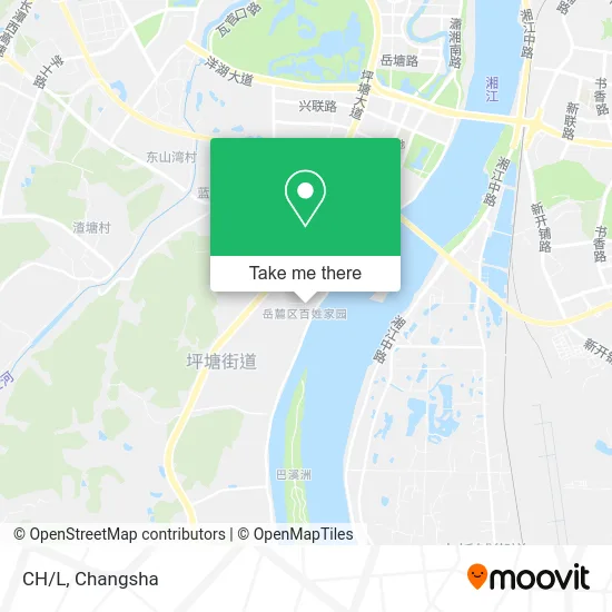
See CH/L, Wangcheng District, on the map
Public Transit to CH/L in Wangcheng District
Wondering how to get to CH/L in Wangcheng District? Moovit helps you find the best way to get to CH/L with step-by-step directions from the nearest public transit station.
Moovit provides free maps and live directions to help you navigate through your city. View schedules, routes, timetables, and find out how long does it take to get to CH/L in real time.
Looking for the nearest stop or station to CH/L? Check out this list of stops closest to your destination: Pingtang Avenue Qingfeng South Road Intersection; Shantang.
Bus: Route 938, Route 938.Metro: Line 3, Line 3.
Want to see if there’s another route that gets you there at an earlier time? Moovit helps you find alternative routes or times. Get directions from and directions to CH/L easily from the Moovit App or Website.
We make riding to CH/L easy, which is why over 1.5 million users, including users in Wangcheng District, trust Moovit as the best app for public transit. You don’t need to download an individual bus app or train app, Moovit is your all-in-one transit app that helps you find the best bus time or train time available.
For information on prices of bus and metro, costs and ride fares to CH/L, please check the Moovit app.
Use the app to navigate to popular places including to the airport, hospital, stadium, grocery store, mall, coffee shop, school, college, and university.
CH/L Address: 潇湘南大道附近 street in Wangcheng District
- Popcorn Pingtang Store,
- Qinyuan Residential Complex,
- Left Bank Pierre Cardin Men's and Women's Fashion,
- Yangtianhe Pharmacy,
- Spot Removal Treasure,
- Pingtan Pharmacy (Riverside Branch),
- Lin Ji Hong Kong Style Roast,
- Pingtang Pharmacy,
- Happy Flower Shop,
- Sky Garden,
- Milan Brand Clothing City,
- Pingtan Labor Protection Hardware Store,
- Qiaoyu Full Automatic Mahjong Machine,
- Mengjie Home Furnishing,
- New Century Clothing Plaza,
- Pingtang Town Kindergarten,
- Heavenly Sound,
- Longyard,
- Yunda Express,
- Urban Woman's Heart
Places Near CH/L (Wangcheng District)
- Changsha South Station Square, Yuelu District,
- Hunan Province Tumor Hospital, Yuelu District,
- National University of Defense Technology (North Gate), Kaifu District,
- Central South University Xiangya Second Hospital, Furong District,
- Changsha Bank (Sifang Branch), Kaifu District,
- Zhongnan University Xiangya Hospital, Kaifu District,
- First Club, Kaifu District,
- Changsha South Station, Yuhua District,
- First Affiliated Hospital of Hunan University of Traditional Chinese Medicine - Outpatient Department, Yuhua District,
- Yuelu Mountain Juzizhou Tourist Area, Yuelu District,
- Xingsha Police Station Songya Community Police Room, Changsha County,
- Hunan University of Traditional Chinese Medicine First Affiliated Hospital, Yuhua District,
- Desiqin City Square, Yuhua District,
- Hunan Provincial Maternal and Child Health Hospital - Outpatient Department, Kaifu District,
- Wanjiali International Mall, Furong District,
- Changsha Bank ATM (Sifang Branch), Kaifu District,
- Hunan Provincial Museum - Multipurpose Hall, Kaifu District,
- Changsha Yangming Mountain Funeral Home, Yuhua District,
- Du Fu River Pavilion, Tianxin District,
- Apple Authorized Dealer (Sam Changsha Store), Yuhua District
How to get to popular places in Changsha with public transit
Get around Wangcheng District by public transit!
Traveling around Wangcheng District has never been so easy. See step by step directions as you travel to any attraction, street or major public transit station. View bus and train schedules, arrival times, service alerts and detailed routes on a map, so you know exactly how to get to anywhere in Wangcheng District.
When traveling to any destination around Wangcheng District use Moovit's Live Directions with Get Off Notifications to know exactly where and how far to walk, how long to wait for your line, and how many stops are left. Moovit will alert you when it's time to get off — no need to constantly re-check whether yours is the next stop.
Wondering how to use public transit in Wangcheng District or how to pay for public transit in Wangcheng District? Moovit public transit app can help you navigate your way with public transit easily, and at minimum cost. It includes public transit fees, ticket prices, and costs. Looking for a map of Wangcheng District public transit lines? Moovit public transit app shows all public transit maps in Wangcheng District with all Bus and Metro routes and stops on an interactive map.
Changsha has 2 transit type(s), including: Bus and Metro, operated by several transit agencies, including Changsha Metro and Changsha Bus Group