How to get to CIC by bus?
Click on the bus route to see step by step directions with maps, line arrival times and updated time schedules.
From Verrières-le-Buisson, Verrieres-Le-Buisson
63 minFrom Paris la Défense Arena, Arrondissement de Nanterre
64 minFrom Wissous, Wissous
63 minFrom Studios du Lendit, Saint-Denis
72 minFrom Pigalle, Paris
36 minFrom Paris La Défense Arena, Nanterre
64 minFrom Boulevard de Magenta, Paris
31 minFrom Stade Bauer, Saint-Ouen
66 minFrom Puteaux, Puteaux
62 minFrom Lycée Janson de Sailly, Paris
37 min
How to get to CIC by train?
Click on the train route to see step by step directions with maps, line arrival times and updated time schedules.
How to get to CIC by metro?
Click on the metro route to see step by step directions with maps, line arrival times and updated time schedules.
From Paris la Défense Arena, Arrondissement de Nanterre
52 minFrom Studios du Lendit, Saint-Denis
46 minFrom Pigalle, Paris
34 minFrom Paris La Défense Arena, Nanterre
52 minFrom Boulevard de Magenta, Paris
34 minFrom Stade Bauer, Saint-Ouen
50 minFrom Puteaux, Puteaux
56 minFrom Lycée Janson de Sailly, Paris
32 min
Bus stops near CIC in Paris
Metro stations near CIC in Paris
Bus lines to CIC in Paris
What are the closest stations to CIC?
The closest stations to CIC are:
- Alésia - Maine is 116 meters away, 2 min walk.
- Alésia is 126 meters away, 2 min walk.
- Alésia - Jean Moulin is 194 meters away, 3 min walk.
- Alésia - Général Leclerc is 256 meters away, 4 min walk.
- Alésia - Les Plantes is 286 meters away, 4 min walk.
- Porte D'Orléans is 592 meters away, 8 min walk.
- Denfert-Rochereau is 779 meters away, 11 min walk.
- Pernety is 798 meters away, 11 min walk.
Which train lines stop near CIC?
These train lines stop near CIC: N, U.
Which metro line stops near CIC?
4 (Porte de Clignancourt)
Which bus lines stop near CIC?
These bus lines stop near CIC: 194, 197, 38, 68, 92.
What’s the nearest metro station to CIC in Paris?
The nearest metro station to CIC in Paris is Alésia. It’s a 2 min walk away.
What’s the nearest bus station to CIC in Paris?
The nearest bus station to CIC in Paris is Alésia - Maine. It’s a 2 min walk away.
What time is the first light rail to CIC in Paris?
The T3A is the first light rail that goes to CIC in Paris. It stops nearby at 6:22 AM.
What time is the last light rail to CIC in Paris?
The T3A is the last light rail that goes to CIC in Paris. It stops nearby at 1:32 AM.
What time is the first metro to CIC in Paris?
The 4 is the first metro that goes to CIC in Paris. It stops nearby at 5:35 AM.
What time is the last metro to CIC in Paris?
The 4 is the last metro that goes to CIC in Paris. It stops nearby at 1:09 AM.
What time is the first bus to CIC in Paris?
The N66 is the first bus that goes to CIC in Paris. It stops nearby at 3:00 AM.
What time is the last bus to CIC in Paris?
The N21 is the last bus that goes to CIC in Paris. It stops nearby at 3:40 AM.
What time is the first RER to CIC in Paris?
The B is the first RER that goes to CIC in Paris. It stops nearby at 5:18 AM.
What time is the last RER to CIC in Paris?
The B is the last RER that goes to CIC in Paris. It stops nearby at 12:58 AM.
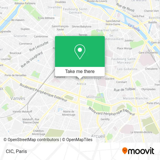
See CIC, Paris, on the map
Public Transit to CIC in Paris
Wondering how to get to CIC in Paris? Moovit helps you find the best way to get to CIC with step-by-step directions from the nearest public transit station.
Moovit provides free maps and live directions to help you navigate through your city. View schedules, routes, timetables, and find out how long does it take to get to CIC in real time.
Looking for the nearest stop or station to CIC? Check out this list of stops closest to your destination: Alésia - Maine; Alésia; Alésia - Jean Moulin; Alésia - Général Leclerc; Alésia - Les Plantes; Porte D'Orléans; Denfert-Rochereau; Pernety.
Train: N, U.Metro: 4, T3A, B, 6, 13.Bus: 194, 197, 38, 68, 92, N66, 62.
Want to see if there’s another route that gets you there at an earlier time? Moovit helps you find alternative routes or times. Get directions from and directions to CIC easily from the Moovit App or Website.
We make riding to CIC easy, which is why over 1.5 million users, including users in Paris, trust Moovit as the best app for public transit. You don’t need to download an individual bus app or train app, Moovit is your all-in-one transit app that helps you find the best bus time or train time available.
For information on prices of metro, bus, RER and train, costs and ride fares to CIC, please check the Moovit app.
Use the app to navigate to popular places including to the airport, hospital, stadium, grocery store, mall, coffee shop, school, college, and university.
CIC Address: 218 Avenue du Maine 75014 Paris street in Paris
- Lidl,
- Quartier Petit-Montrouge,
- Abc,
- Église Saint-Pierre-de-Montrouge,
- 226 Avenue du Maine,
- Alésia,
- Rue Thibault,
- Axa Assurance Deneaux Jerome,
- 14eme,
- Arrêt Alésia-Jean Moulin [62],
- L'Éphémère,
- Burger King Alésia,
- Métro-Alésia,
- Rue d'Alésia,
- Avenue du Général Leclerc (Escalator),
- Métro Alésia [4],
- Rue du Moulin Vert,
- Brasserie Zeyer,
- Korian,
- Le Zeyer
Places Near CIC (Paris)
- Hôpital de la Pitié-Salpêtrière, Paris,
- Théâtre Mogador, Paris,
- Hôpital Pitié Salpêtrière, Paris,
- Beaugrenelle, Paris,
- Atelier Des Lumieres, Paris,
- Fondation Louis Vuitton, Paris,
- Gare Routière Flixbus, Paris,
- Marché Saint-Pierre, Paris,
- Hôpital Saint-Joseph, Paris,
- Hôpital Cochin, Paris,
- 29 Rue Manin, Paris,
- Hopital Foch, Suresnes,
- Galeries Lafayette, Paris,
- Centre Hospitalier des 15/20, Paris,
- Hôpital Beaujon, Clichy,
- Galeries Lafayette Haussmann, Paris,
- Créteil Soleil, Creteil,
- Hôpital Henri Mondor, Creteil,
- Hôpital Necker, Paris,
- Hopital Lariboisière, Paris
How to get to popular places in Paris with public transit
Get around Paris by public transit!
Traveling around Paris has never been so easy. See step by step directions as you travel to any attraction, street or major public transit station. View bus and train schedules, arrival times, service alerts and detailed routes on a map, so you know exactly how to get to anywhere in Paris.
When traveling to any destination around Paris use Moovit's Live Directions with Get Off Notifications to know exactly where and how far to walk, how long to wait for your line, and how many stops are left. Moovit will alert you when it's time to get off — no need to constantly re-check whether yours is the next stop.
Wondering how to use public transit in Paris or how to pay for public transit in Paris? Moovit public transit app can help you navigate your way with public transit easily, and at minimum cost. It includes public transit fees, ticket prices, and costs. Looking for a map of Paris public transit lines? Moovit public transit app shows all public transit maps in Paris with all Bus, Train, Metro, Light Rail, RER, Funicular and Gondola routes and stops on an interactive map.
Paris has 7 transit type(s), including: Bus, Train, Metro, Light Rail, RER, Funicular and Gondola, operated by several transit agencies, including RATP, RER, RER Bus de remplacement, Train, Train Bus de remplacement, Tramway Bus de remplacement, TER, ADP, Magical Shuttle, Argenteuil - Boucles de Seine, Autocars Dominique, Bièvre, Brie et 2 Morin, Le Bus - C.C. du Clermontois and Cœur d’Essonne