How to get to CIUNAC by bus?
Click on the bus route to see step by step directions with maps, line arrival times and updated time schedules.
From JR HUALLAGA CERCADO DE LIMA, Lima
52 minFrom Municipalidad Distrital De Los Olivos, Los Olivos
45 minFrom Plaza Grau, Lima
39 minFrom Jr. Andahuaylas, Lima
56 minFrom Megaplaza Lima Norte, Independen
51 minFrom Hospital Guillermo Almenara - Neurocirugía, La Victori
43 minFrom MUNICIPALIDAD DE LOS OLIVOS, Los Olivos
54 minFrom Avenida Carlos Izaguirre, Los Olivos
45 minFrom AV CANEVARO LINCE, Lima
30 minFrom ALTURA DE LA 39 DE LA AVENIDA BRASIL, Magdalena
21 min
Bus stops near CIUNAC in Ventanilla
Bus lines to CIUNAC in Ventanilla
- 1304, Pachacamac - Callao,VIEW
- 1315, Jose Galvez (Pachacamac) - Óvalo Centenario (Callao),VIEW
- 1317, Manchay (Pachacamac) - Miguel Grau (Callao),VIEW
- 1435, Minka (Callao) - Torre Blanca (Carabayllo),VIEW
- OM19, Chepen (Villa El Salvador),VIEW
- 201, Ovalo La Perla (Callao) - Ceres (Ate),VIEW
- 1269, Santa Rosa (Callao) - Las Gaviotas (Ate),VIEW
- 1007, Ensenada (Puente Piedra) - Av. Bolivia (Lima),VIEW
- 1228, Ovalo La Perla (Callao) - Huaycán (Ate),VIEW
- 1234, Avenida Venezuela (La Perla) - Manuel Scorza (San Juan De Miraflores),VIEW
- 1429, Callao - S.M.P.,VIEW
- 1448, Pachacútec (Ventanilla) - Av. Venezuela (San Miguel),VIEW
- 1481, Montenegro (San Juan De Lurigancho) - Minka (Callao),VIEW
- CR05, Lima - Callao,VIEW
- CR30, Jr.Uruguay (Lima) - Puerto Nuevo (Callao),VIEW
- CR42, Ovalo La Perla (La Perla) - Payet (Independencia),VIEW
- CR47, Callao - Lima,VIEW
- CR48, Lima - Callao,VIEW
- CR52, Callao - Lima,VIEW
- CR78, Wilson (Lima),VIEW
What are the closest stations to CIUNAC?
The closest stations to CIUNAC are:
- Turmalinas is 43 meters away, 1 min walk.
- Bomberos is 115 meters away, 2 min walk.
- Avenida El Pacifico, 293 is 534 meters away, 7 min walk.
- Cogorno is 721 meters away, 10 min walk.
Which bus lines stop near CIUNAC?
These bus lines stop near CIUNAC: 1315, 1317, 1435.
What’s the nearest bus station to CIUNAC in Ventanilla?
The nearest bus station to CIUNAC in Ventanilla is Turmalinas. It’s a 1 min walk away.
What time is the first bus to CIUNAC in Ventanilla?
The 1228 is the first bus that goes to CIUNAC in Ventanilla. It stops nearby at 4:00 AM.
What time is the last bus to CIUNAC in Ventanilla?
The 1315 is the last bus that goes to CIUNAC in Ventanilla. It stops nearby at 1:15 AM.
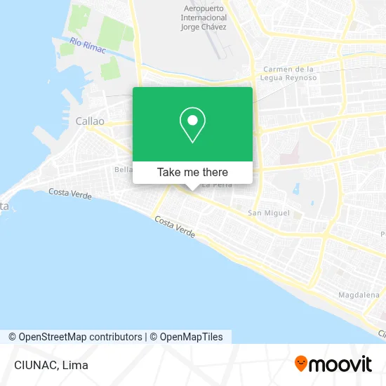
See CIUNAC, Ventanilla, on the map
Public Transit to CIUNAC in Ventanilla
Wondering how to get to CIUNAC in Ventanilla? Moovit helps you find the best way to get to CIUNAC with step-by-step directions from the nearest public transit station.
Moovit provides free maps and live directions to help you navigate through your city. View schedules, routes, timetables, and find out how long does it take to get to CIUNAC in real time.
Looking for the nearest stop or station to CIUNAC? Check out this list of stops closest to your destination: Turmalinas; Bomberos; Avenida El Pacifico; Cogorno.
Bus: 1315, 1317, 1435, 1304, OM19, 201, 1269, 1007, 1228, 1234, 1429, 1448.
Want to see if there’s another route that gets you there at an earlier time? Moovit helps you find alternative routes or times. Get directions from and directions to CIUNAC easily from the Moovit App or Website.
We make riding to CIUNAC easy, which is why over 1.5 million users, including users in Ventanilla, trust Moovit as the best app for public transit. You don’t need to download an individual bus app or train app, Moovit is your all-in-one transit app that helps you find the best bus time or train time available.
For information on prices of bus, costs and ride fares to CIUNAC, please check the Moovit app.
Use the app to navigate to popular places including to the airport, hospital, stadium, grocery store, mall, coffee shop, school, college, and university.
Location: Ventanilla, Lima
- Don Carbon,
- D'Carbón,
- Ovalo Juan Pablo II,
- Sonata Café,
- Flovar Confecciones,
- Compañía De Bomberos Garibaldi Nº 7,
- Ceragem Arcangel,
- Software-Asesoría-Btsys Eirl,
- Btsys Eirl,
- Cía de Bomberos Garibaldi 7,
- Prite Callao,
- Avenida Callao 39,
- Imprentas-Productos Booz S. A. c.,
- Restaurante Turístico Mi Trujillo,
- Dulces Fabi,
- Academia De Quechua Yachay Wasi,
- Hotel Las Terrazas,
- Mueblería,
- Banco BBVA Continental-Guardia Chalaca,
- Novisimo
Places Near CIUNAC (Ventanilla)
- Av. Abancay, Lima,
- Parque Kennedy, Miraflores,
- Circuito Mágico Del Agua, Lima,
- Centro Comercial Plaza Norte, Independen,
- Parque de las Leyendas, San Miguel,
- Aeropuerto Internacional Jorge Chávez, Ventanilla,
- Plaza San Miguel, San Miguel,
- Real Plaza Puruchuco, Ate,
- Av. La Marina, San Miguel,
- Paradero Av.Brasil,
- Pontificia Universidad Católica del Perú - PUCP, San Miguel,
- Hospital Edgardo Rebagliati Martins, Jesus Mari,
- Mall Del Sur,
- Miraflores, Miraflores,
- Av. Salaverry, Jesus Mari,
- Barranco, Barranco,
- Gamarra,
- av arequipa, Lima,
- Larcomar, Miraflores,
- Jockey Plaza, Santiago D
How to get to popular places in Lima with public transit
Get around Ventanilla by public transit!
Traveling around Ventanilla has never been so easy. See step by step directions as you travel to any attraction, street or major public transit station. View bus and train schedules, arrival times, service alerts and detailed routes on a map, so you know exactly how to get to anywhere in Ventanilla.
When traveling to any destination around Ventanilla use Moovit's Live Directions with Get Off Notifications to know exactly where and how far to walk, how long to wait for your line, and how many stops are left. Moovit will alert you when it's time to get off — no need to constantly re-check whether yours is the next stop.
Wondering how to use public transit in Ventanilla or how to pay for public transit in Ventanilla? Moovit public transit app can help you navigate your way with public transit easily, and at minimum cost. It includes public transit fees, ticket prices, and costs. Looking for a map of Ventanilla public transit lines? Moovit public transit app shows all public transit maps in Ventanilla with all Bus, Metro and Ferry routes and stops on an interactive map.
Lima has 3 transit type(s), including: Bus, Metro and Ferry, operated by several transit agencies, including Metro de Lima Línea 2 , Metro de Lima, Corredor Rojo, Metropolitano, Metropolitano - Alimentadores, Corredor Morado, Corredor Azul, Rutas Tradicionales, Transportes y Servicios La Esperanza S.A., Las Flores S.A., Virgen de la Asunción S.A., Consorcio HAM, Transportes y Service Canadá S.A., ETUL4SA and ETUCHISA