How to get to CKC.Institute by bus?
Click on the bus route to see step by step directions with maps, line arrival times and updated time schedules.
From The Westin Georgetown, Washington D.C., Washington
83 minFrom Kaiser Permanente - Falls Church Medical Center, Falls Church
53 minFrom Franconia-Springfield Metro Station, Fairfax County
64 minFrom Saint Elizabeth's West Campus (DHS/USCG), Washington
106 minFrom Fort Myer, Arlington County
55 minFrom 2121, Washington
86 minFrom Eisenhower Executive Office Building, Washington
93 minFrom Residence Inn by Marriott Arlington Capital View, Arlington County
50 minFrom Uspto, Alexandria
33 minFrom Enid A. Haupt Garden, Washington
119 min
Bus stops near CKC.Institute in Alexandria
Metro station near CKC.Institute in Alexandria
- Van Dorn Street Metro Station, 55 min walk,VIEW
Bus lines to CKC.Institute in Alexandria
- A27, Pentagon-Shirlington-Van Dorn St,VIEW
- A28, Pentagon-Holmes Run-Landmark,VIEW
- 36A, West Alexandria Transit Center (School Special),VIEW
- 36B, Mark Center Sta Via Valley Dr/Park Place,VIEW
- 102, King St-Old Town Station,VIEW
- F20, East To King St-Old Town,VIEW
- A29, North To Metro Center,VIEW
- A76, North To Rosslyn,VIEW
- 35, Pentagon Transit Center,VIEW
What are the closest stations to CKC.Institute?
The closest stations to CKC.Institute are:
- Seminary Rd+N Kenmore Av is 121 yards away, 2 min walk.
- Seminary Rd & Library La is 268 yards away, 4 min walk.
- Southern Towers;Opp Stratford Bldg is 1019 yards away, 13 min walk.
- Southern Towers Rd & Stratford Bldg is 1019 yards away, 13 min walk.
- Van Dorn Street Metro Station is 4678 yards away, 55 min walk.
Which bus lines stop near CKC.Institute?
These bus lines stop near CKC.Institute: 102, A27, A28, F20.
What’s the nearest bus station to CKC.Institute in Alexandria?
The nearest bus station to CKC.Institute in Alexandria is Seminary Rd+N Kenmore Av. It’s a 2 min walk away.
What time is the first metro to CKC.Institute in Alexandria?
The BLUE is the first metro that goes to CKC.Institute in Alexandria. It stops nearby at 5:05 AM.
What time is the last metro to CKC.Institute in Alexandria?
The BLUE is the last metro that goes to CKC.Institute in Alexandria. It stops nearby at 12:39 AM.
What time is the first bus to CKC.Institute in Alexandria?
The F20 is the first bus that goes to CKC.Institute in Alexandria. It stops nearby at 4:18 AM.
What time is the last bus to CKC.Institute in Alexandria?
The F20 is the last bus that goes to CKC.Institute in Alexandria. It stops nearby at 2:45 AM.
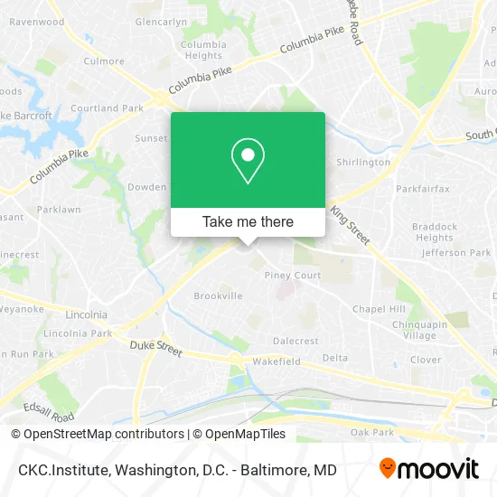
See CKC.Institute, Alexandria, on the map
Public Transit to CKC.Institute in Alexandria
Wondering how to get to CKC.Institute in Alexandria? Moovit helps you find the best way to get to CKC.Institute with step-by-step directions from the nearest public transit station.
Moovit provides free maps and live directions to help you navigate through your city. View schedules, routes, timetables, and find out how long does it take to get to CKC.Institute in real time.
Looking for the nearest stop or station to CKC.Institute? Check out this list of stops closest to your destination: Seminary Rd+N Kenmore Av; Seminary Rd & Library La; Southern Towers;Opp Stratford Bldg; Southern Towers Rd & Stratford Bldg; Van Dorn Street Metro Station.
Bus: 102, A27, A28, F20, 36A, 36B, A29, A76, 35.Metro: BLUE.
Want to see if there’s another route that gets you there at an earlier time? Moovit helps you find alternative routes or times. Get directions from and directions to CKC.Institute easily from the Moovit App or Website.
We make riding to CKC.Institute easy, which is why over 1.5 million users, including users in Alexandria, trust Moovit as the best app for public transit. You don’t need to download an individual bus app or train app, Moovit is your all-in-one transit app that helps you find the best bus time or train time available.
For information on prices of bus and metro, costs and ride fares to CKC.Institute, please check the Moovit app.
Use the app to navigate to popular places including to the airport, hospital, stadium, grocery store, mall, coffee shop, school, college, and university.
CKC.Institute Address: 4701 Kenmore Ave Alexandria, VA 22304 street in Alexandria
- Readonline.Us,
- Seminary Towers Apartments,
- Toft's Mobile Automotive Repair,
- Seminary Towers,
- Metrobus Route 8Z, 8W, 8X, 8S,
- Dash bus AT2,
- Imane Artisan,
- # 500,
- Pure White Dental,
- Kidney Diseases, Hypertension & Primary Care of Virginia, LLC,
- Plastic & Reconstructive Surgery,
- Access Neurology,
- Gastro Health,
- Christine Thayer PHD,
- Colonial Parking Station,
- Dr. Marvin Chadab MD - Dermatology,
- T. Jenny Chen, MD,
- Lindsay Jones, MD,
- FedEx,
- Kaufman Allergy
Places Near CKC.Institute (Alexandria)
- M&T Bank Stadium, Baltimore,
- Westfield Montgomery Mall, Montgomery County,
- The Anthem, Washington,
- Museum Of The Bible, Washington,
- National Museum of African American History and Culture, Washington,
- Camden Yards, Baltimore,
- Amazon Hq2, Arlington County,
- Basilica of the National Shrine, Washington,
- PG Mall, Prince George's County,
- Georgetown, Washington,
- Warner Theatre, Washington,
- Sibley Memorial Hospital, Washington,
- Pennsylvania Ave NW (3rd st and pennsylvania), Washington,
- Capital One Arena, Washington,
- Washington DC VA Medical Center, Washington,
- Marriott Marquis Washington, DC, Washington,
- Washington National Cathedral, Washington,
- Rock Creek Tennis Center, Washington,
- National Theatre, Washington,
- National Zoo, Washington
How to get to popular places in Washington, D.C. - Baltimore, MD with public transit
Get around Alexandria by public transit!
Traveling around Alexandria has never been so easy. See step by step directions as you travel to any attraction, street or major public transit station. View bus and train schedules, arrival times, service alerts and detailed routes on a map, so you know exactly how to get to anywhere in Alexandria.
When traveling to any destination around Alexandria use Moovit's Live Directions with Get Off Notifications to know exactly where and how far to walk, how long to wait for your line, and how many stops are left. Moovit will alert you when it's time to get off — no need to constantly re-check whether yours is the next stop.
Wondering how to use public transit in Alexandria or how to pay for public transit in Alexandria? Moovit public transit app can help you navigate your way with public transit easily, and at minimum cost. It includes public transit fees, ticket prices, and costs. Looking for a map of Alexandria public transit lines? Moovit public transit app shows all public transit maps in Alexandria with all Bus, Train, Metro, Light Rail and Ferry routes and stops on an interactive map.
Washington, D.C. - Baltimore, MD has 5 transit type(s), including: Bus, Train, Metro, Light Rail and Ferry, operated by several transit agencies, including WMATA, Montgomery County Ride On, Fairfax Connector, TheBus, PRTC, DASH - Alexandria, Arlington Transit (ART), RTA of Central Maryland, MDOT MTA, MDOT MTA Light RailLink, MDOT MTA Commuter Bus, MDOT MTA Local Bus, FXBGO!, Virginia Railway Express (VRE) and MARC