How to get to CLR Web Designs by bus?
Click on the bus route to see step by step directions with maps, line arrival times and updated time schedules.
From I-695 @ Exit 18 (Liberty Rd/MD 26), Baltimore County
127 minFrom I-695 @ Exit 17 (Security Blvd/MD 122), Baltimore County
107 minFrom Pimlico Race Course, Baltimore
94 minFrom I-83 Exit 16 (Timonium Road), Baltimore County
176 minFrom Randallstown, MD, Baltimore County
134 minFrom Mva, Baltimore
52 minFrom Reisterstown Road Plaza, Baltimore
48 minFrom Johns Hopkins Medicine at Green Spring Station, Baltimore County
134 min
Bus stop near CLR Web Designs in Baltimore County
- Reisterstown Rd & Hammershire Rd Nb, 13 min walk,VIEW
Bus lines to CLR Web Designs in Baltimore County
- 87, Glyndon,VIEW
What are the closest stations to CLR Web Designs?
The closest stations to CLR Web Designs are:
- Reisterstown Rd & Hammershire Rd Nb is 1001 yards away, 13 min walk.
Which bus lines stop near CLR Web Designs?
These bus lines stop near CLR Web Designs: 87, 89.
What’s the nearest bus station to CLR Web Designs in Baltimore County?
The nearest bus station to CLR Web Designs in Baltimore County is Reisterstown Rd & Hammershire Rd Nb. It’s a 13 min walk away.
What time is the first bus to CLR Web Designs in Baltimore County?
The 87 is the first bus that goes to CLR Web Designs in Baltimore County. It stops nearby at 4:10 AM.
What time is the last bus to CLR Web Designs in Baltimore County?
The 87 is the last bus that goes to CLR Web Designs in Baltimore County. It stops nearby at 1:03 AM.
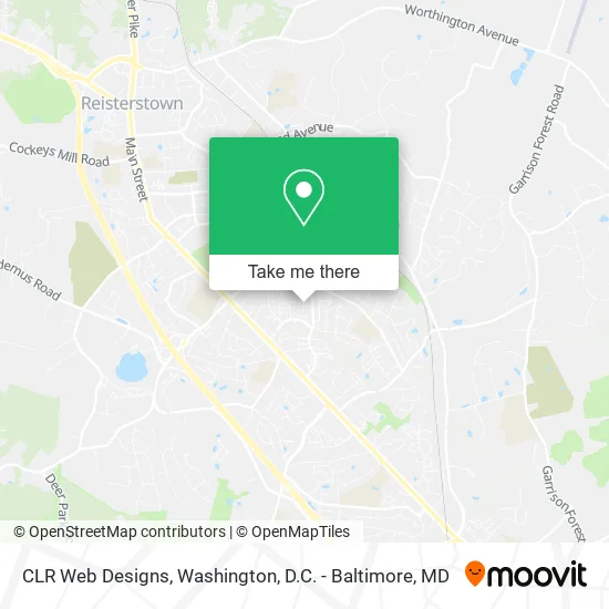
See CLR Web Designs, Baltimore County, on the map
Public Transit to CLR Web Designs in Baltimore County
Wondering how to get to CLR Web Designs in Baltimore County? Moovit helps you find the best way to get to CLR Web Designs with step-by-step directions from the nearest public transit station.
Moovit provides free maps and live directions to help you navigate through your city. View schedules, routes, timetables, and find out how long does it take to get to CLR Web Designs in real time.
Looking for the nearest stop or station to CLR Web Designs? Check out this list of stops closest to your destination: Reisterstown Rd & Hammershire Rd Nb.
Bus: 87, 89.
Want to see if there’s another route that gets you there at an earlier time? Moovit helps you find alternative routes or times. Get directions from and directions to CLR Web Designs easily from the Moovit App or Website.
We make riding to CLR Web Designs easy, which is why over 1.5 million users, including users in Baltimore County, trust Moovit as the best app for public transit. You don’t need to download an individual bus app or train app, Moovit is your all-in-one transit app that helps you find the best bus time or train time available.
For information on prices of bus, metro and light rail, costs and ride fares to CLR Web Designs, please check the Moovit app.
Use the app to navigate to popular places including to the airport, hospital, stadium, grocery store, mall, coffee shop, school, college, and university.
CLR Web Designs Address: 2 Chardon Ct Reisterstown, MD 21136 street in Baltimore County
- The Local Searches,
- Falls Musalla,
- Ereisterstown,
- Haul Away Maryland,
- Church of the Nativity,
- Chestnut Hill CNDMN Assoc,
- Mas & Assoc,
- Maria's Bookkeeping,
- Sby Associates,
- United Healthcare,
- American Lock & Key,
- Giant,
- ASAP Locksmith Service of MD,
- smart Communications,
- Wells Fargo,
- Baltimore Insurance Group,
- Reisterstown Road & Hammershire Road Northbound,
- Treasures of God Learning Center,
- Christian Liberty Church - CLC,
- M&T Bank Atm
Places Near CLR Web Designs (Baltimore County)
- Washington National Cathedral, Washington,
- Amazon Hq2, Arlington County,
- Capital One Arena, Washington,
- Camden Yards, Baltimore,
- M&T Bank Stadium, Baltimore,
- National Zoo, Washington,
- National Museum of African American History and Culture, Washington,
- Warner Theatre, Washington,
- PG Mall, Prince George's County,
- Rock Creek Tennis Center, Washington,
- National Mall, Washington,
- Pennsylvania Ave NW (3rd st and pennsylvania), Washington,
- The Anthem, Washington,
- Museum Of The Bible, Washington,
- Marriott Marquis Washington, DC, Washington,
- Washington DC VA Medical Center, Washington,
- Westfield Montgomery Mall, Montgomery County,
- Basilica of the National Shrine, Washington,
- Sibley Memorial Hospital, Washington,
- Georgetown, Washington
How to get to popular places in Washington, D.C. - Baltimore, MD with public transit
Get around Baltimore County by public transit!
Traveling around Baltimore County has never been so easy. See step by step directions as you travel to any attraction, street or major public transit station. View bus and train schedules, arrival times, service alerts and detailed routes on a map, so you know exactly how to get to anywhere in Baltimore County.
When traveling to any destination around Baltimore County use Moovit's Live Directions with Get Off Notifications to know exactly where and how far to walk, how long to wait for your line, and how many stops are left. Moovit will alert you when it's time to get off — no need to constantly re-check whether yours is the next stop.
Wondering how to use public transit in Baltimore County or how to pay for public transit in Baltimore County? Moovit public transit app can help you navigate your way with public transit easily, and at minimum cost. It includes public transit fees, ticket prices, and costs. Looking for a map of Baltimore County public transit lines? Moovit public transit app shows all public transit maps in Baltimore County with all Bus, Train, Metro, Light Rail and Ferry routes and stops on an interactive map.
Washington, D.C. - Baltimore, MD has 5 transit type(s), including: Bus, Train, Metro, Light Rail and Ferry, operated by several transit agencies, including WMATA, Montgomery County Ride On, Fairfax Connector, TheBus, PRTC, DASH - Alexandria, Arlington Transit (ART), RTA of Central Maryland, MDOT MTA, MDOT MTA Light RailLink, MDOT MTA Commuter Bus, MDOT MTA Local Bus, FXBGO!, Virginia Railway Express (VRE) and MARC