How to get to CSG Gastro by bus?
Click on the bus route to see step by step directions with maps, line arrival times and updated time schedules.
How to get to CSG Gastro by train?
Click on the train route to see step by step directions with maps, line arrival times and updated time schedules.
Bus stops near CSG Gastro in Norfolk
Light Rail stations near CSG Gastro in Norfolk
- Monticello, 5 min walk,VIEW
Bus lines to CSG Gastro in Norfolk
What are the closest stations to CSG Gastro?
The closest stations to CSG Gastro are:
- Olney & Norfolk General is 162 yards away, 3 min walk.
- Monticello is 233 yards away, 5 min walk.
- Colonial & Boissevain is 733 yards away, 9 min walk.
Which bus lines stop near CSG Gastro?
These bus lines stop near CSG Gastro: 023, 961.
Which train line stops near CSG Gastro?
NORTHEAST REGIONAL (Norfolk)
Which light rail line stops near CSG Gastro?
800 (Evmc Fort Norfolk Station)
What’s the nearest light rail station to CSG Gastro in Norfolk?
The nearest light rail station to CSG Gastro in Norfolk is Monticello. It’s a 5 min walk away.
What’s the nearest bus station to CSG Gastro in Norfolk?
The nearest bus station to CSG Gastro in Norfolk is Olney & Norfolk General. It’s a 3 min walk away.
What time is the first light rail to CSG Gastro in Norfolk?
The 800 is the first light rail that goes to CSG Gastro in Norfolk. It stops nearby at 5:27 AM.
What time is the last light rail to CSG Gastro in Norfolk?
The 800 is the last light rail that goes to CSG Gastro in Norfolk. It stops nearby at 11:40 PM.
What time is the first bus to CSG Gastro in Norfolk?
The 023 is the first bus that goes to CSG Gastro in Norfolk. It stops nearby at 5:05 AM.
What time is the last bus to CSG Gastro in Norfolk?
The 002 is the last bus that goes to CSG Gastro in Norfolk. It stops nearby at 12:39 AM.
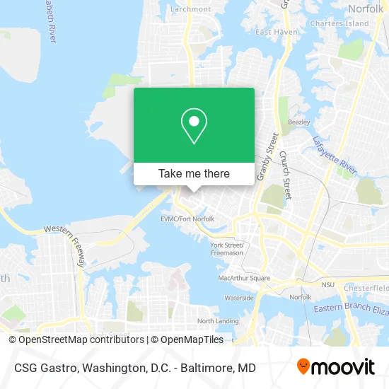
See CSG Gastro, Norfolk, on the map
Public Transit to CSG Gastro in Norfolk
Wondering how to get to CSG Gastro in Norfolk? Moovit helps you find the best way to get to CSG Gastro with step-by-step directions from the nearest public transit station.
Moovit provides free maps and live directions to help you navigate through your city. View schedules, routes, timetables, and find out how long does it take to get to CSG Gastro in real time.
Looking for the nearest stop or station to CSG Gastro? Check out this list of stops closest to your destination: Olney & Norfolk General; Monticello; Colonial & Boissevain.
Bus: 023, 961, 002, 044, 011.Train: NORTHEAST REGIONAL.Light Rail: 800.
Want to see if there’s another route that gets you there at an earlier time? Moovit helps you find alternative routes or times. Get directions from and directions to CSG Gastro easily from the Moovit App or Website.
We make riding to CSG Gastro easy, which is why over 1.5 million users, including users in Norfolk, trust Moovit as the best app for public transit. You don’t need to download an individual bus app or train app, Moovit is your all-in-one transit app that helps you find the best bus time or train time available.
For information on prices of bus, train and light rail, costs and ride fares to CSG Gastro, please check the Moovit app.
Use the app to navigate to popular places including to the airport, hospital, stadium, grocery store, mall, coffee shop, school, college, and university.
CSG Gastro Address: 601 Children's Ln Norfolk, VA 23507 street in Norfolk
- Mariel Focseneanu, MD,
- Dana Ramirez, MD,
- Rachel A. Armentrout, M.D.,
- Lopa P. Hartke, MD,
- Stephanie Moody Antonio, MD,
- Brett Siegfried MD,
- Anthony D Villella, MD,
- Peter M Dozier, MD,
- Philip Smith, MD,
- Clarence W Gowen, M.D.,
- J Ramon Ongkingco Faap MD,
- Childrens Crdiac Surgery Nrfolk,
- Hampton Roads Pediatrics,
- Amy Newmeyer, MD,
- Margaret McGuire, MD,
- Frank Chocano, M.D.,
- Liana Hosu, MD,
- Thomas Cholis, MD,
- Lee Trotter, do,
- Lawrence Pasquinelli MD
Places Near CSG Gastro (Norfolk)
- Basilica of the National Shrine, Washington,
- Rock Creek Tennis Center, Washington,
- Warner Theatre, Washington,
- Marriott Marquis Washington, DC, Washington,
- National Zoo, Washington,
- National Museum of African American History and Culture, Washington,
- Washington National Cathedral, Washington,
- Westfield Montgomery Mall, Montgomery County,
- Georgetown, Washington,
- Amazon Hq2, Arlington County,
- Camden Yards, Baltimore,
- Museum Of The Bible, Washington,
- The Anthem, Washington,
- PG Mall, Prince George's County,
- Sibley Memorial Hospital, Washington,
- M&T Bank Stadium, Baltimore,
- Capital One Arena, Washington,
- Washington DC VA Medical Center, Washington,
- National Mall, Washington,
- Pennsylvania Ave NW (3rd st and pennsylvania), Washington
How to get to popular places in Washington, D.C. - Baltimore, MD with public transit
Get around Norfolk by public transit!
Traveling around Norfolk has never been so easy. See step by step directions as you travel to any attraction, street or major public transit station. View bus and train schedules, arrival times, service alerts and detailed routes on a map, so you know exactly how to get to anywhere in Norfolk.
When traveling to any destination around Norfolk use Moovit's Live Directions with Get Off Notifications to know exactly where and how far to walk, how long to wait for your line, and how many stops are left. Moovit will alert you when it's time to get off — no need to constantly re-check whether yours is the next stop.
Wondering how to use public transit in Norfolk or how to pay for public transit in Norfolk? Moovit public transit app can help you navigate your way with public transit easily, and at minimum cost. It includes public transit fees, ticket prices, and costs. Looking for a map of Norfolk public transit lines? Moovit public transit app shows all public transit maps in Norfolk with all Bus, Train, Metro, Light Rail and Ferry routes and stops on an interactive map.
Washington, D.C. - Baltimore, MD has 5 transit type(s), including: Bus, Train, Metro, Light Rail and Ferry, operated by several transit agencies, including WMATA, Montgomery County Ride On, Fairfax Connector, TheBus, PRTC, DASH - Alexandria, Arlington Transit (ART), RTA of Central Maryland, MDOT MTA, MDOT MTA Light RailLink, MDOT MTA Commuter Bus, MDOT MTA Local Bus, FXBGO!, Virginia Railway Express (VRE) and MARC