Directions to CSX (Changsha County) with public transportation
The following transit lines have routes that pass near CSX
How to get to CSX by bus?
Click on the bus route to see step by step directions with maps, line arrival times and updated time schedules.
From Changsha County People's Hospital, Changsha County
86 minFrom Quanting Second Primary School - East Gate, Changsha County
63 minFrom Quanting Third Primary School, Changsha County
62 minFrom Changsha Langli Industrial Park, Changsha County
83 minFrom Kangqiao Changjun 2-116, Changsha County
70 minFrom Huanghua Town, Changsha County
45 minFrom Quanting Elementary School, Changsha County
56 minFrom Quanting Primary School - East Gate 1, Changsha County
54 minFrom Lingxiao Technology Huanghua Base, Changsha County
37 minFrom Hunan Judicial Police Vocational College - Library, Furong District
70 min
Metro station near CSX in Changsha County
- Maglev Airport, 16 min walk,VIEW
Bus stops near CSX in Changsha County
Bus lines to CSX in Changsha County
What are the closest stations to CSX?
The closest stations to CSX are:
- Maglev Airport is 870 meters away, 16 min walk.
- Huanghua Airport is 969 meters away, 17 min walk.
- Huanghua International Airport is 1171 meters away, 20 min walk.
Which bus line stops near CSX?
Route 114 (Huanghua Airport)
What’s the nearest metro station to CSX in Changsha County?
The nearest metro station to CSX in Changsha County is Maglev Airport. It’s a 16 min walk away.
What time is the first metro to CSX in Changsha County?
The Maglev Express is the first metro that goes to CSX in Changsha County. It stops nearby at 7:00 AM.
What time is the last metro to CSX in Changsha County?
The Maglev Express is the last metro that goes to CSX in Changsha County. It stops nearby at 10:30 PM.
What time is the first bus to CSX in Changsha County?
The Airport Express is the first bus that goes to CSX in Changsha County. It stops nearby at 6:07 AM.
What time is the last bus to CSX in Changsha County?
The Airport Express is the last bus that goes to CSX in Changsha County. It stops nearby at 1:00 AM.
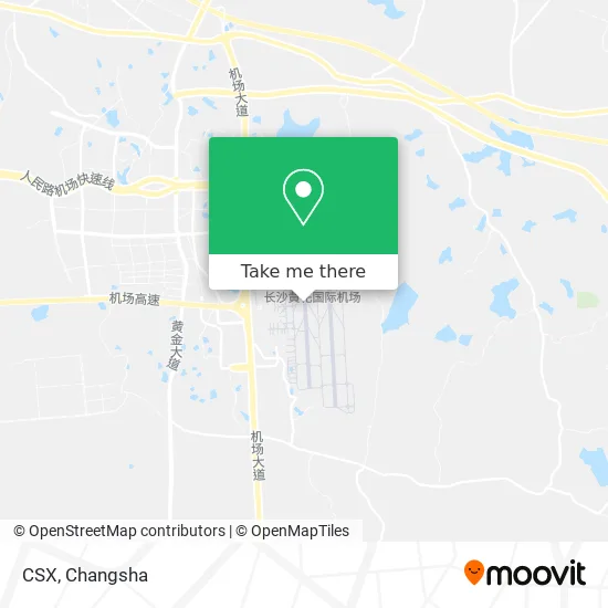
See CSX, Changsha County, on the map
Public Transit to CSX in Changsha County
Wondering how to get to CSX in Changsha County? Moovit helps you find the best way to get to CSX with step-by-step directions from the nearest public transit station.
Moovit provides free maps and live directions to help you navigate through your city. View schedules, routes, timetables, and find out how long does it take to get to CSX in real time.
Looking for the nearest stop or station to CSX? Check out this list of stops closest to your destination: Maglev Airport; Huanghua Airport; Huanghua International Airport.
Bus: Route 114, Rural Transit Line 4, Route 114, Airport Express, Airport Express (South Station Line), Airport Express (West Station Line).Metro: Maglev Express.
Want to see if there’s another route that gets you there at an earlier time? Moovit helps you find alternative routes or times. Get directions from and directions to CSX easily from the Moovit App or Website.
We make riding to CSX easy, which is why over 1.5 million users, including users in Changsha County, trust Moovit as the best app for public transit. You don’t need to download an individual bus app or train app, Moovit is your all-in-one transit app that helps you find the best bus time or train time available.
For information on prices of bus, costs and ride fares to CSX, please check the Moovit app.
Use the app to navigate to popular places including to the airport, hospital, stadium, grocery store, mall, coffee shop, school, college, and university.
Location: Changsha County, Changsha
- Changsha Huanghua International Airport,
- Changsha Huanghua International Airport,
- Changsha Huanghua International Airport,
- Changsha Huanghua Airport,
- Platform 5 (Changsha Huanghua International Airport T2 Terminal),
- Magnetic Levitation Airport Station,
- Huanghua Airport,
- Very Huai Xiang,
- Children's Playground,
- Blue Bookstore,
- Fire Palace (Huanghua Airport Branch),
- Goose Soup Noodle House,
- Lindon Bookhouse,
- Yilaya Chain Convenience Store,
- Xiangfu Food Store,
- KFC (Blue Sky Restaurant),
- Cross-Strait Coffee (Huanghua Airport Branch),
- Bank of China ATM (T2 Terminal),
- Yulou East (Airport Branch),
- Changsha Huanghua International Airport T1 Terminal B and C - Paid Parking
Places Near CSX (Changsha County)
- Hunan Provincial Maternal and Child Health Hospital - Outpatient Department, Kaifu District,
- Changsha South Station Square, Yuelu District,
- Zhongnan University Xiangya Hospital, Kaifu District,
- Wanjiali International Mall, Furong District,
- First Club, Kaifu District,
- Changsha South Station, Yuhua District,
- First Affiliated Hospital of Hunan University of Traditional Chinese Medicine - Outpatient Department, Yuhua District,
- Xingsha Police Station Songya Community Police Room, Changsha County,
- Hunan University of Traditional Chinese Medicine First Affiliated Hospital, Yuhua District,
- Apple Authorized Dealer (Sam Changsha Store), Yuhua District,
- Hunan Province Tumor Hospital, Yuelu District,
- Changsha Bank ATM (Sifang Branch), Kaifu District,
- Du Fu River Pavilion, Tianxin District,
- Central South University Xiangya Second Hospital, Furong District,
- Yuelu Mountain Juzizhou Tourist Area, Yuelu District,
- Desiqin City Square, Yuhua District,
- Hunan Provincial Museum - Multipurpose Hall, Kaifu District,
- Changsha Bank (Sifang Branch), Kaifu District,
- Changsha Yangming Mountain Funeral Home, Yuhua District,
- National University of Defense Technology (North Gate), Kaifu District
How to get to popular places in Changsha with public transit
Get around Changsha County by public transit!
Traveling around Changsha County has never been so easy. See step by step directions as you travel to any attraction, street or major public transit station. View bus and train schedules, arrival times, service alerts and detailed routes on a map, so you know exactly how to get to anywhere in Changsha County.
When traveling to any destination around Changsha County use Moovit's Live Directions with Get Off Notifications to know exactly where and how far to walk, how long to wait for your line, and how many stops are left. Moovit will alert you when it's time to get off — no need to constantly re-check whether yours is the next stop.
Wondering how to use public transit in Changsha County or how to pay for public transit in Changsha County? Moovit public transit app can help you navigate your way with public transit easily, and at minimum cost. It includes public transit fees, ticket prices, and costs. Looking for a map of Changsha County public transit lines? Moovit public transit app shows all public transit maps in Changsha County with all Bus and Metro routes and stops on an interactive map.
Changsha has 2 transit type(s), including: Bus and Metro, operated by several transit agencies, including Changsha Metro and Changsha Bus Group