Directions to C T Library Association (Middletown) with public transportation
The following transit lines have routes that pass near C T Library Association
 Bus: 55, 590, 583, 581-582 SAYBROOK RD/WESLEYAN HILLS, 584.
How to get to C T Library Association by bus?
Click on the bus route to see step by step directions with maps, line arrival times and updated time schedules.
Bus stops near C T Library Association in Middletown
Bus lines to C T Library Association in Middletown
What are the closest stations to C T Library Association?
The closest stations to C T Library Association are:
- Russel Library @ Court Street is 52 yards away, 1 min walk.
- Main St @ Opp Trinity Church is 388 yards away, 5 min walk.
- Middletown Police Department is 404 yards away, 5 min walk.
- Main Street Market is 442 yards away, 6 min walk.
- Sbona Towers is 505 yards away, 7 min walk.
Which bus lines stop near C T Library Association?
These bus lines stop near C T Library Association: 55, 590.
What’s the nearest bus station to C T Library Association in Middletown?
The nearest bus station to C T Library Association in Middletown is Russel Library @ Court Street. It’s a 1 min walk away.
What time is the first bus to C T Library Association in Middletown?
The 55 is the first bus that goes to C T Library Association in Middletown. It stops nearby at 5:45 AM.
What time is the last bus to C T Library Association in Middletown?
The 581-582 SAYBROOK RD/WESLEYAN HILLS is the last bus that goes to C T Library Association in Middletown. It stops nearby at 10:49 PM.
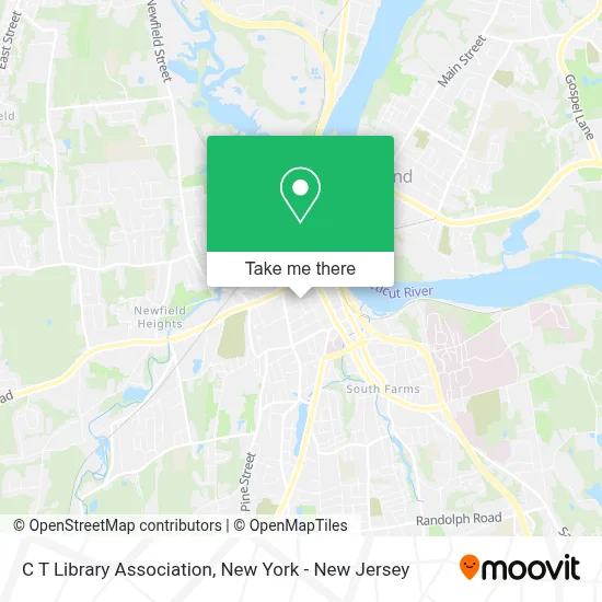
See C T Library Association, Middletown, on the map
Public Transit to C T Library Association in Middletown
Wondering how to get to C T Library Association in Middletown? Moovit helps you find the best way to get to C T Library Association with step-by-step directions from the nearest public transit station.
Moovit provides free maps and live directions to help you navigate through your city. View schedules, routes, timetables, and find out how long does it take to get to C T Library Association in real time.
Looking for the nearest stop or station to C T Library Association? Check out this list of stops closest to your destination: Russel Library @ Court Street; Main St @ Opp Trinity Church; Middletown Police Department; Main Street Market; Sbona Towers.
Bus: 55, 590, 583, 581-582 SAYBROOK RD/WESLEYAN HILLS, 584.
Want to see if there’s another route that gets you there at an earlier time? Moovit helps you find alternative routes or times. Get directions from and directions to C T Library Association easily from the Moovit App or Website.
We make riding to C T Library Association easy, which is why over 1.5 million users, including users in Middletown, trust Moovit as the best app for public transit. You don’t need to download an individual bus app or train app, Moovit is your all-in-one transit app that helps you find the best bus time or train time available.
For information on prices of train and bus, costs and ride fares to C T Library Association, please check the Moovit app.
Use the app to navigate to popular places including to the airport, hospital, stadium, grocery store, mall, coffee shop, school, college, and university.
C T Library Association Address: 234 Court St street in Middletown
- Hair by Kay,
- Sporting Ct,
- Queen Of the Apostles Preparatory Academy,
- Central Ct Real Estate With Sara Etienne,
- Asterisk Financial Inc.,
- Mary Beth Bain,
- Russ Thompson - Realty Agent,
- Michael Kalmick - Realtor,
- Andrea Mattesen - Realtor Exp Realty,
- Deborah Kleckowski- Insurance Agent,
- Discount Car Insurance | Lowered Rates Of Middletown,
- The Library Studio,
- The Apiary Collective,
- Realtors Michelle Mazzotta & Theos Mallios, Brokered by Exp Realty,
- Michelle Mazzotta & Theo Mallios, Realtors Exp Realty,
- Arcadis Middletown,
- Annette Murphy, Realtor and Skier,
- Geoinsight, Inc,
- New Beginnings - Leslie Blaser,
- Integra Realty Resources
Places Near C T Library Association (Middletown)
- 111 Centre New York City Supreme Court, Manhattan,
- Rockefeller Center, Manhattan,
- Hudson Yards, Manhattan,
- Mountainside Hospital, Glen Ridge,
- 3 Stone St, Manhattan,
- Chinatown, Manhattan,
- San Gennaro Feast, Manhattan,
- Wall Street, Manhattan,
- 376 Hudson Street, Manhattan,
- 26 Federal Plaza, Manhattan,
- Bellevue Hospital, Manhattan,
- SoHo, Manhattan,
- 66 John Street, Manhattan,
- 1 Police Plaza, Manhattan,
- Katz's Deli, Manhattan,
- Pier 83, Manhattan,
- Times Square, Manhattan,
- qqqq, Manhattan,
- Queens Center Mall, Queens,
- 911 Memorial, Manhattan
How to get to popular places in New York - New Jersey with public transit
Get around Middletown by public transit!
Traveling around Middletown has never been so easy. See step by step directions as you travel to any attraction, street or major public transit station. View bus and train schedules, arrival times, service alerts and detailed routes on a map, so you know exactly how to get to anywhere in Middletown.
When traveling to any destination around Middletown use Moovit's Live Directions with Get Off Notifications to know exactly where and how far to walk, how long to wait for your line, and how many stops are left. Moovit will alert you when it's time to get off — no need to constantly re-check whether yours is the next stop.
Wondering how to use public transit in Middletown or how to pay for public transit in Middletown? Moovit public transit app can help you navigate your way with public transit easily, and at minimum cost. It includes public transit fees, ticket prices, and costs. Looking for a map of Middletown public transit lines? Moovit public transit app shows all public transit maps in Middletown with all Bus, Train, Subway, Light Rail, Ferry and Cable Car routes and stops on an interactive map.
New York - New Jersey has 6 transit type(s), including: Bus, Train, Subway, Light Rail, Ferry and Cable Car, operated by several transit agencies, including MTA Subway, Metro-North Railroad, LIRR, PATH, MTA New York City Transit - Express routes, MTA Bus, NJ Transit, NYC Ferry, NICE bus, Bee-Line Bus, NJ Transit Rail, Norwalk Transit District, Hartford Line, River Valley Transit and HART