Directions to C T System (Baltimore) with public transportation
The following transit lines have routes that pass near C T System
 Bus: 40, 54, 73, 94, CITYLINK NAVY.
- Train: MARC.
- Metro: METRO.
- Light Rail: LIGHT RAILLINK.
How to get to C T System by bus?
Click on the bus route to see step by step directions with maps, line arrival times and updated time schedules.
From I-695 @ Exit 17 (Security Blvd/MD 122), Baltimore County
42 minFrom Western High School, Baltimore
39 minFrom Hampden, Baltimore
28 minFrom NSA Friendship Annex (FANX), Anne Arundel County
76 minFrom MVA Glen Burnie, Anne Arundel County
36 minFrom I-695 @ Exit 18 (Liberty Rd/MD 26), Baltimore County
56 minFrom Reisterstown Road Plaza, Baltimore
59 minFrom Medstar Union Memorial Hospital, Baltimore
34 minFrom Johns Hopkins Bayview Medical Center, Baltimore
39 minFrom Walmart, Baltimore County
55 min
How to get to C T System by metro?
Click on the metro route to see step by step directions with maps, line arrival times and updated time schedules.
Bus stops near C T System in Baltimore
Train station near C T System in Baltimore
- Camden Station Marc, 10 min walk,VIEW
Light Rail stations near C T System in Baltimore
- Baltimore Arena (University Center), 15 min walk,VIEW
Bus lines to C T System in Baltimore
- 51, Towson Town Center,VIEW
- 103, Downtown,VIEW
- 120, Hopkins Hospital,VIEW
- 160, Whispering Woods,VIEW
- 163, W Baltimore Marc,VIEW
- 320, 320/7 Johns Hopkins,VIEW
- 410, 410/6 Centreville - Bel Air,VIEW
- 411, 411/3 Hopkins Hospital,VIEW
- 420, 420/1 Johns Hopkins,VIEW
- ORANGE ROUTE, B&O Railroad Museum,VIEW
- CITYLINK BROWN, Overlea,VIEW
- CITYLINK NAVY, Turner Station,VIEW
- CITYLINK YELLOW, Downtown,VIEW
- 54, Clifton Park,VIEW
- 76, Downtown,VIEW
- 91, Mondawmin Station,VIEW
- 94, Fort Mchenry,VIEW
- 154, Hillendale,VIEW
- 69, Jumpers Hole,VIEW
- 70, Um Medical Center,VIEW
What are the closest stations to C T System?
The closest stations to C T System are:
- Hopkins Pl & Pratt St is 227 yards away, 3 min walk.
- Howard St & Camden St Sb is 290 yards away, 4 min walk.
- Eutaw St. - Camden Yards (Eb) is 364 yards away, 5 min walk.
- Pratt St & Howard St is 388 yards away, 5 min walk.
- Russell St & Camden St Nb is 401 yards away, 5 min walk.
- Camden Station Marc is 817 yards away, 10 min walk.
- Baltimore Arena (University Center) is 1253 yards away, 15 min walk.
Which bus lines stop near C T System?
These bus lines stop near C T System: 40, 54, 73, 94, CITYLINK NAVY, CITYLINK PURPLE, CITYLINK SILVER.
Which metro line stops near C T System?
METRO (Towards John Hopkins)
Which light rail line stops near C T System?
LIGHT RAILLINK (Northbound)
What’s the nearest light rail station to C T System in Baltimore?
The nearest light rail station to C T System in Baltimore is Baltimore Arena (University Center). It’s a 15 min walk away.
What’s the nearest train station to C T System in Baltimore?
The nearest train station to C T System in Baltimore is Camden Station Marc. It’s a 10 min walk away.
What’s the nearest bus station to C T System in Baltimore?
The nearest bus station to C T System in Baltimore is Hopkins Pl & Pratt St. It’s a 3 min walk away.
What time is the first light rail to C T System in Baltimore?
The LIGHT RAILLINK is the first light rail that goes to C T System in Baltimore. It stops nearby at 3:59 AM.
What time is the last light rail to C T System in Baltimore?
The LIGHT RAILLINK is the last light rail that goes to C T System in Baltimore. It stops nearby at 1:17 AM.
What time is the first train to C T System in Baltimore?
The MARC is the first train that goes to C T System in Baltimore. It stops nearby at 5:00 AM.
What time is the last train to C T System in Baltimore?
The MARC is the last train that goes to C T System in Baltimore. It stops nearby at 8:55 PM.
What time is the first bus to C T System in Baltimore?
The CITYLINK YELLOW is the first bus that goes to C T System in Baltimore. It stops nearby at 3:00 AM.
What time is the last bus to C T System in Baltimore?
The CITYLINK YELLOW is the last bus that goes to C T System in Baltimore. It stops nearby at 3:20 AM.
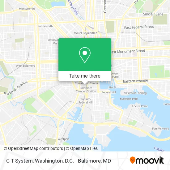
See C T System, Baltimore, on the map
Public Transit to C T System in Baltimore
Wondering how to get to C T System in Baltimore? Moovit helps you find the best way to get to C T System with step-by-step directions from the nearest public transit station.
Moovit provides free maps and live directions to help you navigate through your city. View schedules, routes, timetables, and find out how long does it take to get to C T System in real time.
Looking for the nearest stop or station to C T System? Check out this list of stops closest to your destination: Hopkins Pl & Pratt St; Howard St & Camden St Sb; Eutaw St. - Camden Yards (Eb); Pratt St & Howard St; Russell St & Camden St Nb; Camden Station Marc; Baltimore Arena (University Center).
Bus: 40, 54, 73, 94, CITYLINK NAVY, CITYLINK PURPLE, CITYLINK SILVER, 51, 103, 120, 160, 163, 320, 410, 411, 420, ORANGE ROUTE, CITYLINK BROWN, CITYLINK YELLOW, 76.Train: MARC.Metro: METRO.Light Rail: LIGHT RAILLINK.
Want to see if there’s another route that gets you there at an earlier time? Moovit helps you find alternative routes or times. Get directions from and directions to C T System easily from the Moovit App or Website.
We make riding to C T System easy, which is why over 1.5 million users, including users in Baltimore, trust Moovit as the best app for public transit. You don’t need to download an individual bus app or train app, Moovit is your all-in-one transit app that helps you find the best bus time or train time available.
For information on prices of bus, light rail and metro, costs and ride fares to C T System, please check the Moovit app.
Use the app to navigate to popular places including to the airport, hospital, stadium, grocery store, mall, coffee shop, school, college, and university.
C T System Address: 351 W Camden St Baltimore, MD 21201 street in Baltimore
- Um Orthopaedics at Camden Yards,
- Linda Iseler N.P.,
- Maryland Lock and Lockout Service,
- Physical and Occupational Therapy the Warehouse at Camden Yards,
- Camden MARC Station,
- Birdland Members Clubhouse,
- Superbook Bar & Restaurant,
- ATM,
- Maryland State Government Secretary of Transportation,
- Orioles Team Store,
- Baltimore Camden Station,
- Camden Station Marc,
- Memorial Stadium,
- Suite 51,
- My hot wife's Volvo,
- S Howard St (W Conway St and howard street),
- 巴尔的摩市 (Baltimore (City) County),
- Mystery Spot,
- Oriole Park At Camden Yards,
- Adt Security
Places Near C T System (Baltimore)
- National Zoo, Washington,
- Basilica of the National Shrine, Washington,
- Rock Creek Tennis Center, Washington,
- M&T Bank Stadium, Baltimore,
- Sibley Memorial Hospital, Washington,
- National Museum of African American History and Culture, Washington,
- Capital One Arena, Washington,
- Georgetown, Washington,
- Camden Yards, Baltimore,
- PG Mall, Prince George's County,
- Pennsylvania Ave NW (3rd st and pennsylvania), Washington,
- Museum Of The Bible, Washington,
- Warner Theatre, Washington,
- National Mall, Washington,
- Washington DC VA Medical Center, Washington,
- The Anthem, Washington,
- Amazon Hq2, Arlington County,
- Westfield Montgomery Mall, Montgomery County,
- Washington National Cathedral, Washington,
- Marriott Marquis Washington, DC, Washington
How to get to popular places in Washington, D.C. - Baltimore, MD with public transit
Get around Baltimore by public transit!
Traveling around Baltimore has never been so easy. See step by step directions as you travel to any attraction, street or major public transit station. View bus and train schedules, arrival times, service alerts and detailed routes on a map, so you know exactly how to get to anywhere in Baltimore.
When traveling to any destination around Baltimore use Moovit's Live Directions with Get Off Notifications to know exactly where and how far to walk, how long to wait for your line, and how many stops are left. Moovit will alert you when it's time to get off — no need to constantly re-check whether yours is the next stop.
Wondering how to use public transit in Baltimore or how to pay for public transit in Baltimore? Moovit public transit app can help you navigate your way with public transit easily, and at minimum cost. It includes public transit fees, ticket prices, and costs. Looking for a map of Baltimore public transit lines? Moovit public transit app shows all public transit maps in Baltimore with all Bus, Train, Metro, Light Rail and Ferry routes and stops on an interactive map.
Washington, D.C. - Baltimore, MD has 5 transit type(s), including: Bus, Train, Metro, Light Rail and Ferry, operated by several transit agencies, including WMATA, Montgomery County Ride On, Fairfax Connector, TheBus, PRTC, DASH - Alexandria, Arlington Transit (ART), RTA of Central Maryland, MDOT MTA, MDOT MTA Light RailLink, MDOT MTA Commuter Bus, MDOT MTA Local Bus, FXBGO!, Virginia Railway Express (VRE) and MARC